Altitude Sensor Module: Why 7 Sensors in One Board Changes Everything
RFOXiA Integrated Sensors Module
The Best Altitude Sensor Module for Drones, Robotics, and Professional IoT — MultiNav Pro+™
If you've ever wired up a drone build, a robotics platform, or a field-deployed IoT node, you know the pain of sensor sprawl. One module for pressure and altitude. Another for temperature and humidity. A third for motion. A fourth for air quality. By the time you've sourced, wired, debugged, and integrated four separate sensors across four different I2C addresses — assuming no conflicts — you've lost a weekend and added bulk you didn't need.
The RFOXiA MultiNav Pro+™ Sensors Module was built to solve exactly that problem.
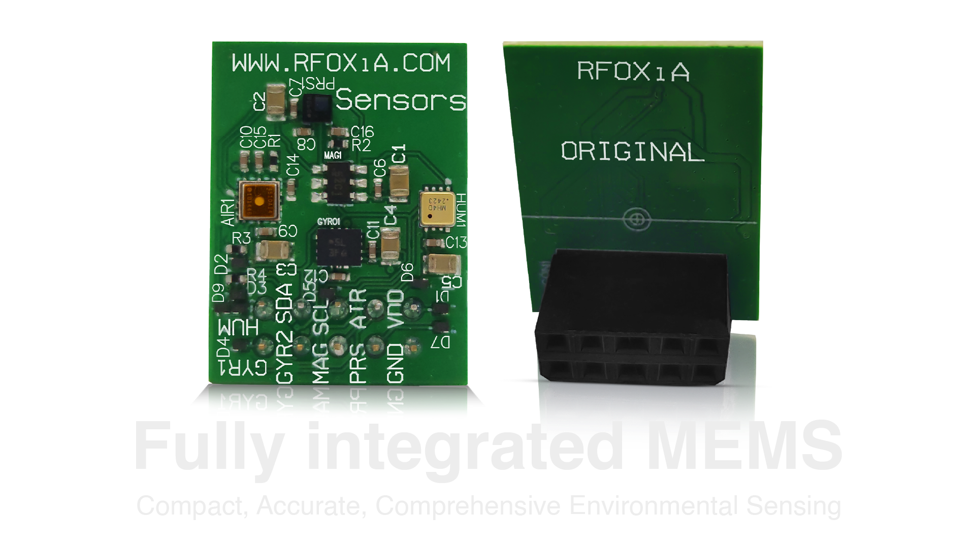
Seven professional-grade sensors. One compact 24mm × 18mm board. A single I2C bus. FCC certified and ready to ship at $39.
This is not a hobbyist breakout board with a generic sensor soldered to a carrier PCB. Every sensor on this module was selected for professional applications — from precision drone navigation to urban air quality monitoring to data network contributions that actually pay you back.
Let's go deep on what this module does, why the sensor selection matters, and why it represents a genuinely different approach to altitude sensor module design for serious builders.
What Is an Altitude Sensor Module — and Why Does It Need to Do More?
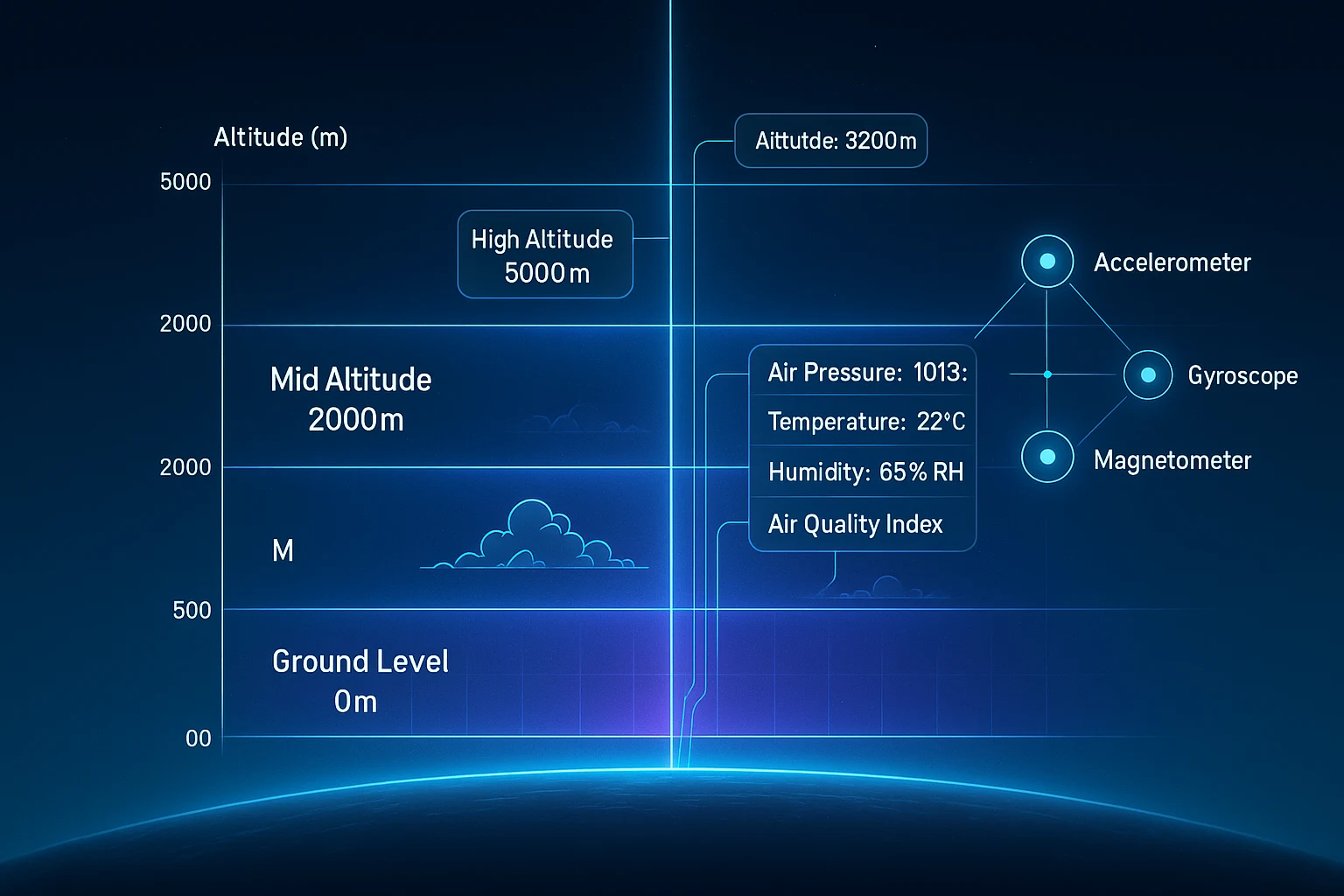
The term altitude sensor module is commonly used to describe any small board that reads barometric pressure and converts it to an estimated altitude above sea level. These are useful, widely available, and relatively cheap.
But altitude measurement in isolation has limited value for most real-world deployments.
Consider a drone operating in a hot, humid coastal city versus a cold, dry high-altitude mountain environment. The raw pressure reading will differ. Without temperature correction and humidity context, your altitude calculation drifts. Add wind, turbulence, and vibration — and without a motion sensing layer, your system can't distinguish between environmental pressure variation and actual altitude change.
A truly capable altitude sensor module for professional applications needs to:
- Measure barometric pressure accurately (altitude derivation)
- Correct for temperature and humidity
- Track motion to contextualize pressure changes
- Monitor air quality for environmental data value
- Fit in the tight spaces where drones and field hardware live
- Communicate cleanly without bus conflicts
The MultiNav Pro+™ Sensors Module delivers all of this in a single board.
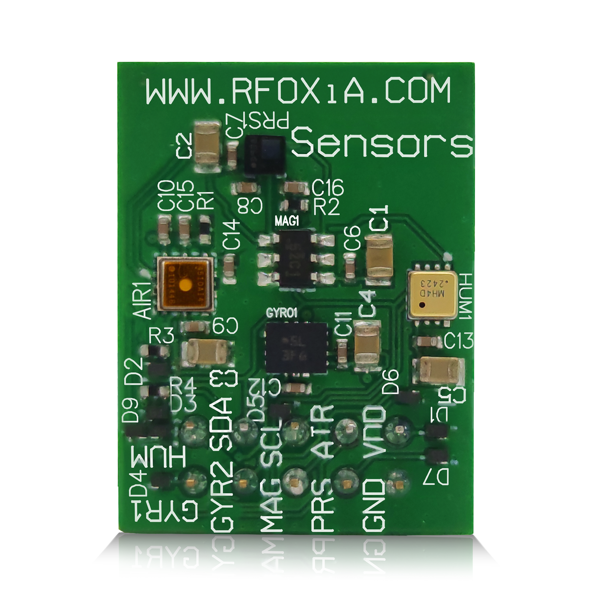
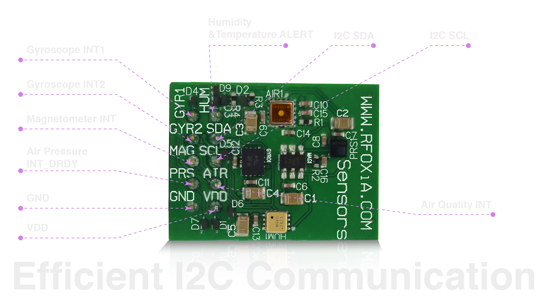
Seven Sensors. Zero Compromises. One Board.
Here is exactly what is packed into the MultiNav Pro+™ Sensors Module:
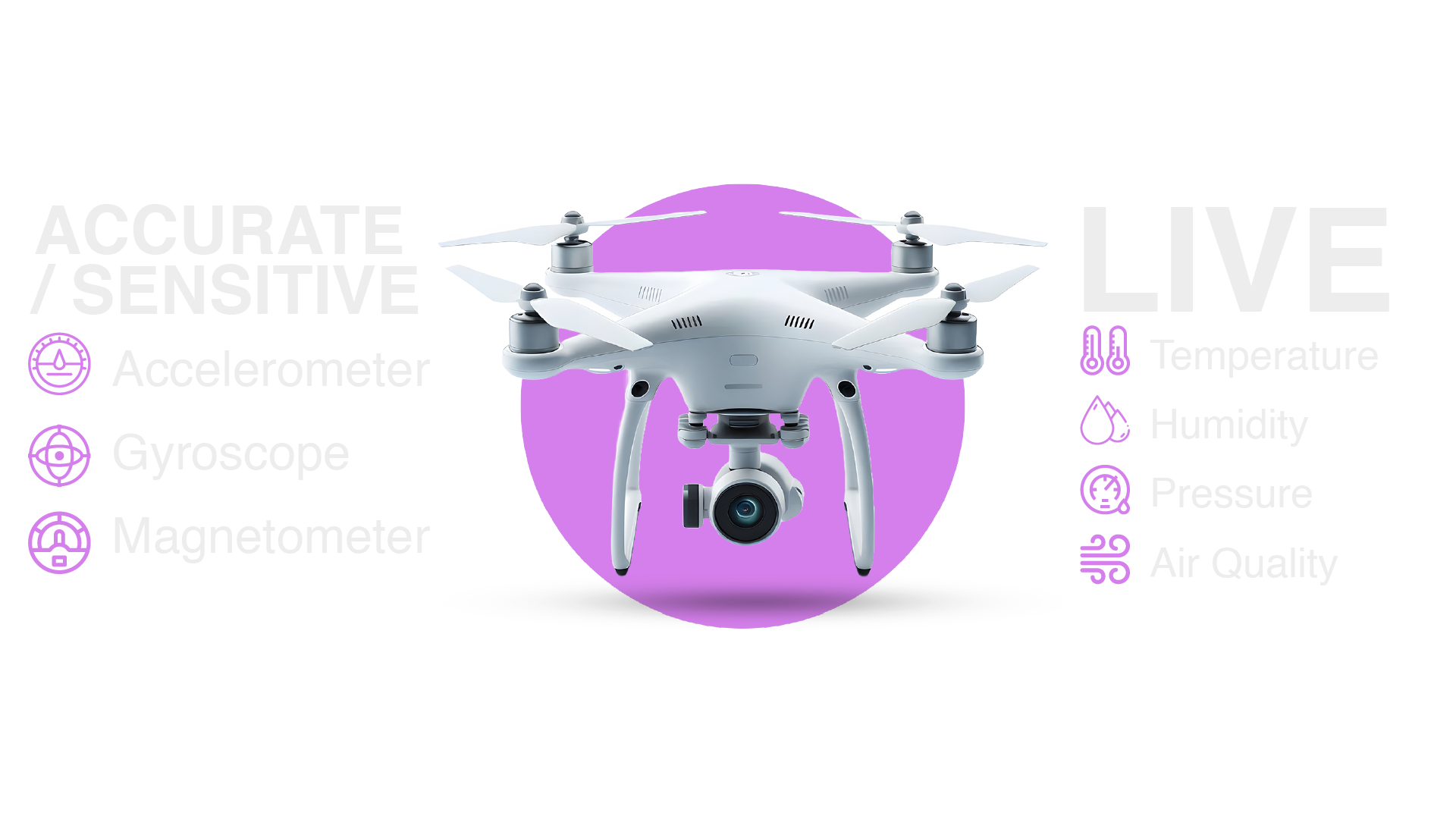
Motion Sensing Layer
- Accelerometer — measures linear acceleration across three axes
- Gyroscope — measures angular velocity across three axes
- Magnetometer — measures magnetic field strength for heading and orientation
Environmental Sensing Layer
- Barometric Pressure — altitude derivation, weather monitoring
- Temperature — thermal compensation and environmental reporting
- Humidity — moisture monitoring and pressure correction
- Air Quality — VOC and pollution detection for environmental data applications
Nothing is missing. Nothing is redundant. This is a purpose-built sensor array for applications that demand complete situational awareness — positional, environmental, and atmospheric.
For developers building altitude-sensitive applications, the combination of a barometric pressure sensor with on-board temperature and humidity correction is particularly significant. Most standalone altitude sensor modules require you to run a separate temperature sensor in firmware and apply correction coefficients manually. Here, the sensors coexist on the same board, close in physical proximity, sharing the same I2C bus, with no additional wiring or correction overhead required.
Sensor Selection: Professional Components, Not Commodity Parts
Let's talk about the specific components selected for this board — because sensor choice matters enormously for reliability, accuracy, and long-term support.
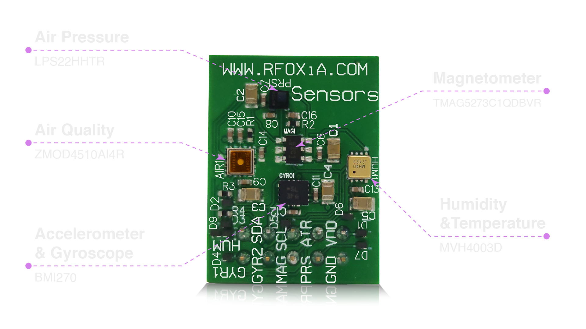
BMI270 — Bosch Sensortec (Accelerometer & Gyroscope)
The BMI270 is a 6-axis IMU from Bosch Sensortec, the same organization that supplies inertial sensors to automotive and industrial applications worldwide. It is specifically optimized for wearables and robotics applications where low power consumption and high performance must coexist. Its integrated hardware motion detection features — step detection, orientation detection, tap sensing — make it a serious choice for developers building state-aware systems rather than simple data loggers.
For altitude-sensitive drone applications, a high-quality 6-axis IMU is critical. Altitude hold algorithms, attitude estimation, and vibration filtering all depend on clean, low-noise IMU data. The BMI270 delivers.
TMAG5273C1QDBVR — Texas Instruments (Magnetometer)
Texas Instruments' TMAG5273 is a 3-axis linear Hall effect sensor optimized for low-power magnetic field measurement. As a magnetometer, it provides heading reference for navigation systems — essential for any drone or robotic platform that needs to know which direction it is pointing, independent of GPS.
Combined with the BMI270 accelerometer and gyroscope, this creates a full 9-axis IMU stack, enabling sensor fusion algorithms (Madgwick, Mahony, EKF) to deliver stable, drift-corrected orientation estimates.
LPS22HHTR — STMicroelectronics (Air Pressure / Altitude)
The LPS22HH from STMicroelectronics is a compact absolute pressure sensor specifically designed for altitude measurement and weather monitoring applications. It offers a pressure range of 260 to 1260 hPa with a relative accuracy of ±0.1 hPa — which corresponds to approximately ±0.8 meters of altitude resolution under standard conditions.
For any developer building an altitude sensor module implementation, this is one of the most respected barometric sensors on the market. It is used in commercial drones, consumer wearables, and industrial IoT devices from major manufacturers.
Output data rate can be configured from one-shot to 200Hz — allowing high-speed altitude sampling for dynamic applications like fast-moving drones where altitude changes rapidly.
MVH4003D — MEMSVision (Humidity & Temperature)
The MVH4003D from MEMSVision provides combined humidity and temperature measurement in a compact package. Accurate temperature data directly improves the performance of the LPS22HH pressure sensor, since temperature-compensated pressure readings yield more accurate altitude derivations.
Having both sensors on the same board, from a coordinated design standpoint, allows the firmware to apply temperature correction in real time — something that would require additional wiring and software complexity on a multi-board setup.
ZMOD4510AI4R — RENESAS (Air Quality)
The ZMOD4510 from RENESAS is an air quality sensor designed for outdoor and indoor pollution monitoring. It detects ozone (O3) and nitrogen dioxide (NO2), two of the most critical pollutants for urban air quality monitoring.
This sensor is what transforms the MultiNav Pro+™ from a flight controller sensor array into a genuine environmental monitoring node. Users who deploy this module outdoors and stream verified sensor data to the RFOXiA network can earn daily data rewards — because air quality data at street level is genuinely valuable to insurance companies, agricultural operators, smart city planners, and climate researchers who cannot get this resolution from public APIs.
Precision Motion and Environmental Sensing: Working Together
What makes the MultiNav Pro+™ particularly powerful for altitude-critical applications is the fusion between the motion sensing layer and the environmental sensing layer.
A conventional altitude sensor module gives you pressure. Maybe temperature. That is the end of the story. You derive altitude, you log it, you act on it.
With the MultiNav Pro+™, your system can:
- Detect rapid altitude change through barometric pressure and validate it against Z-axis accelerometer data
- Apply temperature correction to pressure readings in real time using on-board temperature data
- Estimate heading using the magnetometer and combine with GPS for full navigation state estimation
- Monitor environmental change — rising temperature, humidity shift, degrading air quality — and report it as structured data
- Compensate for vibration using gyroscope data to filter mechanical noise from pressure readings
For drone operators, this means smarter altitude hold. For field researchers, it means richer datasets. For IoT developers, it means a single module that can replace three or four discrete sensor boards without sacrificing capability.
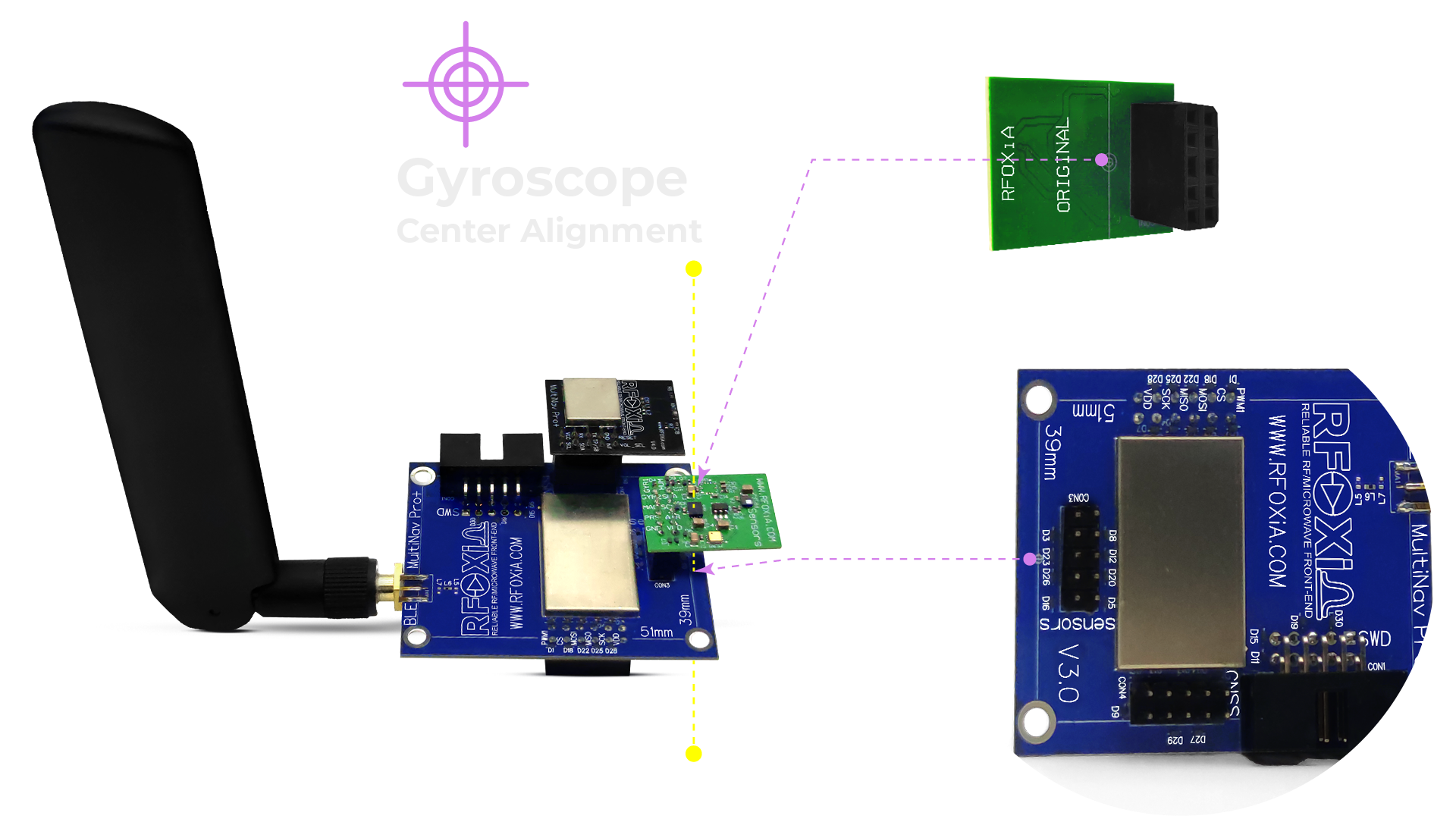
I2C Architecture: Clean Bus, No Conflicts
One of the most frequently overlooked aspects of multi-sensor module design is bus management. I2C allows multiple devices on a shared two-wire bus — but only if each device has a unique address. Many commodity sensor modules use default addresses that conflict with other common sensors, creating a development nightmare when building multi-sensor systems.
The MultiNav Pro+™ Sensors Module was designed with I2C address management as a first-class concern. All seven sensors share a single I2C line, each with a dedicated, non-conflicting address. A single two-wire connection from your microcontroller gives you access to the entire sensor array — accelerometer, gyroscope, magnetometer, pressure, temperature, humidity, and air quality — without bus arbitration issues, without level shifting complexity, without address remapping in firmware.
For embedded developers who have spent hours debugging I2C address conflicts on multi-board builds, this architecture alone is worth the price of admission.
The single I2C bus also dramatically simplifies PCB routing on the host hardware. Instead of running four separate sensor connections to four separate modules, you route one I2C line and power. This is not a minor convenience — in tight form factors like FPV racing drones, every trace matters.
Form Factor: 24mm × 18mm for the Spaces That Matter
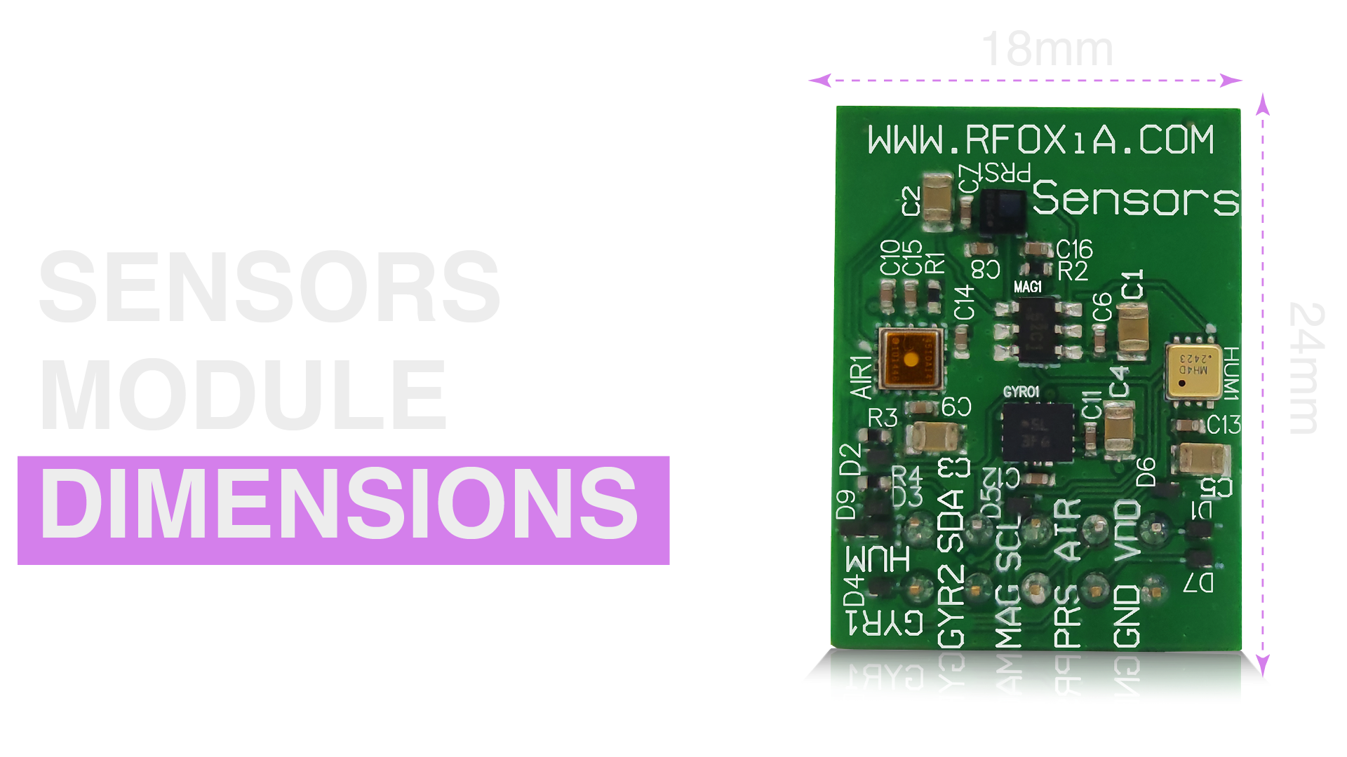
At 24mm × 18mm, the MultiNav Pro+™ Sensors Module fits into the constrained geometries where serious hardware lives.
For reference:
- A standard 30×30mm flight controller stack mounting pattern is common in 5-inch FPV drones — this module fits alongside a flight controller in that space
- Wearable devices typically have sensor budgets measured in centimeters — this module fits
- Field IoT enclosures for environmental monitoring are often palm-sized — this module fits
The compact form factor is not accidental. It is the result of intentional component selection: choosing sensors in QFN, WLCSP, and SOT packages rather than through-hole or oversized SMD packages, optimizing the PCB layout for density, and routing the I2C bus efficiently to minimize board area.
This is what professional hardware design looks like at the module level.
Real-Time Environmental Data — and Getting Paid for It
Here is where the RFOXiA ecosystem introduces something no other altitude sensor module manufacturer offers: a path to passive income from your deployed sensor hardware.
When you deploy the MultiNav Pro+™ Sensors Module outdoors — verified by GPS coordinates from the RFOXiA GNSS Module — and stream its five environmental data points (temperature, humidity, pressure, air quality, and location) to the RFOXiA data network, you earn daily data rewards.
The reward structure:
- Base rate: $0.08–$0.25 per day depending on location scarcity
- Pioneer rate: Higher locked-in rates for early network contributors
- Scarcity bonus: Nodes in data-sparse locations earn more
- Uptime bonus: Consistent streaming earns higher rates
- Maximum potential: Up to $0.40/day for complete verified data sessions
Why does this data have value? Because the organizations that need hyper-local environmental data — insurance companies modeling climate risk, agricultural technology firms tracking micro-climates, smart city operators optimizing energy use, logistics companies monitoring freight conditions — cannot get street-level resolution from public weather APIs. Those APIs report from weather stations kilometers apart, at intervals of minutes or tens of minutes.
Your MultiNav Pro+™ node reports at second-level resolution from your specific geographic location. That is data that enterprise buyers will pay for. RFOXiA aggregates and sells it — and shares the revenue with you.
Your sensor module, deployed and generating income. That is the RFOXiA ecosystem in action.
If you're ready to explore this capability, the RFOXiA Integrated Sensors Module is the starting point.
Applications: Where the MultiNav Pro+™ Sensors Module Excels
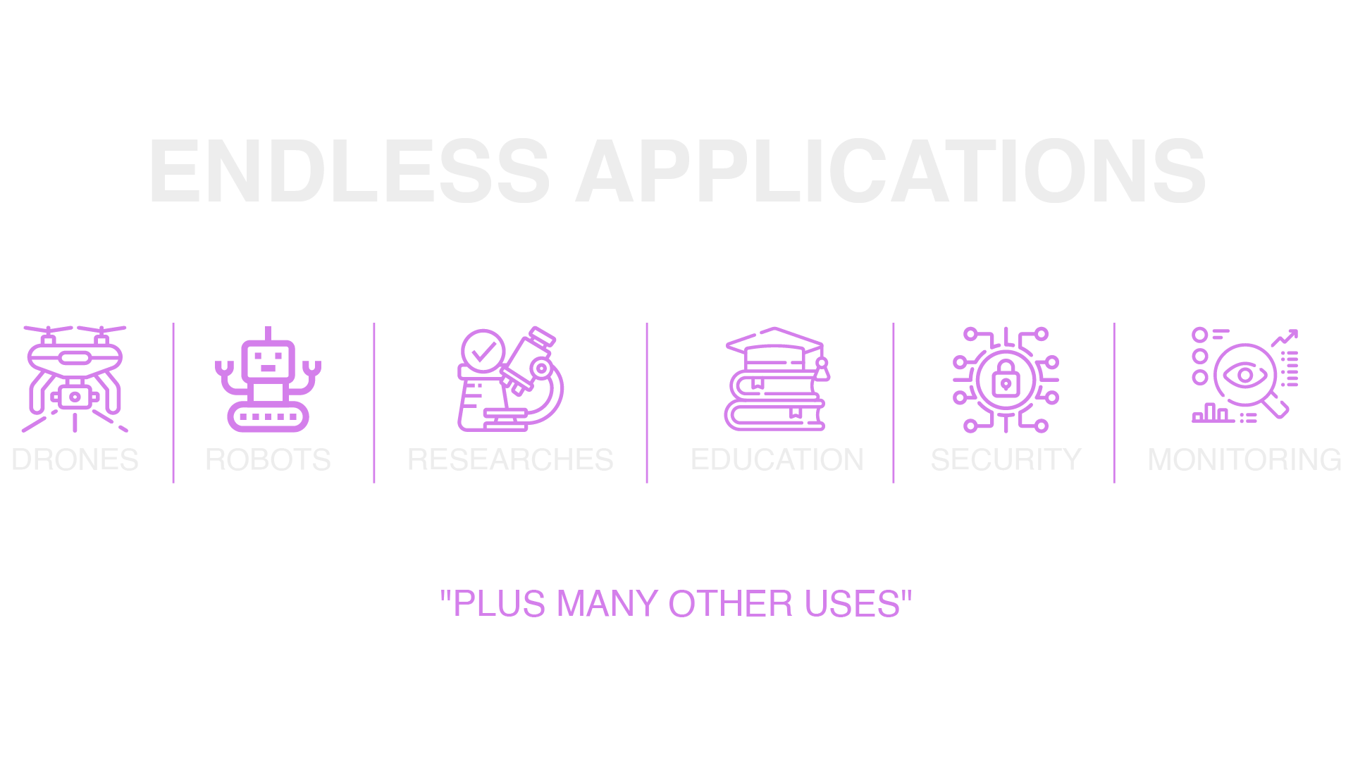
The breadth of applications for a professional-grade altitude sensor module with full environmental and motion sensing is significant. Here is where builders are deploying the MultiNav Pro+™:
Drone Navigation and Altitude Hold
The combination of LPS22HH barometric altitude with BMI270 IMU data enables sophisticated altitude hold implementations. The temperature correction from the MVH4003D ensures pressure readings stay accurate across varying atmospheric conditions. For fixed-wing aircraft and multirotors operating at varying altitudes, this combination outperforms single-sensor altitude estimation significantly.
FPV Racing and Freestyle
FPV pilots who want telemetry data — altitude, orientation, environmental conditions — streamed to their goggles or ground station benefit from having all of this data available on a single I2C-accessible module rather than cobbling together multiple boards.
Environmental Research and Field Monitoring
Field researchers deploying battery-powered monitoring nodes in remote locations need maximum sensor capability in minimum volume and power footprint. The MultiNav Pro+™ delivers full environmental sensing — pressure, temperature, humidity, air quality — plus motion and heading data, all from a board that fits in a matchbox-sized enclosure.
Smart Agriculture
Precision agriculture applications benefit from dense, geo-tagged environmental data. Temperature gradients across a field, humidity variations, air pressure changes that predict weather shifts — all of this is available from a single MultiNav Pro+™ node. Combined with the RFOXiA data network, agricultural operators can build high-resolution field data sets that directly inform irrigation and crop management decisions.
Robotics and Autonomous Vehicles
Ground robots navigating complex environments benefit from 9-axis IMU data for dead reckoning, orientation estimation, and terrain detection. The environmental sensing layer adds atmospheric context that can inform operational decisions — for example, pausing outdoor operations when air quality or humidity crosses defined thresholds.
Wearable and Personal IoT
The 24mm × 18mm form factor and single I2C connection make this module an excellent candidate for wearable health and environmental monitoring devices. Air quality exposure tracking, altitude logging for hiking applications, and motion-based activity recognition are all enabled by this single module.
Urban Air Quality Networks
City-scale air quality monitoring requires dense node networks. Each MultiNav Pro+™ deployed in an urban environment contributes ZMOD4510-based ozone and NO2 data with GPS-verified location — exactly the kind of ground-truth data that smart city initiatives need and currently cannot source at this resolution.
The RFOXiA Ecosystem: This Module Is One Piece of Something Larger
The MultiNav Pro+™ Sensors Module does not exist in isolation. It is part of a vertically integrated developer ecosystem that includes:
- MultiNav Pro+™ BLE Module — 5km ground-to-ground, 15-20km man-to-drone range wireless link for transmitting sensor data to ground stations without cellular infrastructure
- MultiNav Pro+™ GNSS Module — 1.5-meter accuracy, 18Hz fix rate precision GPS for location-verified data and drone navigation
- Power/Program Kit — supercapacitor-based power system, 5-minute charge, 24-hour runtime, with integrated STLink programmer
- RFOXiA Connect App — iOS and Android mobile application for live sensor data visualization and device control
- RFOXiA Club — full developer platform with AI firmware builder, community dev hub, command center for live data streaming, and data rewards dashboard
When the Sensors Module connects to the BLE Module, its environmental data can be transmitted wirelessly over distances of kilometers — without a cellular connection, without Wi-Fi infrastructure, without any existing network. This is what makes the RFOXiA ecosystem relevant for disaster response, remote field research, and off-grid environmental monitoring in ways that cloud-connected sensor solutions cannot match.
For developers who want the complete stack, the Developer Bundle combines all four modules at $199 — an integrated solution that no other manufacturer offers at this price point.
AI Firmware Development: From Description to Code
One of the most significant barriers for hardware developers integrating a multi-sensor module is firmware complexity. Reading seven sensors across an I2C bus, managing sample rates, applying calibration coefficients, fusing motion data, and formatting output for downstream consumption — this is not trivial embedded development work.
RFOXiA Club's AI Firmware Builder changes this equation. Describe your application in plain language — "read all seven sensors at 10Hz, apply Madgwick filter to IMU data, log altitude and air quality to serial output" — and the AI generates production-ready firmware with full source code.
This is not boilerplate generation. The AI understands the specific sensors on the MultiNav Pro+™ board, their I2C addresses, their initialization sequences, and their data formats. It produces firmware that works with your specific hardware, not generic template code that requires significant modification.
For developers who want to move from idea to working prototype quickly, this dramatically changes the development timeline from weeks to hours.
Specifications Summary
| Feature | Detail |
|---|---|
| Accelerometer & Gyroscope | BMI270 — Bosch Sensortec |
| Magnetometer | TMAG5273C1QDBVR — Texas Instruments |
| Barometric Pressure | LPS22HHTR — STMicroelectronics |
| Humidity & Temperature | MVH4003D — MEMSVision |
| Air Quality | ZMOD4510AI4R — RENESAS |
| Communication | I2C — single bus, dedicated addresses |
| Module Size | 24mm × 18mm |
| Certification | FCC Certified |
| Price | $39 |
| Ecosystem | RFOXiA Club, Connect App, AI Firmware Builder |
FCC Certification: Ready for Professional Deployment
Every RFOXiA module — including the MultiNav Pro+™ Sensors Module — carries FCC certification. This is not an academic detail. FCC certification means this hardware has been tested and approved for use in the United States, and it is the primary credential that unlocks distribution through professional channels including DigiKey, Mouser, and similar distributors.
For professional developers integrating modules into products, FCC certification on the component level simplifies your own compliance path. For researchers and institutions procuring hardware, it removes procurement friction. For anyone deploying hardware in an environment where regulatory compliance matters, it is simply required.
Why $39 Is the Right Price for This Altitude Sensor Module
Sourcing seven discrete sensors from professional manufacturers — Bosch, Texas Instruments, STMicroelectronics, MEMSVision, RENESAS — designing a 24mm × 18mm four-layer PCB to integrate them with a clean I2C bus, producing an FCC-certified module, and making it available at $39 requires manufacturing efficiency and a long-term platform strategy.
RFOXiA's vertically integrated approach — hardware design, manufacturing partnerships in China, direct distribution — eliminates the margin layers that inflate prices at distributors. The data network creates a business model that allows hardware to be priced accessibly, because the platform generates value beyond the hardware sale.
For context: sourcing and populating seven individual sensor breakout boards from major breakout board manufacturers would cost significantly more than $39, require considerably more wiring, introduce I2C address conflict risk, and occupy five to ten times the PCB area.
This is a genuinely good deal. It exists because of intentional product strategy, not a compromise on component quality.
Get Started with the MultiNav Pro+™ Sensors Module
If you are building a drone, a robotics platform, a field environmental monitoring system, or any IoT application that needs professional-grade sensing in a compact form — the MultiNav Pro+™ Sensors Module is the right starting point.
At $39 with FCC certification, seven industry-grade sensors, clean I2C integration, and access to the full RFOXiA ecosystem including the AI Firmware Builder and data reward network, there is no comparable product at this price point.
The RFOXiA Integrated Sensors Module is in stock and ships from our warehouse. Join RFOXiA Club for free and receive $10 in welcome credits toward your first purchase.
Builders who want the complete ecosystem — BLE wireless link, GNSS positioning, sensors, and professional power management — should explore the Developer Bundle at $199, which packages all four modules with full platform access.
Your altitude sensor module should do more than measure altitude. The MultiNav Pro+™ Sensors Module does.
Explore the MultiNav Pro+™ Sensors Module →
Written by: Moamen Mohamed LinkedIn