
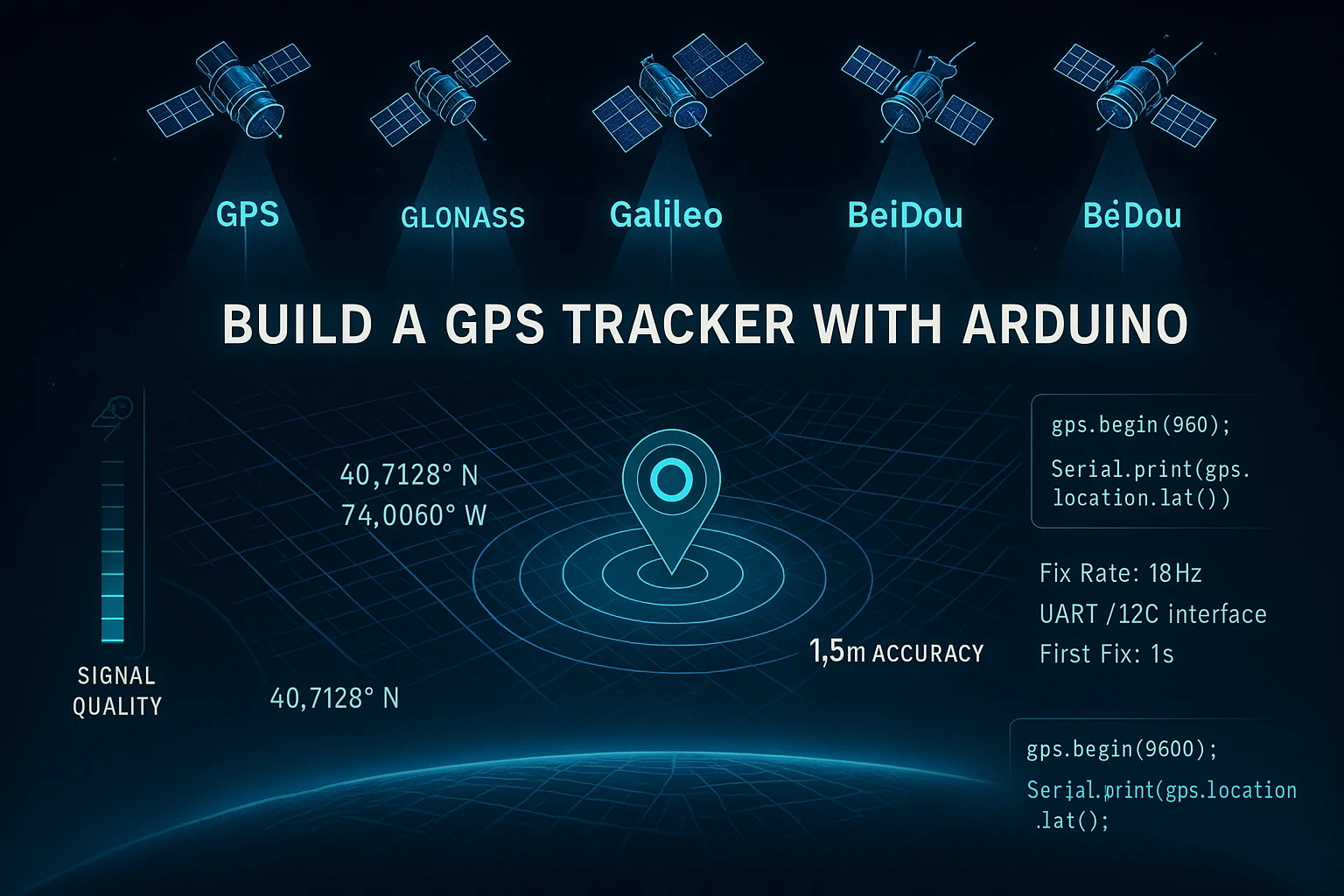
Build GPS Tracker Arduino Projects with the MultiNav Pro+ GNSS Module
The Complete Guide to Build GPS Tracker Arduino Systems That Actually Perform
If you have ever tried to build GPS tracker Arduino projects and ended up disappointed by sluggish fix rates, drifting accuracy, or modules that lose lock the moment your drone banks into a turn — you are not alone. Most GPS modules available to makers were designed for pedestrian navigation, not for fast-moving autonomous platforms, precision field research, or mission-critical IoT deployments.
This guide covers everything you need to know to build GPS tracker Arduino projects the right way: choosing the right hardware, wiring it up, writing clean firmware, and pushing your tracking system far beyond what generic modules can deliver.
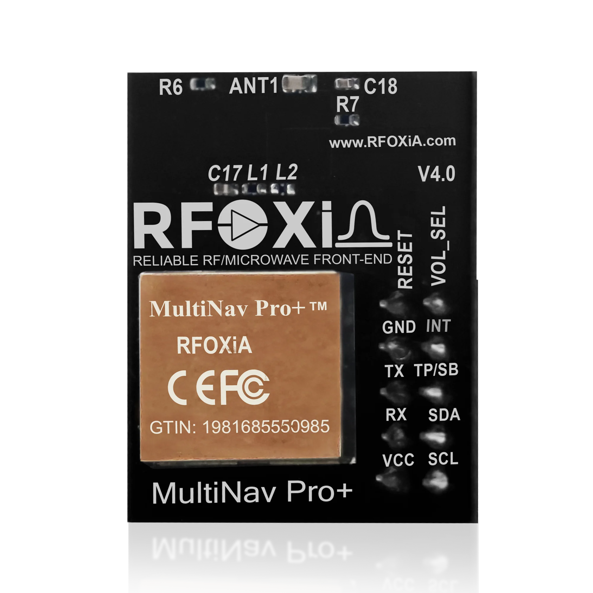
The hardware we are focusing on is the MultiNav Pro+™ GNSS Module from RFOXiA — a professional-grade precision navigation module built around the u-blox MIA-M10Q chip, designed to fit into maker and developer hands at a price that does not require a research grant.
Why Most GPS Modules Fail Makers and Engineers
Before we get into the hardware specs and code, it is worth understanding why so many GPS tracker projects fall short.
The most common failures are:
- Slow fix rate. A 1Hz update rate means your tracker is reporting position once per second. For a drone flying at 60km/h, that is a 16-meter gap between readings. You cannot do meaningful path tracking or real-time control with that latency.
- Single-constellation support. Modules that only support GPS (United States satellites) are completely dependent on one network. Cloud cover, urban canyons, and geographic position all affect GPS-only accuracy significantly.
- Poor RF front-end design. Cheap modules skip proper antenna filtering, which means interference from onboard electronics degrades signal quality exactly when you need it most.
- No software library. Parsing raw NMEA sentences from scratch is tedious and error-prone. A good module comes with a tested library that abstracts this work away.
The MultiNav Pro+ was designed specifically to solve every one of these problems.
MultiNav Pro+ GNSS Module: Specifications Overview
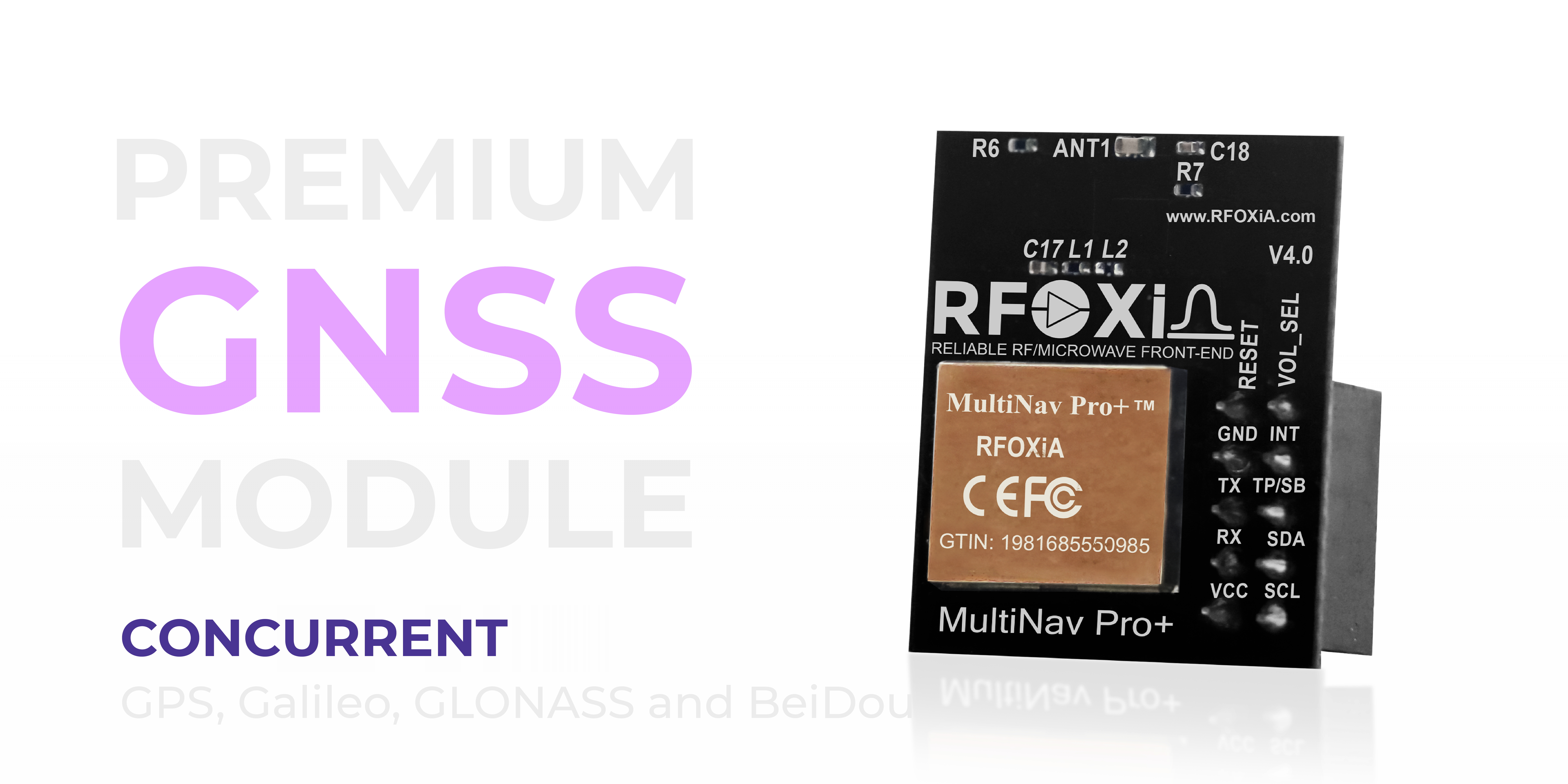
The MultiNav Pro+ is built on the u-blox MIA-M10Q — one of the most capable GNSS receiver chips available for embedded applications. Here is what that means in practice:
| Specification | Value |
|---|---|
| Accuracy | Less than 1.5 meters CEP |
| Fix Rate | Up to 18Hz |
| First Fix | 1 second (hot start) |
| Constellation Support | GPS, Galileo, GLONASS, BeiDou (concurrent) |
| Interface | UART and I2C |
| Supply Voltage | 1.8V and 3.3V |
| Current Draw | 25–30mA |
| Dimensions | 26mm x 22mm |
| Antenna | Integrated high-gain chip antenna |
| Certification | FCC certified |
These are not theoretical maximums. The 18Hz fix rate and 1.5-meter accuracy are achievable in real-world outdoor deployments.
Why 18Hz Matters When You Build GPS Tracker Arduino Systems for Drones

When you build GPS tracker Arduino systems for static or slow-moving applications like weather stations or asset trackers, a 1Hz update rate might be acceptable. But the moment you start tracking anything that moves — a drone, a ground rover, a race car, a person running — update rate becomes critical.
At 18Hz, the MultiNav Pro+ delivers a new position fix 18 times every second. Compare this to a standard 1Hz GPS module:
- 1Hz at 60km/h drone: 16.7 meters between updates
- 18Hz at 60km/h drone: less than 1 meter between updates
This difference is the gap between a GPS track that looks like a rough sketch and one that accurately represents the flight path. For autonomous navigation, geofencing, or precision return-to-home, this is not a nice-to-have — it is foundational.
Compact and Power-Efficient: Built for Real Deployments
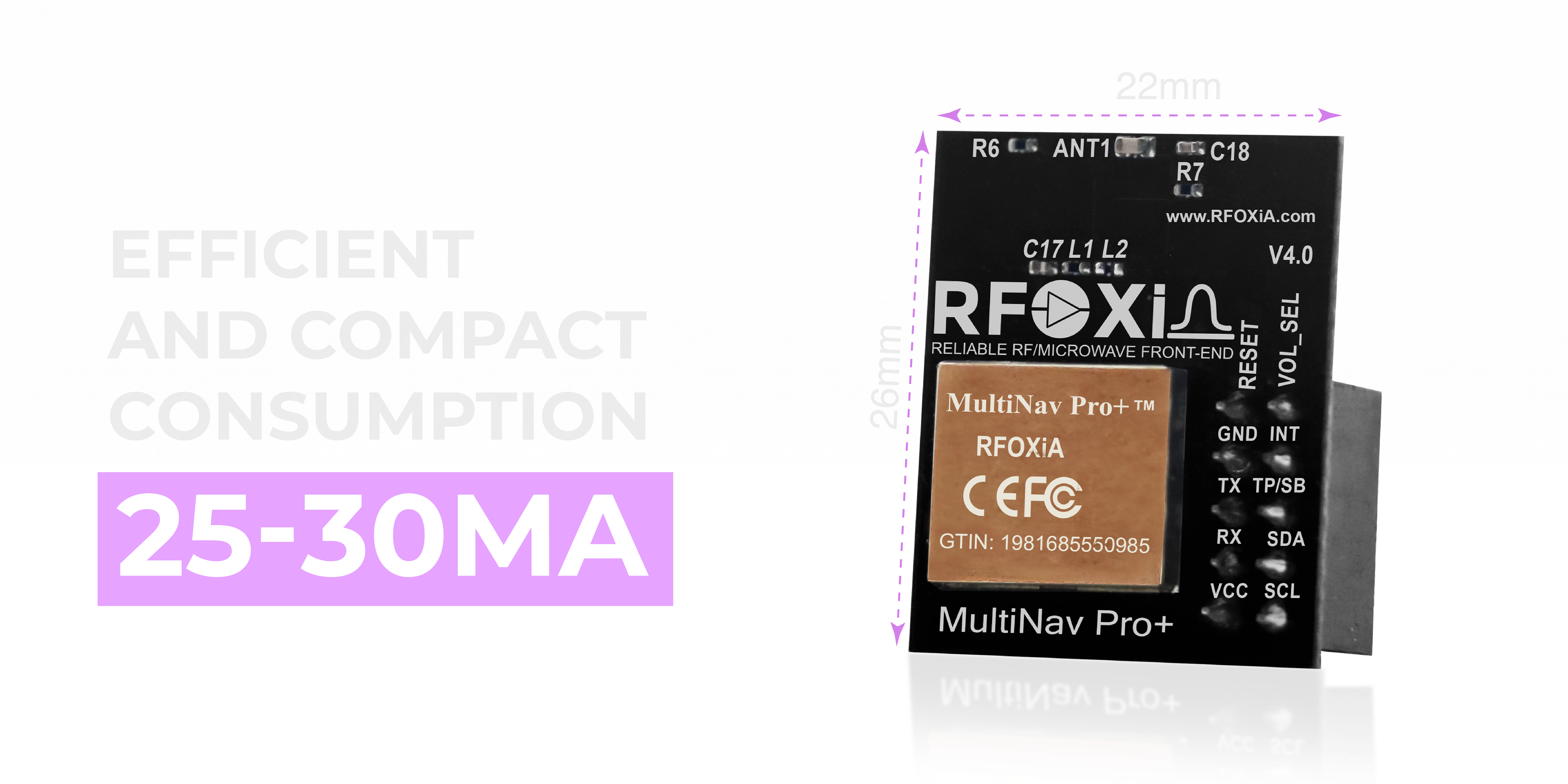
At 26mm x 22mm and drawing only 25–30mA, the MultiNav Pro+ fits into tight form factors without compromising your power budget. For battery-powered IoT deployments, drones, wearables, or handheld trackers, this efficiency matters.
The concurrent multi-constellation operation — receiving GPS, Galileo, GLONASS, and BeiDou signals simultaneously — does not come at a power penalty. The MIA-M10Q chip is specifically engineered for this balance, delivering maximum satellite availability at minimum current draw.
More satellites visible means faster first fix, more robust lock in challenging environments like tree cover or urban buildings, and overall better accuracy. This is a meaningful advantage when you build GPS tracker Arduino projects that need to work reliably in the field, not just on a desk.
Wiring the MultiNav Pro+ to Arduino
Hardware Requirements
- Arduino Uno, Mega, or any 3.3V-compatible board (Arduino Due, ESP32, STM32, Raspberry Pi Pico)
- MultiNav Pro+ GNSS Module
- Jumper wires
- USB cable
Important note on voltage: The MultiNav Pro+ operates at 3.3V logic. If you are using an Arduino Uno (5V logic), you will need a logic level shifter on the UART TX/RX lines. Boards like the ESP32, Arduino Due, or STM32-based boards are natively 3.3V and work directly without level shifting.
UART Wiring (Recommended)
| MultiNav Pro+ Pin | Arduino Pin |
|---|---|
| VCC | 3.3V |
| GND | GND |
| TX | RX (via level shifter if 5V board) |
| RX | TX (via level shifter if 5V board) |
I2C Wiring (Alternative)
| MultiNav Pro+ Pin | Arduino Pin |
|---|---|
| VCC | 3.3V |
| GND | GND |
| SCL | SCL (A5 on Uno) |
| SDA | SDA (A4 on Uno) |
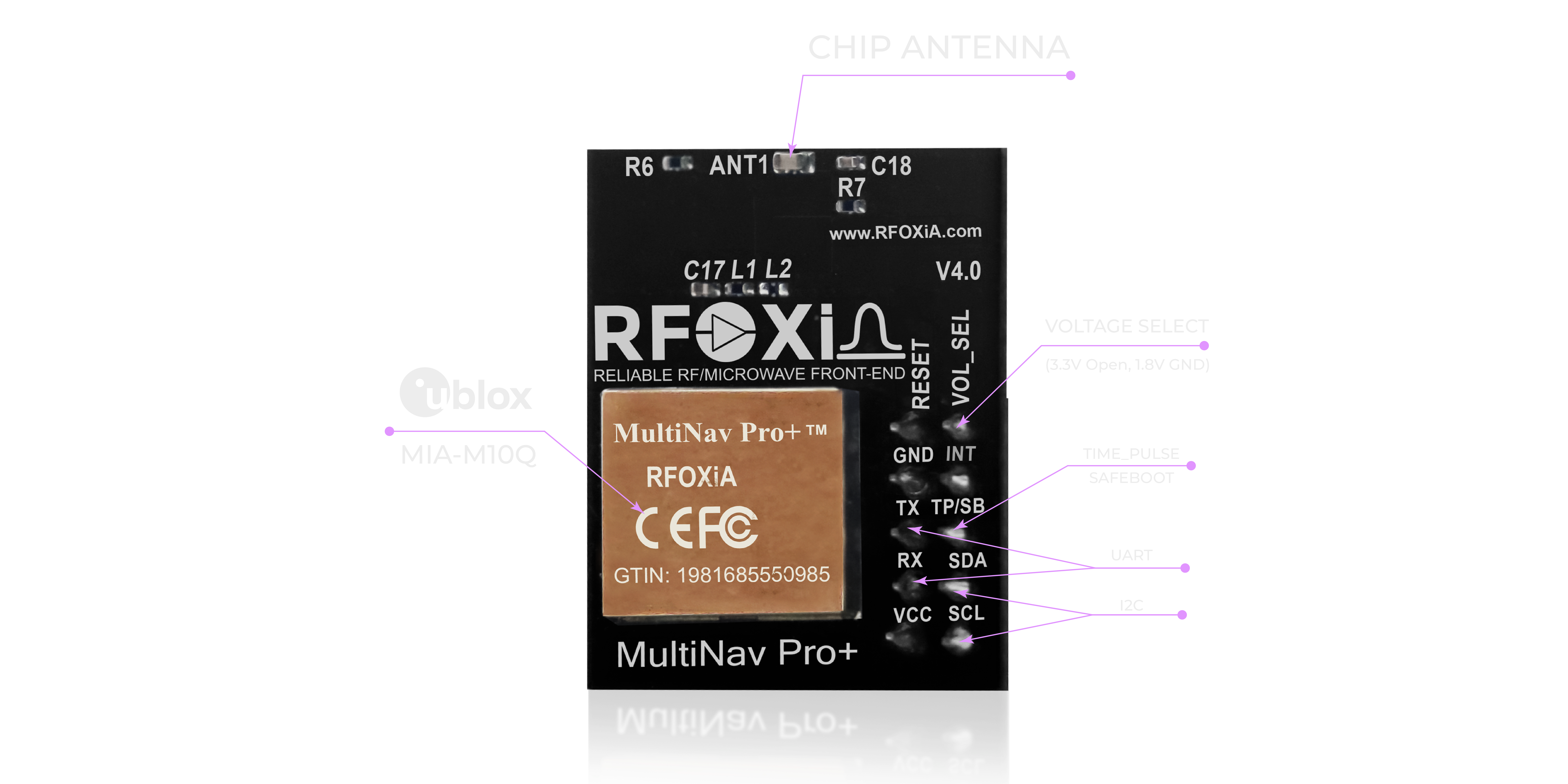
Both UART and I2C are fully supported. UART is generally preferred for GPS modules because it supports higher throughput at the fix rates the MultiNav Pro+ can deliver — especially at 18Hz where data bandwidth is meaningful. I2C is useful when you are integrating alongside multiple sensors on a shared bus.
Open Source Driver: Getting the Software Running
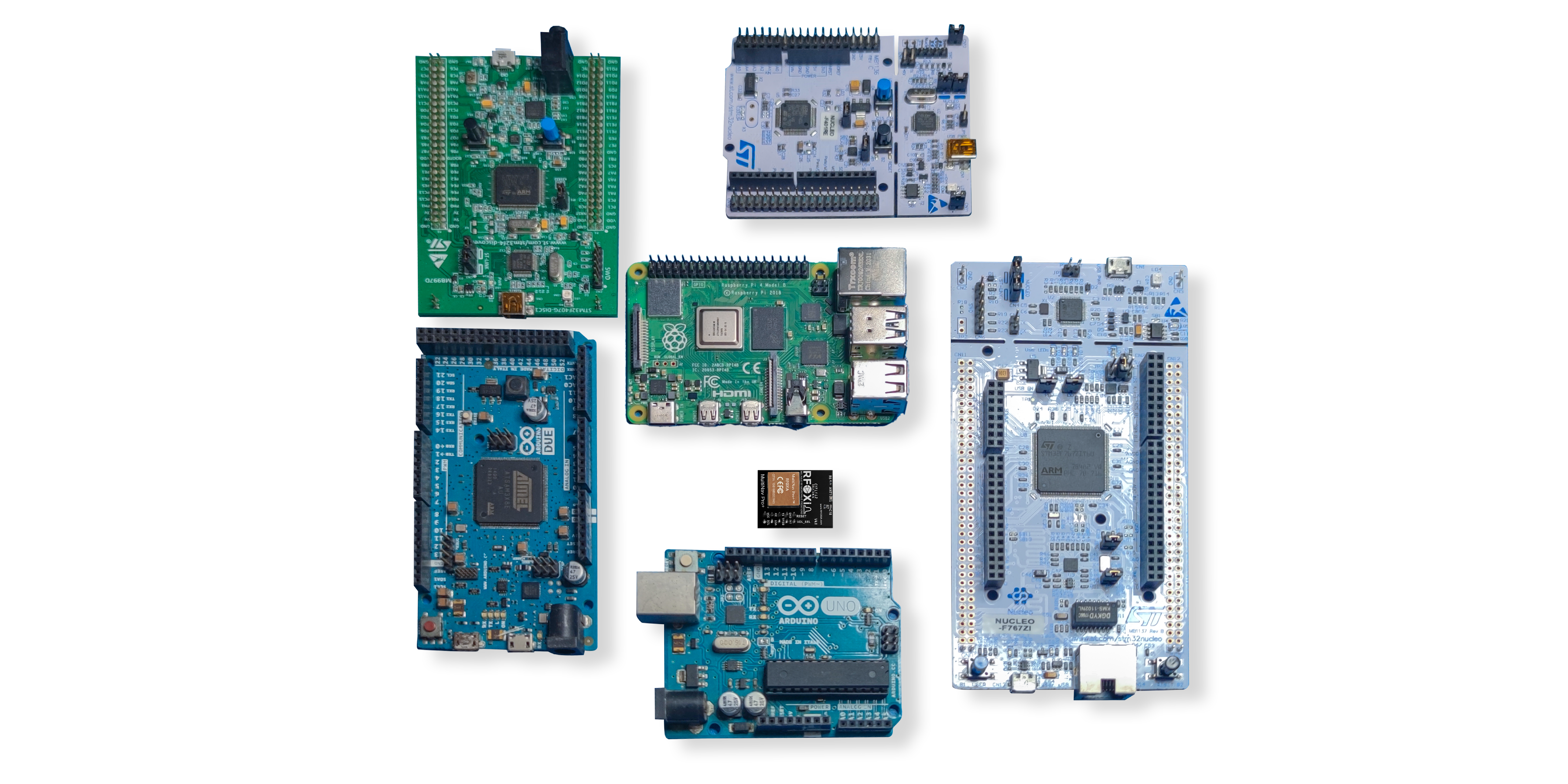
One of the most underrated features of the MultiNav Pro+ is the fully open-source C language driver library that ships with it. This library:
- Parses all standard NMEA protocol sentences (GGA, RMC, VTG, GSA, GSV)
- Exposes clean function calls for latitude, longitude, altitude, speed, heading, fix quality, and satellite count
- Is written in standard C — compatible with Arduino IDE, PlatformIO, STM32CubeIDE, ESP-IDF, and any other C/C++ toolchain
- Is well-commented and structured so you can modify and extend it for your application
To build GPS tracker Arduino projects, you do not need to write a single line of NMEA parsing code. Import the library, initialize the serial port, call the update function in your loop, and access your position data directly.
Basic Arduino Code Structure
The following pseudocode illustrates how clean the integration is:
#include <MultiNavPro.h>

MultiNavPro gnss;

void setup() {
  Serial.begin(115200);
  Serial1.begin(9600); // GNSS UART
  gnss.begin(Serial1);
}

void loop() {
  gnss.update();
  if (gnss.isFixed()) {
    Serial.print("Lat: ");
    Serial.println(gnss.getLatitude(), 6);
    Serial.print("Lon: ");
    Serial.println(gnss.getLongitude(), 6);
    Serial.print("Alt: ");
    Serial.println(gnss.getAltitude());
    Serial.print("Fix Rate: ");
    Serial.println(gnss.getFixRate());
  }
}
With this foundation, you can add SD card logging, OLED display output, GSM/LoRa data transmission, or integration with the RFOXiA Accurate GNSS Module ecosystem for live data streaming — all in a few dozen additional lines of code.
U-Center Software: Professional Visualization and Configuration
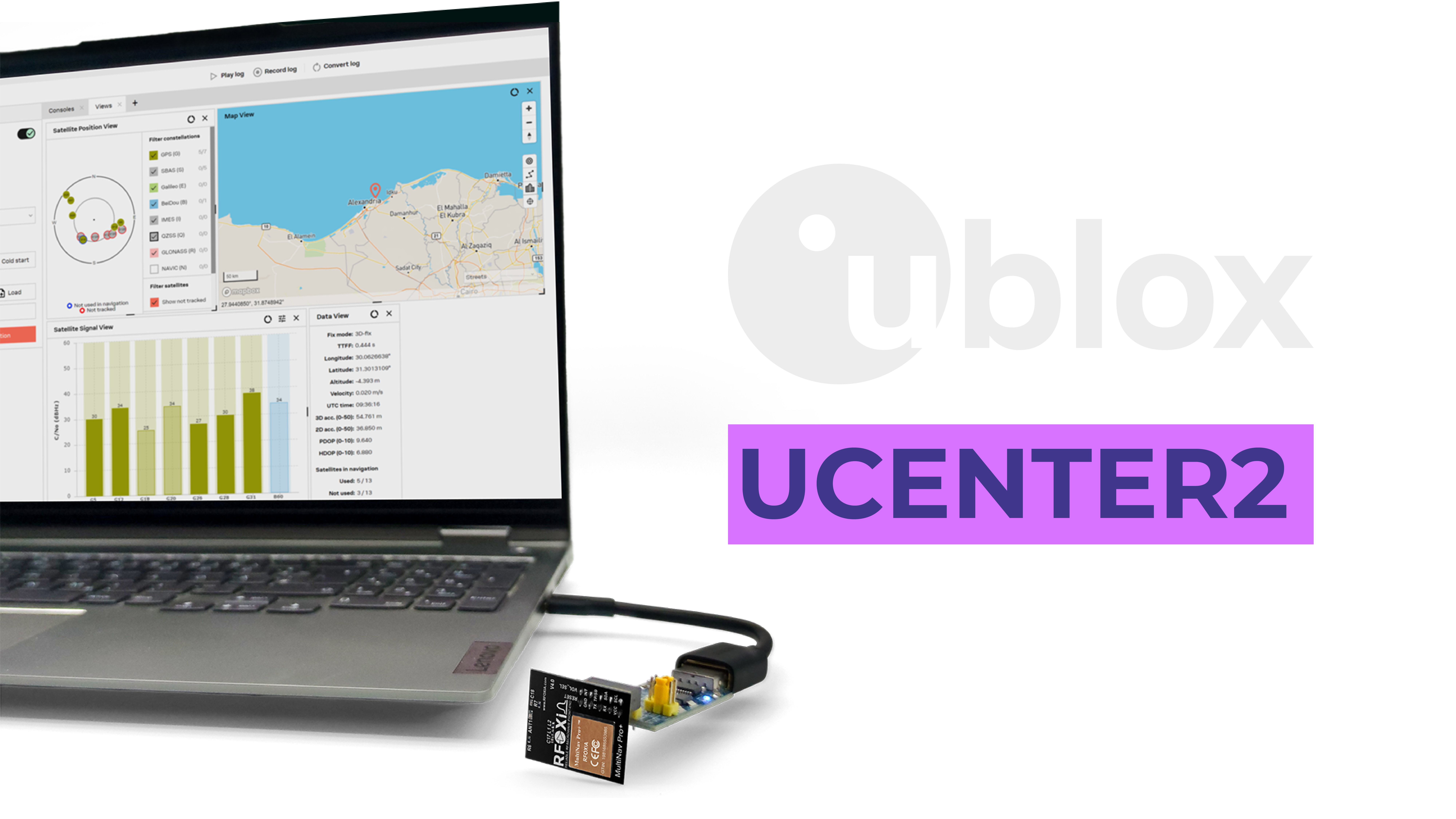
Because the MultiNav Pro+ is built on the u-blox MIA-M10Q, it is fully compatible with u-center — u-blox's professional GNSS evaluation and configuration software. U-center gives you:
- Real-time satellite sky plot — see exactly which satellites are in view and their signal strengths
- Live position tracking — map view with path history
- Configuration panel — change fix rate, enable/disable constellations, configure power modes, set geofence parameters
- Data logging — record raw NMEA or UBX protocol data for post-processing
- Message viewer — inspect every GNSS message in real time for debugging
For developers building GPS tracker Arduino systems for professional or research applications, u-center is an invaluable diagnostic tool. You can validate your antenna placement, identify interference sources, and configure the module precisely before locking in your firmware — all without writing code.
Use Cases: Where the MultiNav Pro+ Delivers Real Value

The MultiNav Pro+ is not a one-trick module. When you build GPS tracker Arduino projects with this hardware, you are equipped for a wide range of serious applications:
Drone Navigation and Autonomous Flight
At 18Hz and 1.5-meter accuracy, the MultiNav Pro+ provides the position feedback loop that autonomous drones need for stable GPS-hold, waypoint navigation, and precision landing. Fast fix rates mean your flight controller always has fresh position data, even in aggressive maneuvers.
IoT Environmental Monitoring with Location Verification
In the RFOXiA data network, GPS coordinates are used to verify that sensor modules are deployed outdoors in real locations. A module streaming environmental data with a confirmed GPS fix is verifiably trustworthy — spoofing resistance built into the architecture. This makes the MultiNav Pro+ central to the RFOXiA data monetization ecosystem.
Asset and Vehicle Tracking
For fleet management, cargo tracking, or high-value equipment monitoring, the 1.5-meter accuracy and concurrent constellation support provide reliable tracking even in urban environments with tall buildings.
Precision Agriculture
Row guidance, field mapping, and spray zone logging all benefit from sub-2-meter accuracy at high update rates. The MultiNav Pro+ at $49 brings professional agriculture-grade GNSS performance within reach of small farm operators and agricultural research projects.
Wearables and Personal Safety Devices
The compact 26x22mm footprint and 25-30mA current draw make the MultiNav Pro+ viable for wearable applications — hiking GPS, personal locators, search-and-rescue beacons — where size and battery life directly affect usability.
Academic Research and Student Projects
The open-source library, u-center compatibility, Arduino integration, and accessible price point make the MultiNav Pro+ an exceptional choice for university research projects, capstone engineering designs, and advanced maker builds.
Integrating GPS with the Full RFOXiA Wireless Ecosystem
The MultiNav Pro+ does not need to work alone. RFOXiA has designed its entire hardware ecosystem to work together as an integrated platform:
- BLE Module (MultiNav Pro+ BLE) — pair with your GPS module to transmit location data wirelessly at ranges up to 20km man-to-drone, completely without internet infrastructure
- Sensors Module — add temperature, humidity, pressure, air quality, accelerometer, gyroscope, and magnetometer data alongside your GPS stream
- Power/Program Kit — 5-minute charge, 24-hour runtime supercapacitor power system keeps your complete module stack running in remote deployments
- RFOXiA Connect App — live GPS tracking on your phone with real-time map display, drone control overlay, and sensor data dashboard — all without internet
When you combine the MultiNav Pro+ GNSS module with the BLE module and sensors, you get a complete wireless telemetry system for roughly $150 in hardware — a capability level that would have required thousands of dollars of industrial equipment five years ago.
The RFOXiA Accurate GNSS Module is available now for $49 with inventory in stock and ready to ship.
Advanced Project Ideas: Beyond Basic Tracking
Once you have the fundamentals of how to build GPS tracker Arduino systems working, the MultiNav Pro+ opens doors to more sophisticated applications:
Geofenced Alert System
Define a geographic boundary in your firmware. When the tracked object crosses the fence, trigger an alert — via BLE message, buzzer, relay, or wireless data packet. With 1.5-meter accuracy, geofences as small as 3-4 meters in diameter are reliable.
GPS-Synchronized Data Logger
Timestamp every sensor reading with GPS-derived UTC time — more accurate than any RTC chip. Log temperature, air quality, accelerometer data, and GPS coordinates simultaneously to SD card for post-analysis. This is exactly the architecture RFOXiA's data network rewards contributors for deploying.
Dual-Module Relative Positioning
With two MultiNav Pro+ modules and the RFOXiA BLE link, you can calculate relative position between two moving platforms in real time — a technique used in precision landing, drone swarm coordination, and formation flight research.
Breadcrumb Trail Mapper
Log GPS positions at configurable intervals to SD card, then upload and render the track on a map for route analysis, search pattern documentation, or race telemetry.
Frequently Asked Questions
Q: Can I use the MultiNav Pro+ with a 5V Arduino Uno? Yes, but you need a 3.3V to 5V logic level shifter on the UART lines. The power supply should come from your board's 3.3V pin, not the 5V pin.
Q: What is the difference between 1Hz and 18Hz in practice? At 18Hz you get 18 position updates per second versus 1. For static or slow-moving applications the difference is minimal. For drones, robots, or fast vehicles the difference is dramatic — smoother control loops, more accurate path logging, and better geofence triggering.
Q: Does the MultiNav Pro+ work indoors? GNSS signals are weak inside buildings. For indoor positioning, GNSS modules are generally not the right tool. The MultiNav Pro+ performs best with a clear view of the sky.
Q: Is the library compatible with ESP32? Yes. The open-source C library is compatible with ESP32, STM32, Arduino, Raspberry Pi Pico, and any platform with a C/C++ compiler and a UART interface.
Q: What accuracy can I realistically expect? In open-sky conditions with good satellite geometry, the MultiNav Pro+ delivers under 1.5 meters CEP (Circular Error Probable). In challenging environments with partial sky view, accuracy may degrade to 3-5 meters — still significantly better than most consumer GPS modules.
Getting Started Today
Every MultiNav Pro+ ships with a Quick Start Guide and access to the full open-source library. For developers using the RFOXiA Club platform, the AI Firmware Builder can generate complete tracking firmware for your specific application — describe your project in plain language and receive production-ready code in minutes.
Whether you are building your first GPS tracker Arduino project or designing a professional-grade autonomous navigation system, the MultiNav Pro+ delivers the accuracy, speed, and reliability your project deserves — at a price that does not require a university research budget.
Ready to build? Get the RFOXiA Accurate GNSS Module for $49, in stock and shipping now.
Summary: Why the MultiNav Pro+ Is the Right Choice
When you set out to build GPS tracker Arduino projects, the module you choose defines the ceiling of what your project can achieve. The MultiNav Pro+ raises that ceiling significantly:
- 1.5-meter accuracy — professional precision at maker pricing
- 18Hz fix rate — real-time performance for fast platforms
- Concurrent four-constellation support — maximum satellite availability anywhere on Earth
- Open-source Arduino-compatible library — zero time wasted on NMEA parsing
- u-center compatible — professional diagnostic and configuration tool
- FCC certified — ready for commercial deployment and distribution
- 26mm x 22mm, 25-30mA — compact and power-efficient for any form factor
- Full RFOXiA ecosystem integration — pairs with BLE module, sensors, power kit, and mobile app
This is not a hobbyist GPS breakout. It is a professional navigation module designed for builders who take their projects seriously.
Written by: Moamen Mohamed LinkedIn