
GPS Accuracy Problem Drone: Why It Happens and How to Finally Fix It
The GPS Accuracy Problem Drone Pilots Face Every Day
You launch your drone. You arm the GPS hold. You walk away trusting that your machine knows exactly where it is.
Then it drifts.
Sometimes a meter. Sometimes five. Sometimes enough to clip a tree, miss a survey waypoint, or ruin a precision agriculture pass that took an hour to plan.
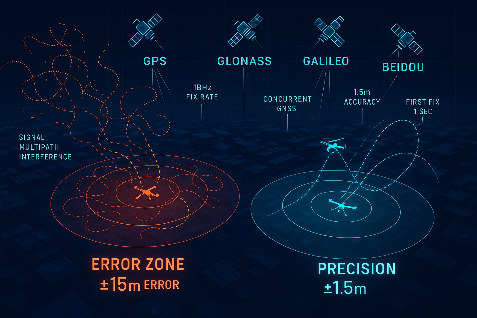
The GPS accuracy problem drone operators deal with is not a software bug or a pilot error. It is a hardware limitation baked into the cheap, commodity GNSS modules that ship inside most consumer and prosumer drones. These modules were designed for smartphones and navigation apps where two or three meters of error is invisible and irrelevant. On a drone flying a 50-meter grid pattern at five meters altitude, two meters of positional error is catastrophic.
This article breaks down exactly why the GPS accuracy problem exists on drones, what the engineering differences are between commodity and professional GNSS hardware, and how a single module upgrade — the RFOXiA MultiNav Pro+ — eliminates the problem at a price point any serious builder can afford.
Why Commodity GPS Modules Fail on Drones
Single-Constellation Tracking
The most common source of GPS positioning error on drones is single-constellation or dual-constellation satellite tracking. Most budget GNSS chips only lock onto the American GPS network. A few add GLONASS. This limits the total number of satellites visible from any given position.
Fewer satellites in view means a weaker geometric dilution of precision (GDOP). Worse GDOP means worse position accuracy. In open sky conditions you might squeeze 3–5 meter accuracy out of a GPS-only module. Near structures, in urban canyons, or at low elevations, accuracy degrades further — sometimes to 10 meters or beyond.
Professional GNSS systems solve this by tracking all four major constellations simultaneously: GPS, GLONASS, Galileo, and BeiDou. With all four active, your receiver sees more satellites from more directions, GDOP improves dramatically, and accuracy tightens to the 1.5 meter range even in challenging sky conditions.
Slow Fix Rates
A drone in motion is not stationary. A 10Hz fix rate — which sounds fast — means your GNSS module reports position 10 times per second. At 15 m/s horizontal velocity (a moderate drone speed), the drone travels 1.5 meters between each position update. If your flight controller interpolates poorly or your autopilot holds the last known position during the gap, you accumulate position error in real time.
The GPS accuracy problem drone builders see during fast autonomous missions is often not static error. It is dynamic lag — the module cannot update fast enough to keep the flight controller properly informed.
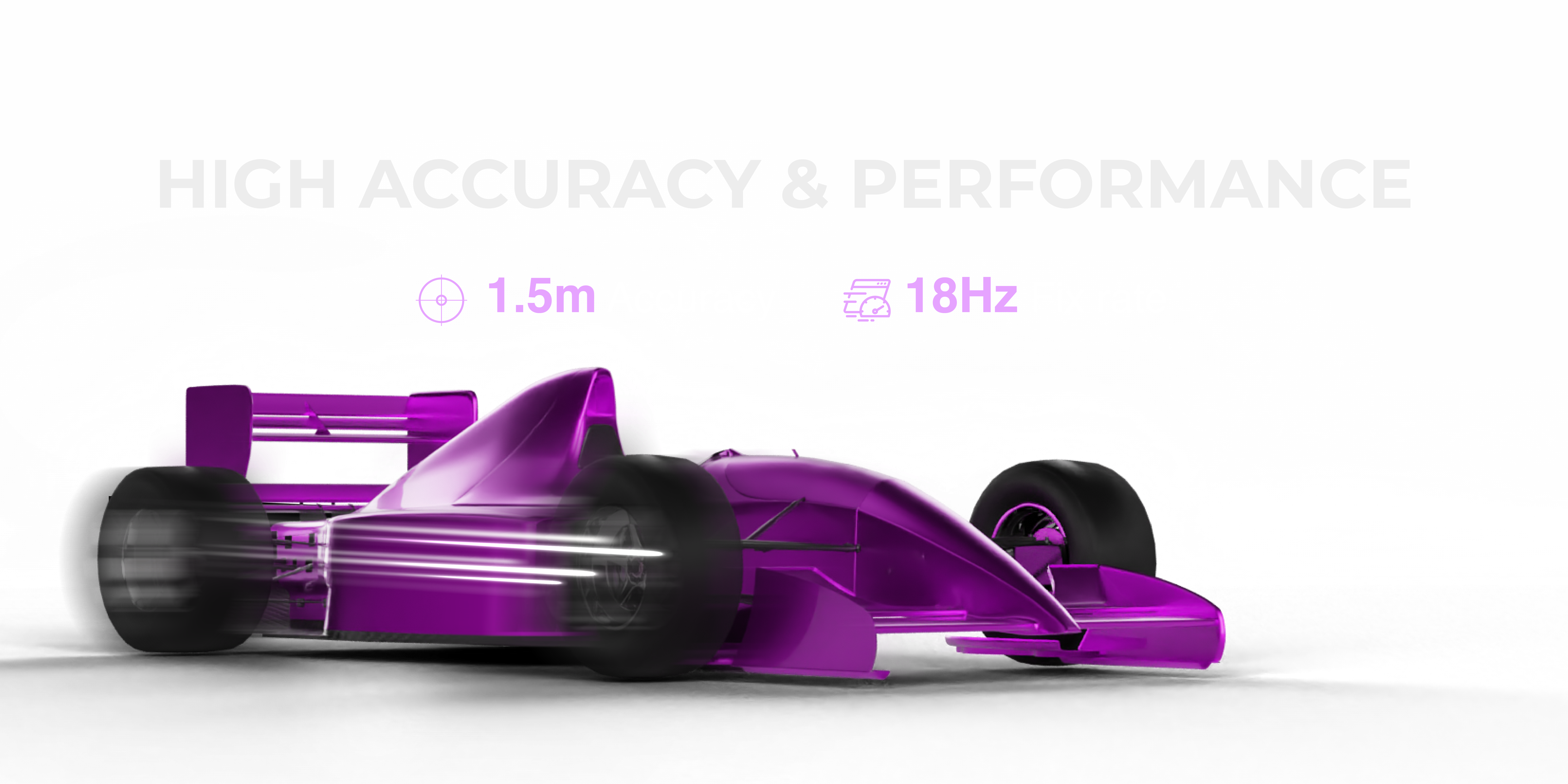
A module running at 18Hz changes everything. At the same 15 m/s velocity, you get a new position fix every 55 milliseconds. The flight controller is always working with near-current data. Corrections happen faster. Paths are held tighter. Precision agriculture, inspection, and racing applications become viable where they were not before.
Interference and Signal Noise
Drones are electrically hostile environments. ESCs switching at high frequency. Motor drive currents surging. LiPo batteries dumping amperes through wiring harnesses. All of this generates electromagnetic interference (EMI) that radiates through the airframe and contaminates GNSS signals.
Commodity GNSS modules ship with minimal RF filtering. They were designed for phones where the GNSS antenna is far from high-current switching elements. On a drone, the GNSS module often sits centimeters from a 40A ESC. Without active RF filtering at the module level, noise floor rises, signal-to-noise ratio on satellite signals falls, and accuracy degrades.
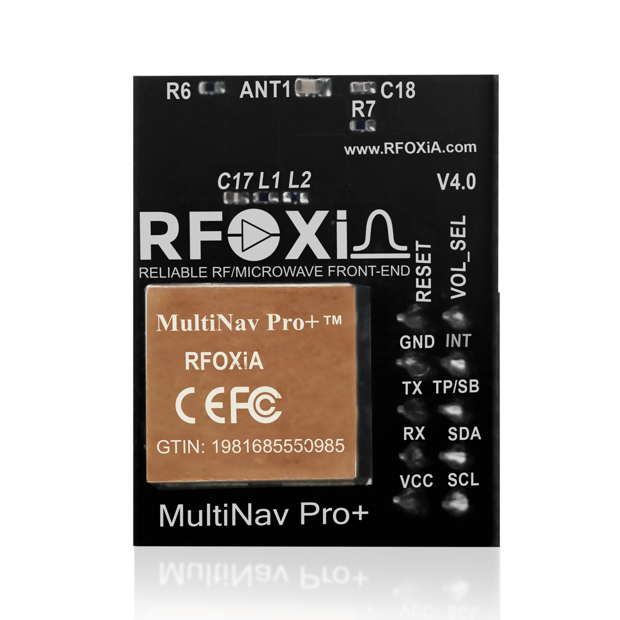
The MultiNav Pro+ addresses this with an integrated RF/microwave microstrip filter designed to reject the interference frequencies common in brushless motor drone platforms. This is not a software workaround — it is hardware-level noise suppression at the front end of the RF chain.
Understanding What 1.5-Meter GNSS Accuracy Actually Means
The number "1.5 meters" is a CEP (Circular Error Probable) figure. It means that 50% of all position fixes land within 1.5 meters of the true position, under standard open sky conditions.
For context:
- Standard phone GPS: 3–5 meters CEP
- Typical drone flight controller GPS: 2.5–4 meters CEP
- MultiNav Pro+: less than 1.5 meters CEP
- RTK GNSS systems: centimeter level (but at $500–$2,000+ per unit)
For most drone applications — inspection, autonomous waypoint flight, tracking, precision agriculture, search and rescue — 1.5 meter CEP hits the sweet spot between cost and performance. You do not need centimeter accuracy to fly a precise 3-meter waypoint grid. You need accuracy that keeps your position error smaller than your grid spacing. The MultiNav Pro+ delivers exactly that.
MultiNav Pro+ Technical Deep Dive
The u-blox MIA-M10Q Core
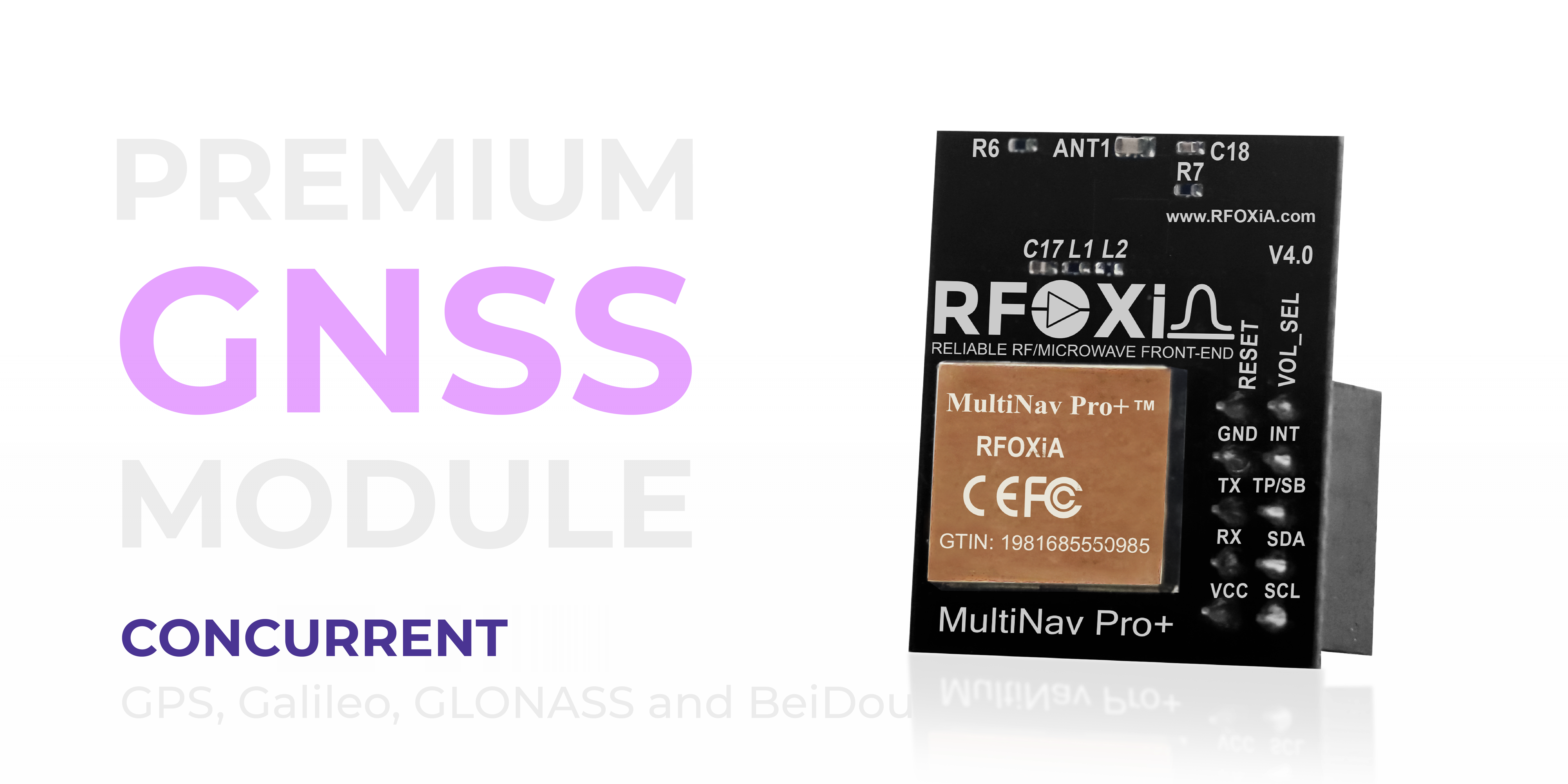
The MultiNav Pro+ is built around the u-blox MIA-M10Q — one of u-blox's newest generation GNSS chips, designed specifically for power-sensitive, high-accuracy applications. This is not a legacy chip repackaged in a new module. The MIA-M10Q brings:
- Concurrent four-constellation support (GPS, Galileo, GLONASS, BeiDou)
- Ultra-low power consumption relative to its performance class
- Sub-second Time to First Fix (TTFF) when operating in hot start mode
- Superior sensitivity for weak signal environments
Choosing a module built on this chip means you are working with a GNSS core that will receive firmware and support updates from one of the most trusted names in professional GNSS hardware.
18Hz Fix Rate
As discussed above, fix rate directly determines how well your system responds to position changes. At 18Hz, the MultiNav Pro+ exceeds the update rate of nearly every other module in its price class. This matters acutely for:
- FPV racing and freestyle — rapid attitude and position changes require fast position feedback
- Autonomous inspection passes — tight grid lines demand consistent position tracking at speed
- Drone delivery — approach and landing precision depends on high-rate position data
- Search and rescue payloads — the drone must know precisely where it is when it logs a detection
1-Second First Fix
A GNSS module that takes 30–60 seconds to achieve first fix is a mission liability. Cold starts on a job site while a client watches or a time-critical mission waits are unnecessary friction. The MultiNav Pro+ achieves first fix in approximately one second under hot start conditions, and acquires satellites rapidly from cold start thanks to the MIA-M10Q's sensitivity architecture.
Compact Footprint: 26 x 22mm
Drone builders obsess over weight and form factor. At 26mm x 22mm, the MultiNav Pro+ fits into even tight airframe bays, nose cones, and payload pods. The integrated chip antenna eliminates the need for an external patch antenna in most applications, further reducing weight and installation complexity.
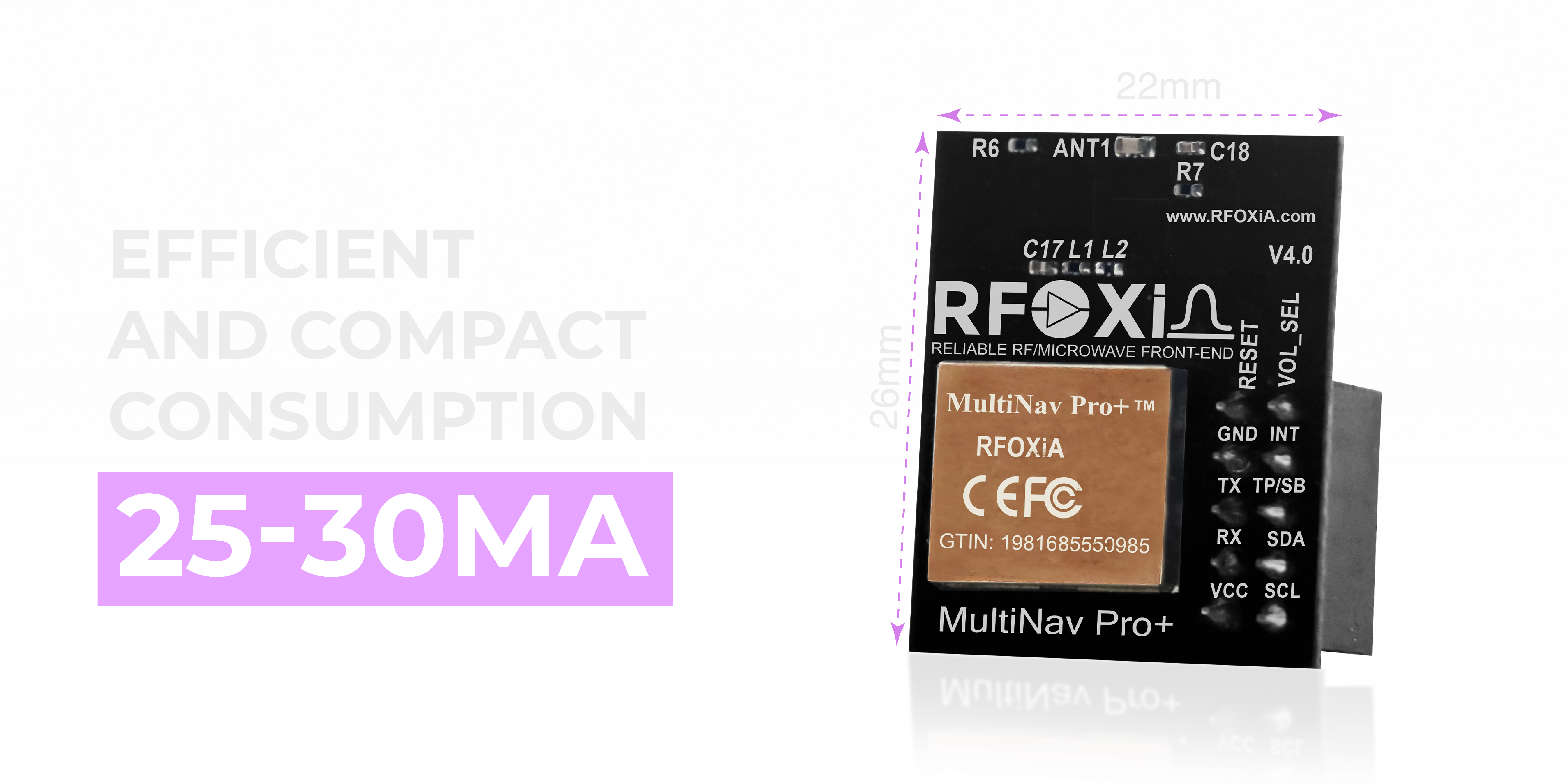
Power Consumption: 25–30mA
On a LiPo-powered drone, every milliamp counts toward flight time. The MultiNav Pro+ draws 25–30mA during active tracking — extremely efficient for a four-constellation receiver operating at 18Hz. You are not sacrificing flight time for position accuracy.
Integration: UART and I2C Support
One of the most common complaints from drone builders upgrading their GNSS stack is integration complexity. Proprietary protocols, unusual baud rate requirements, undocumented registers — these are time killers that frustrate professionals and hobbyists alike.
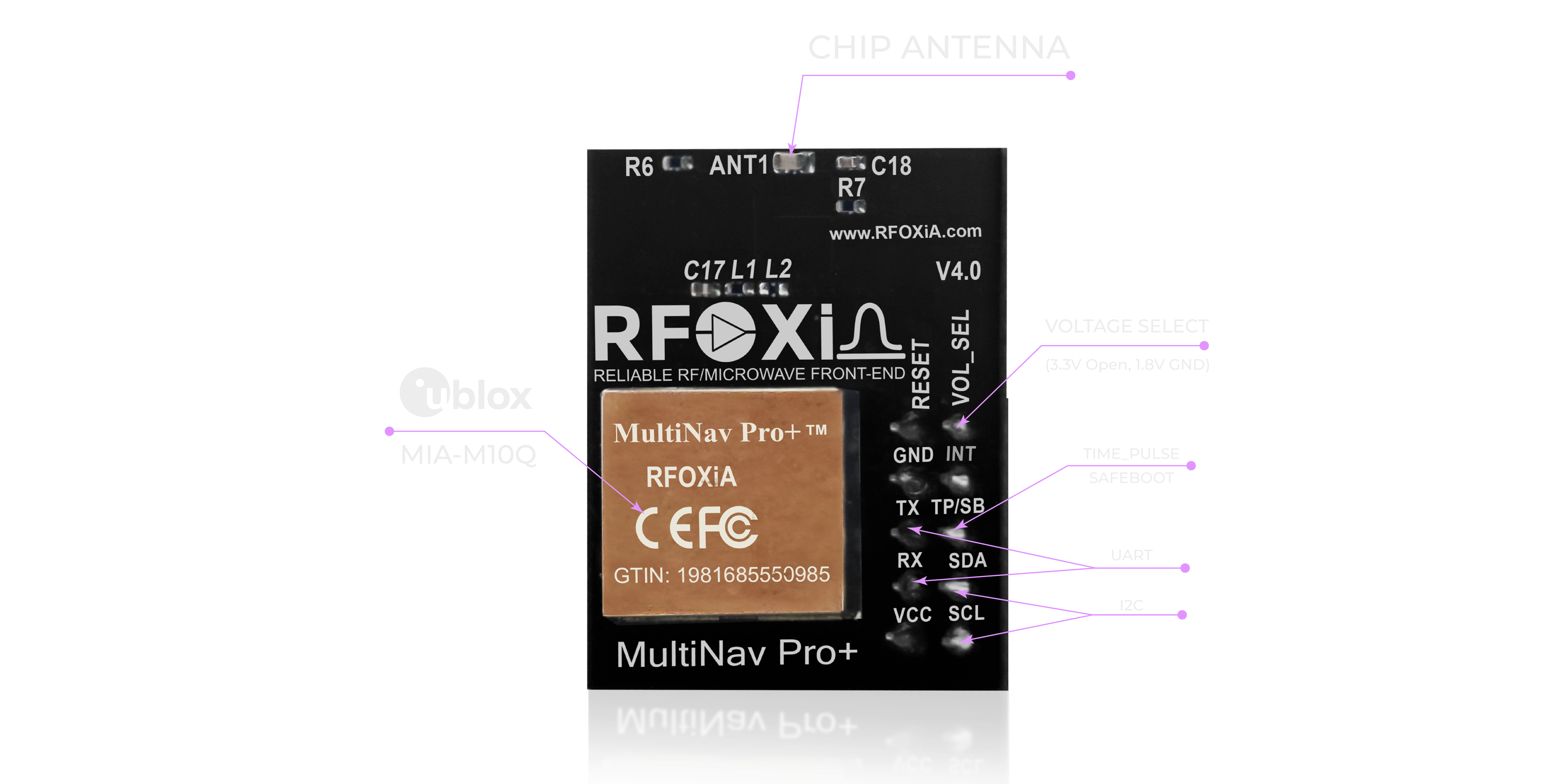
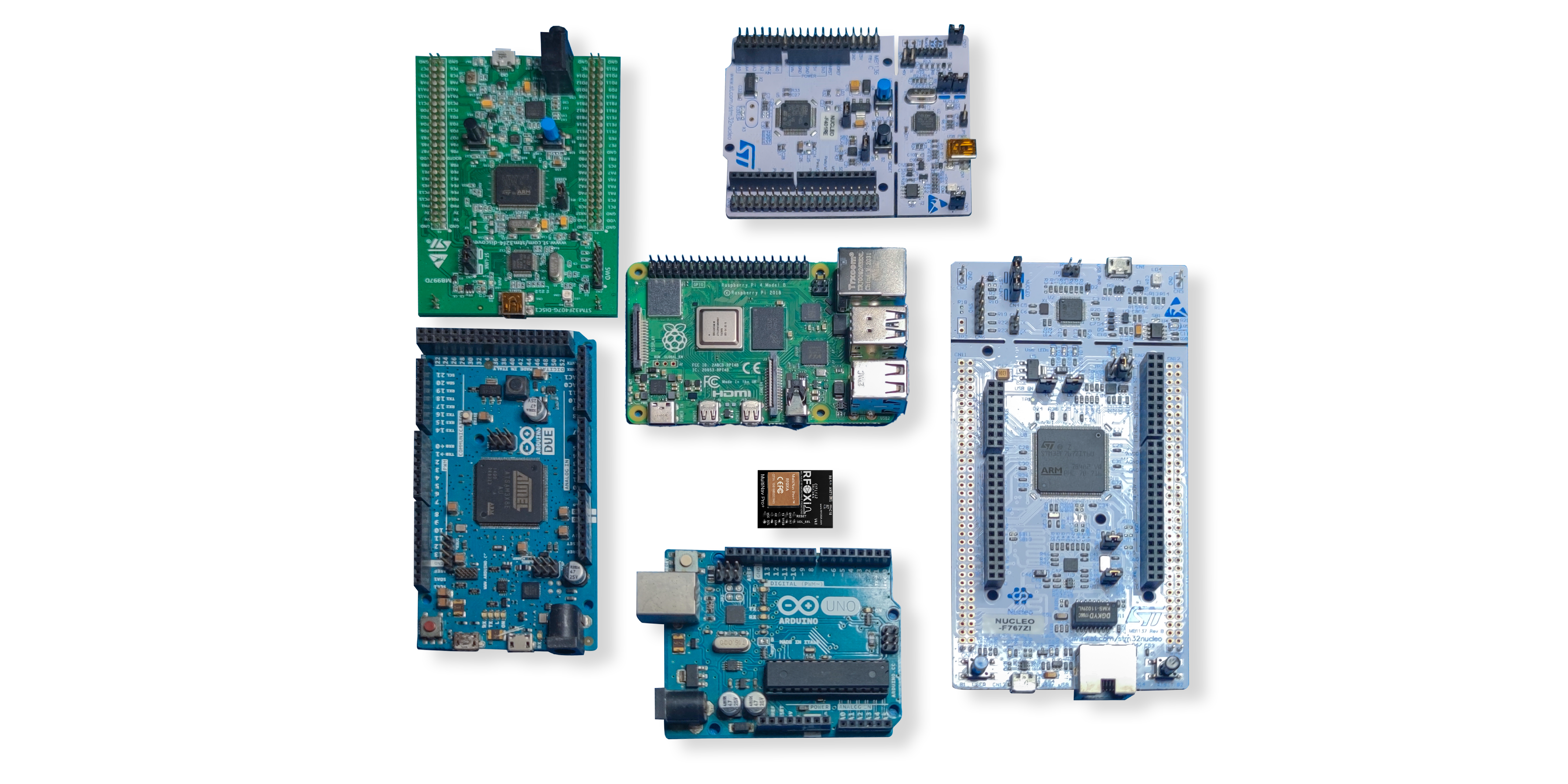
The MultiNav Pro+ communicates over standard UART (TX/RX) and I2C (SCL/SDA) interfaces. Both are natively supported by virtually every flight controller, microcontroller, and single-board computer on the market. ArduPilot, PX4, Betaflight, and custom STM32 or ESP32-based systems all connect without adapter boards or protocol converters.
Voltage compatibility covers 1.8V and 3.3V logic levels — meaning you can integrate directly with both low-voltage SoCs and standard 3.3V microcontrollers without level shifting.
Open Source Driver and Toolchain Support
Hardware that ships without software support is hardware that collects dust. RFOXiA ships the MultiNav Pro+ with a fully open-source C language library covering the complete NMEA standard protocol command set.
This library imports directly into Arduino IDE with no modification. It also integrates cleanly into PlatformIO, STM32CubeIDE, and any other standard embedded toolchain. If you are building a custom flight controller or sensor fusion node, you have production-ready driver code to start from rather than writing NMEA parsers from scratch.
All source code is available on the RFOXiA GitHub. This is genuine open-source hardware support — not a token code snippet, but a complete, usable library.
U-Center Software: Full Satellite Visualization and Configuration
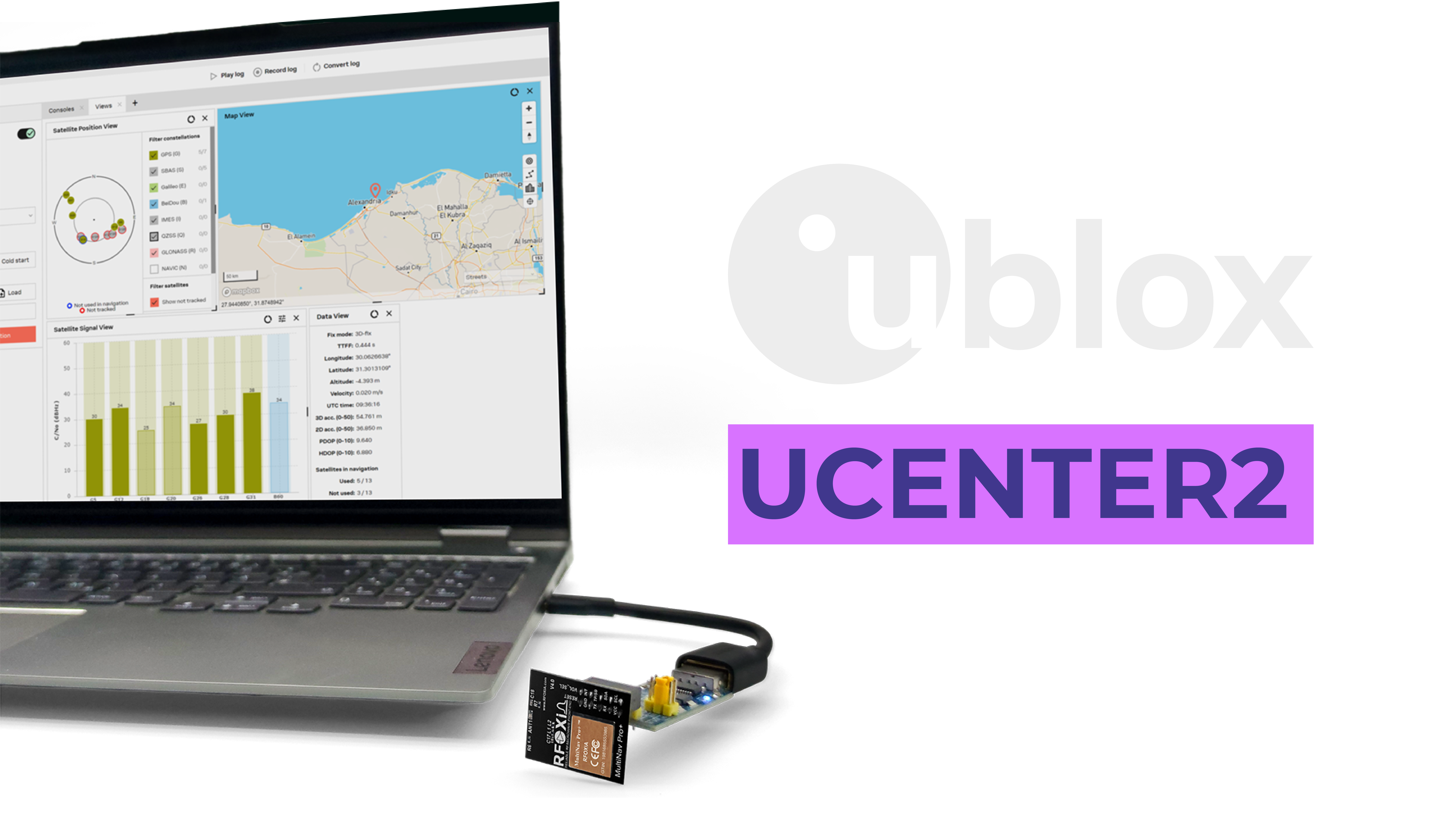
For engineers who need to go deeper — configure fix rates, enable specific constellations, tune power modes, or visualize satellite geometry — the MultiNav Pro+ is fully compatible with u-blox's U-Center software.
U-Center provides a professional GUI for:
- Visualizing each tracked satellite in real time
- Tracking receiver movement on a live map
- Configuring GNSS parameters without manual register manipulation
- Logging position and diagnostic data for post-mission analysis
- Evaluating u-blox GNSS service performance
This is the same software used by professional GNSS engineers working with u-blox hardware in automotive, surveying, and defense applications. Having full U-Center compatibility means your MultiNav Pro+ is not a black box — it is a transparent, configurable, professional-grade instrument.
Who Actually Needs 1.5-Meter GNSS Accuracy?
The short answer: anyone for whom position error has real consequences.
Drone Builders and FPV Pilots
If you build autonomous drones, the GPS accuracy problem drone builders tolerate with commodity modules directly limits mission quality. Waypoint flight, return-to-home reliability, precision landing, and geofencing all improve when your position data is accurate and fast. The MultiNav Pro+ solves the GPS accuracy problem drone builders face without forcing you into the RTK price tier.
Survey and Mapping Operations
For photogrammetry and mapping where GCP (ground control point) placement compensates for GPS error, tighter onboard GNSS accuracy reduces the number of GCPs needed and improves the accuracy of reconstructed models.
Precision Agriculture
Row spacing in precision agriculture is measured in centimeters. A drone sprayer or seeder running on 3-meter GPS accuracy lays down overlapping or gapped coverage. At 1.5 meters, you are in a different league — not RTK, but dramatically better than commodity.
IoT Tracking and Logistics
Fixed-infrastructure IoT trackers, vehicle telemetry nodes, and portable asset tracking units all benefit from sub-2-meter position accuracy, especially in suburban and semi-urban environments where satellite geometry is frequently challenged.
Wearables and Personal Tracking
Emergency response wearables, athlete performance trackers, and outdoor expedition devices all require accurate position reporting. At 26mm x 22mm and 25–30mA current draw, the MultiNav Pro+ fits in wearable form factors without compromising performance.
Research and Education
University robotics programs, UAV research labs, and maker project developers all need professional-grade GNSS hardware that is affordable, well-documented, and open-source compatible. This module ships with everything needed to get into production-grade GNSS development quickly.

The RFOXiA Ecosystem Advantage
The MultiNav Pro+ is not a standalone module thrown into the market. It is a component of the RFOXiA hardware ecosystem, which means it is designed to work seamlessly with:
- MultiNav Pro+ BLE Module — 5km ground-to-ground, 15–20km man-to-drone long-range wireless link, allowing real-time GPS data streaming from drone to ground station
- Sensors Module — 7-sensor environmental monitoring (temperature, humidity, pressure, air quality, accelerometer, gyroscope, magnetometer)
- Power/Program Kit — supercapacitor-based power system, 5-minute charge to 24-hour runtime, with integrated STLink programmer
- RFOXiA Connect App — iOS and Android, live GPS map, sensor data display, and PS5-style drone controller interface — all working without internet
- AI Firmware Builder — describe your GNSS application in plain language, get production-ready firmware back in minutes
If you are solving the GPS accuracy problem drone projects face, you are probably also dealing with range limitations, power management challenges, and firmware development friction. The RFOXiA ecosystem addresses all of these simultaneously.
The RFOXiA Accurate GNSS Module is available individually at $49, or as part of the Developer Bundle which combines the GNSS module with the long-range BLE module, sensor suite, and power kit for $199 — giving you a complete professional wireless developer platform for less than the cost of most standalone RTK receivers.
FCC Certification: Why It Matters for Your Build
FCC certification is not a checkbox. It is the difference between a module you can legally deploy in the United States and one that creates liability.
The MultiNav Pro+ is FCC certified. This means:
- The RF emissions have been independently tested and verified to comply with federal standards
- You can integrate this module into commercial products without triggering a re-certification requirement in many cases
- Distributors, resellers, and enterprise buyers can accept the module without regulatory risk
For drone builders flying commercially under Part 107, operating FCC-certified navigation hardware is part of operating a compliant aircraft. This is not optional.
Solving the GPS Accuracy Problem Drone by Drone
The GPS accuracy problem drone operators face has a real hardware solution. It does not require an RTK system with a base station, a radio link to a correction service, or a $1,000+ navigation computer. It requires a GNSS receiver that tracks all four satellite constellations simultaneously, updates position at 18Hz, filters RF noise at the hardware level, and delivers verified sub-1.5-meter accuracy.
The MultiNav Pro+ does all of this in a 26mm x 22mm module, at 25–30mA current draw, with standard UART and I2C interfaces, open-source drivers, and full U-Center compatibility — for $49.
If your drone project has a GPS accuracy problem, this is the module that solves it.
Explore the full specifications and order the RFOXiA Accurate GNSS Module directly from RFOXiA.
Technical Specifications Summary
| Parameter | MultiNav Pro+ Specification |
|---|---|
| Accuracy | Less than 1.5 meters CEP |
| Fix Rate | Up to 18Hz |
| Time to First Fix | 1 second (hot start) |
| Constellations | GPS, GLONASS, Galileo, BeiDou |
| GNSS Chip | u-blox MIA-M10Q |
| Interfaces | UART (TX/RX), I2C (SCL/SDA) |
| Voltage | 1.8V and 3.3V compatible |
| Current Draw | 25–30mA |
| Dimensions | 26mm x 22mm |
| Antenna | Integrated chip antenna |
| Certification | FCC certified |
| Software | Open-source C library, U-Center compatible |
| Price | $49 |
Final Thoughts
Every builder who has watched a drone drift off waypoint, miss a landing pad, or accumulate positional error across an autonomous mission knows the GPS accuracy problem drone hardware imposes. The frustrating reality is that this problem has been solved at the engineering level — the satellite systems exist, the chip technology exists, and the filtering techniques exist. The only question has been whether that solution was accessible at a price point that makes sense for builders, researchers, and developers.
At $49 with FCC certification, 1.5-meter accuracy, 18Hz update rate, four-constellation tracking, open-source drivers, and integration into a complete wireless development ecosystem, the MultiNav Pro+ answers that question.
Ready to eliminate the GPS accuracy problem from your next drone project? Visit the RFOXiA Accurate GNSS Module product page to order or learn more about the complete RFOXiA Developer Bundle.
FCC certified. Battle tested. Ready to ship.
Written by: Moamen Mohamed LinkedIn