
GPS Module Raspberry Pi Tutorial: How to Get Pinpoint Location with the MultiNav Pro+
The Complete GPS Module Raspberry Pi Tutorial for Makers, Drone Builders, and IoT Developers
If you have been searching for a reliable, high-accuracy GPS module Raspberry Pi tutorial that goes beyond the basics, you are in the right place. Most tutorials online walk you through a cheap, slow GNSS module that barely holds a fix and updates once per second. This guide is different. We are going to show you how to wire, configure, and read data from the RFOXiA MultiNav Pro+ — a professional-grade GNSS module built on the u-blox MIA-M10Q chip — with your Raspberry Pi, and understand exactly why the hardware you choose determines everything about what your project can do.
Whether you are building an autonomous drone, a precision tracking device, a field data logger, or a smart IoT sensor node, this tutorial will give you both the theory and the hands-on steps to get accurate GPS data flowing in minutes.
Why Your GPS Module Choice Matters More Than Your Code
Before we touch a single line of Python, let us talk hardware. The most common mistake makers make when searching for a GPS module Raspberry Pi tutorial is treating all GNSS modules as interchangeable. They are not — not even close.
Here is what separates a professional module from a budget breakout board:
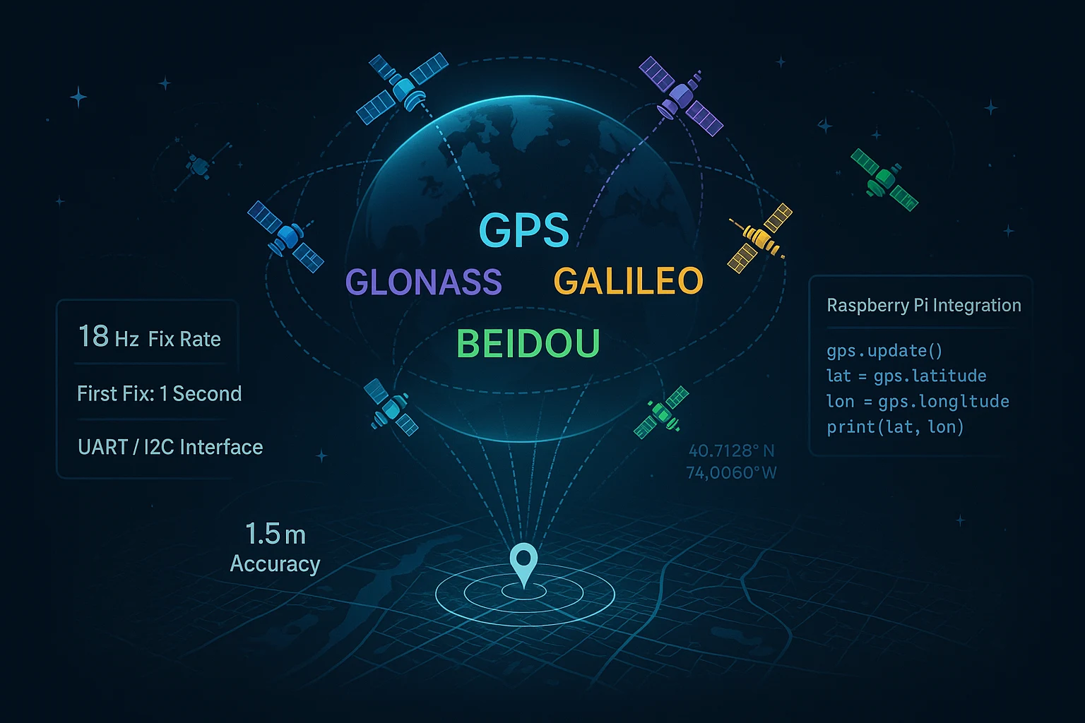
- Fix rate — how many times per second the module calculates your position. A 1Hz module updates once per second. The MultiNav Pro+ updates at 18Hz, meaning 18 complete position calculations every second. For anything moving — drones, vehicles, wearables — this is the difference between smooth tracking and jumpy, unusable data.
- Accuracy — most cheap modules advertise "2.5 meter CEP" under ideal conditions. Real-world performance is often 5-10 meters. The MultiNav Pro+ achieves less than 1.5 meters in real conditions.
- Multi-constellation support — locking onto only GPS satellites means fewer satellites visible from any given location. The MultiNav Pro+ simultaneously connects to GPS, Galileo, GLONASS, and BeiDou, dramatically improving fix reliability and speed.
- Time to first fix — waiting 30-60 seconds for a cold fix is frustrating in the field. The MultiNav Pro+ achieves first fix in as little as 1 second.
With those fundamentals established, let us build something.
What You Will Need for This GPS Module Raspberry Pi Tutorial
Hardware:
- Raspberry Pi (any model with GPIO — Pi 3, Pi 4, Pi Zero 2W all work perfectly)
- RFOXiA MultiNav Pro+ GNSS Module
- 4 female-to-female jumper wires
- Optional: breadboard for prototyping
Software:
- Raspberry Pi OS (Bullseye or Bookworm)
- Python 3
pyseriallibrary (for UART)smbus2library (for I2C)- Optional: u-blox u-center software on a connected laptop for visual satellite tracking
Understanding the MultiNav Pro+ Hardware
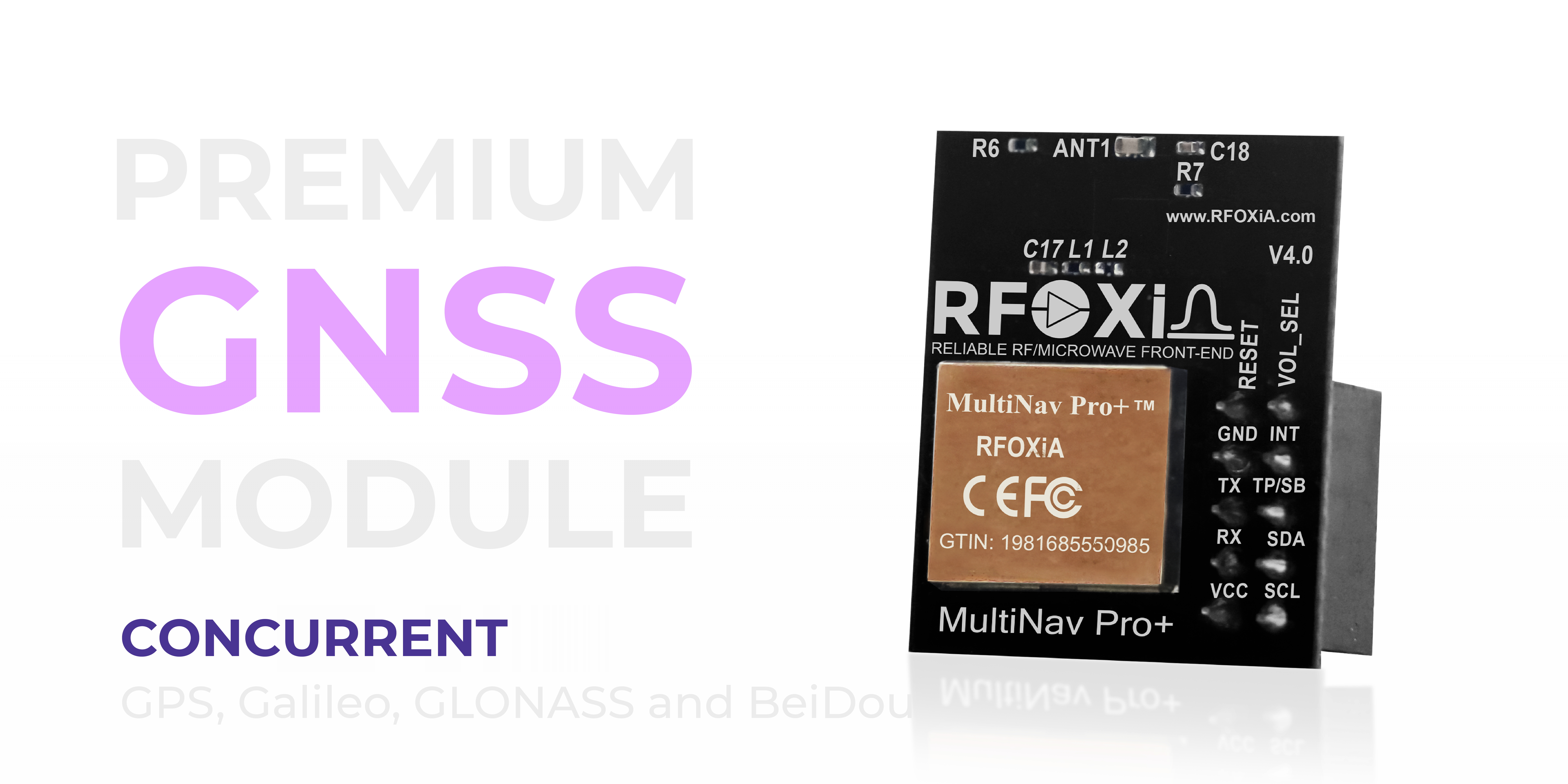
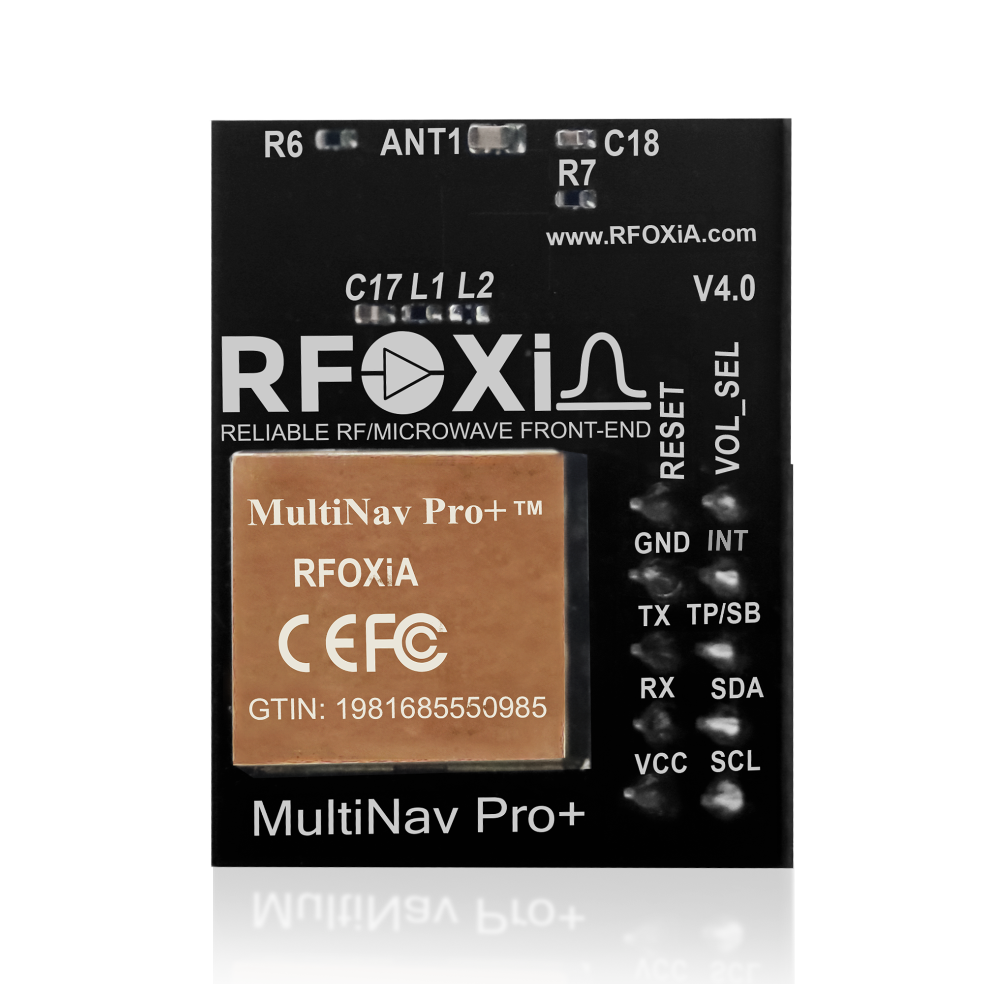
The MultiNav Pro+ is designed from the ground up for seamless integration into real products. It is not a hobby breakout of a five-year-old chip — it is powered by the u-blox MIA-M10Q, one of the most capable compact GNSS receivers available today. The module supports concurrent reception of all four major satellite constellations simultaneously, meaning your Raspberry Pi project gets the benefit of every satellite overhead regardless of which system launched it.
The RF design includes a proprietary RF/microwave microstrip filter on the antenna path, which eliminates the interference problems that plague cheap modules in electrically noisy environments like drone flight controllers, motor driver boards, or densely packed IoT enclosures.
At just 26mm x 22mm, this module fits into projects where space is at a premium without sacrificing any capability.
Performance Specifications at a Glance

Before wiring anything, internalize these numbers — they shape how you design your application:
| Specification | MultiNav Pro+ | Typical Cheap Module |
|---|---|---|
| Accuracy (CEP) | < 1.5 meters | 2.5 - 10 meters |
| Fix Rate | 18Hz | 1Hz |
| Time to First Fix | ~1 second | 30-60 seconds |
| Constellations | GPS + Galileo + GLONASS + BeiDou | GPS only (or GPS+GLONASS) |
| Size | 26 x 22mm | Varies (usually larger) |
| Current Draw | 25-30mA | 20-50mA |
For any serious GPS module Raspberry Pi tutorial application — autonomous navigation, precision tracking, data logging at speed — these differences are not marginal. They are the gap between a project that works and one that does not.
Power and Size: Built for Real Deployments

The MultiNav Pro+ draws just 25-30mA in full multi-constellation tracking mode. On a Raspberry Pi 4 running from a 5000mAh battery pack, your GPS overhead is negligible compared to the Pi itself. For Pi Zero 2W projects on tight power budgets, this matters even more.
The compact 26 x 22mm footprint means you can mount this module directly inside a drone frame, a wearable enclosure, or a waterproof field sensor box without fighting for space.
Wiring the MultiNav Pro+ to Raspberry Pi
Option A: UART Connection (Recommended for High-Speed Data)
UART is the best interface for high-frequency GNSS data. At 18Hz, you are receiving 18 NMEA sentences per second — I2C at standard speed can struggle to keep up. UART handles this effortlessly.
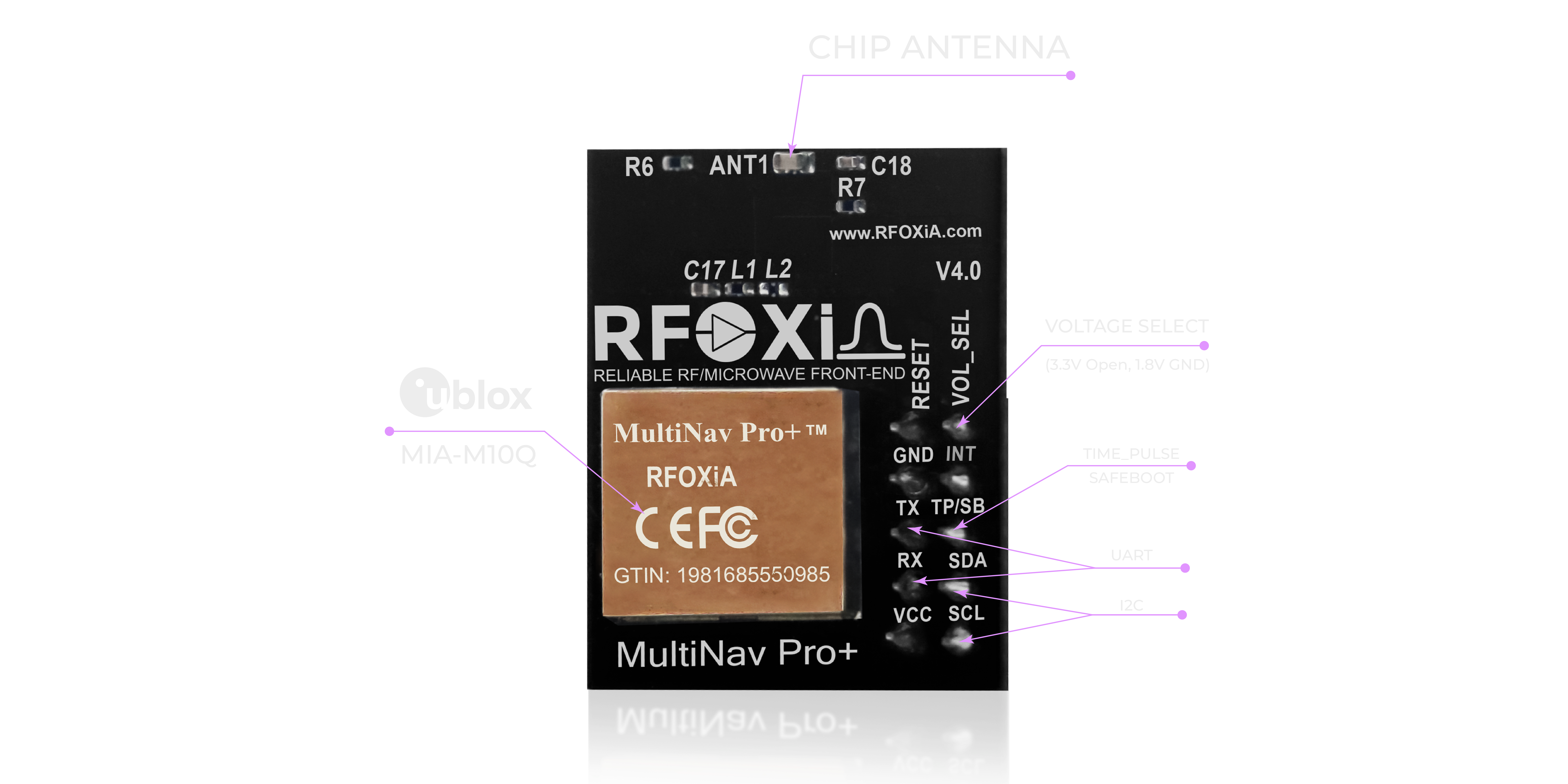
The MultiNav Pro+ supports both 1.8V and 3.3V logic levels. Raspberry Pi GPIO operates at 3.3V — connect directly without a level shifter.
Wiring for UART:
| MultiNav Pro+ Pin | Raspberry Pi Pin | GPIO |
|---|---|---|
| VCC | Pin 1 | 3.3V Power |
| GND | Pin 6 | Ground |
| TX | Pin 10 | GPIO 15 (RXD) |
| RX | Pin 8 | GPIO 14 (TXD) |
Note: TX on the module connects to RX on the Pi, and vice versa. This is standard UART crossover.
Enable UART on Raspberry Pi
By default, the Raspberry Pi serial port may be assigned to the system console. Disable this before using it for GPS:
sudo raspi-config
Navigate to: Interface Options → Serial Port
- "Would you like a login shell to be accessible over the serial port?" → No
- "Would you like the serial port hardware to be enabled?" → Yes
Reboot your Pi.
Option B: I2C Connection (Great for Multi-Device Buses)
If you are already using I2C for other sensors — common in IoT projects — you can connect the MultiNav Pro+ to the same bus:
| MultiNav Pro+ Pin | Raspberry Pi Pin | GPIO |
|---|---|---|
| VCC | Pin 1 | 3.3V Power |
| GND | Pin 6 | Ground |
| SCL | Pin 5 | GPIO 3 (SCL) |
| SDA | Pin 3 | GPIO 2 (SDA) |
Enable I2C via raspi-config → Interface Options → I2C → Yes.
Reading GPS Data via UART with Python
Install the required library:
pip3 install pyserial
Create a file called gps_read.py:
import serial
import time

# Open UART connection
ser = serial.Serial(
    port='/dev/serial0',
    baudrate=9600,
    timeout=1
)

print("Waiting for GPS fix...")

while True:
    try:
        line = ser.readline().decode('ascii', errors='replace').strip()

        # GNGGA sentence contains position, altitude, fix quality
        if line.startswith('$GNGGA') or line.startswith('$GPGGA'):
            parts = line.split(',')

            if len(parts) >= 10 and parts[2] and parts[4]:
                # Parse latitude
                lat_raw = float(parts[2])
                lat_dir = parts[3]
                lat_deg = int(lat_raw / 100)
                lat_min = lat_raw - (lat_deg * 100)
                latitude = lat_deg + (lat_min / 60)
                if lat_dir == 'S':
                    latitude = -latitude

                # Parse longitude
                lon_raw = float(parts[4])
                lon_dir = parts[5]
                lon_deg = int(lon_raw / 100)
                lon_min = lon_raw - (lon_deg * 100)
                longitude = lon_deg + (lon_min / 60)
                if lon_dir == 'W':
                    longitude = -longitude

                altitude = parts[9] if parts[9] else 'N/A'
                fix_quality = parts[6]
                satellites = parts[7]

                print(f"Lat: {latitude:.7f} | Lon: {longitude:.7f} | Alt: {altitude}m | Sats: {satellites} | Fix: {fix_quality}")

    except Exception as e:
        pass

    time.sleep(0.01)  # 10ms loop — handles 18Hz update rate
Run it:
python3 gps_read.py
Within seconds of going outdoors (or near a window), you should see live latitude, longitude, altitude, satellite count, and fix quality printing in real time — updating up to 18 times per second.
Using the Open Source Driver Library
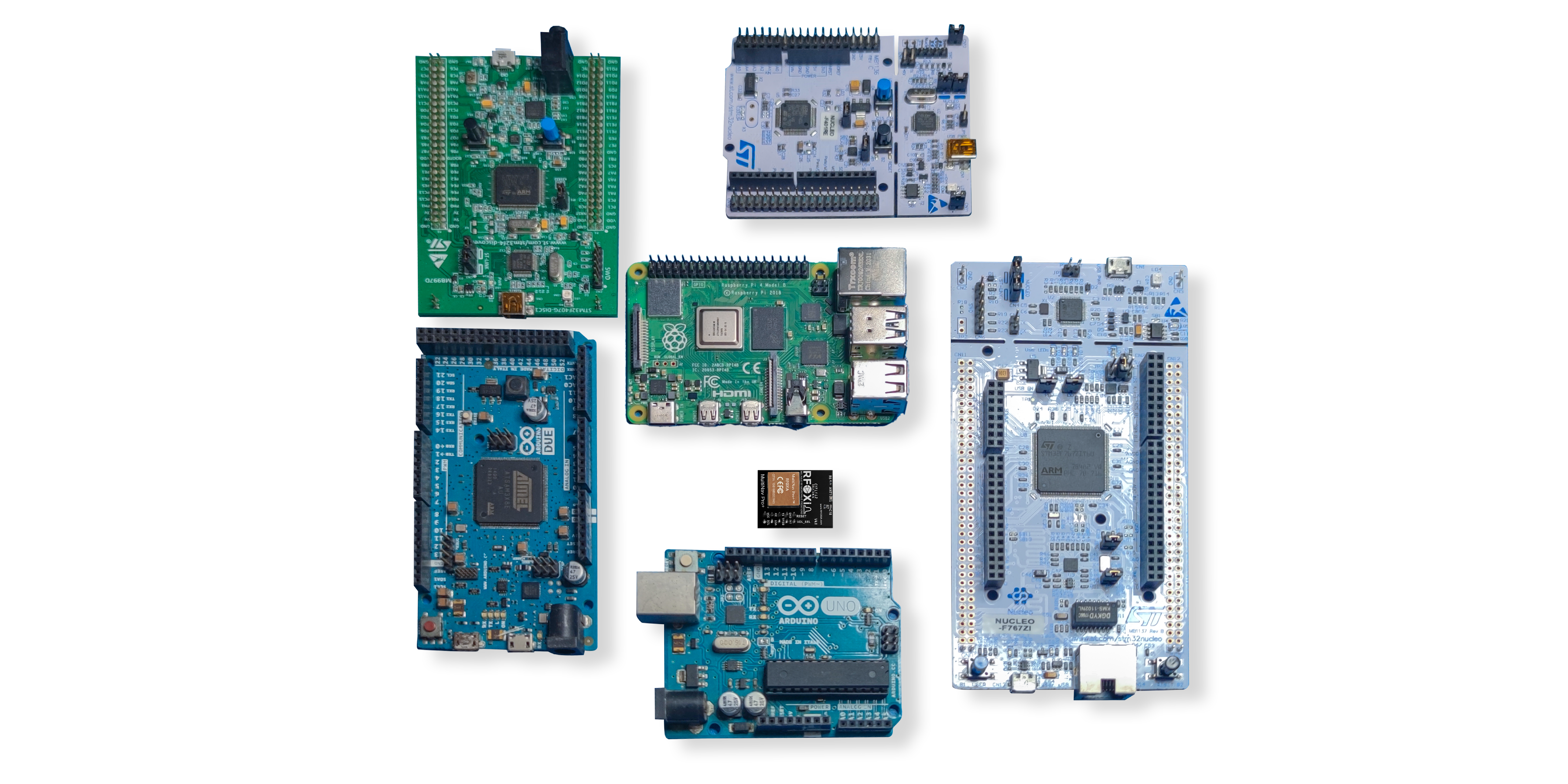
The MultiNav Pro+ comes with a fully open-source C language driver library that implements the complete NMEA standard protocol. If your project uses C or C++ — common for projects where you are linking a microcontroller to a Pi over a serial bridge, or running bare-metal code — the library gives you a production-ready foundation.
The library is designed to drop directly into Arduino IDE or any GCC-based toolchain. For Raspberry Pi projects that combine a Pi (running Python or Node.js) with an STM32 or Arduino co-processor (running sensor fusion, motor control, or flight controller code), this driver handles the GNSS side completely.
You can find the open-source library in the RFOXiA Accurate GNSS Module product documentation.
Visualizing Satellites with u-center Software
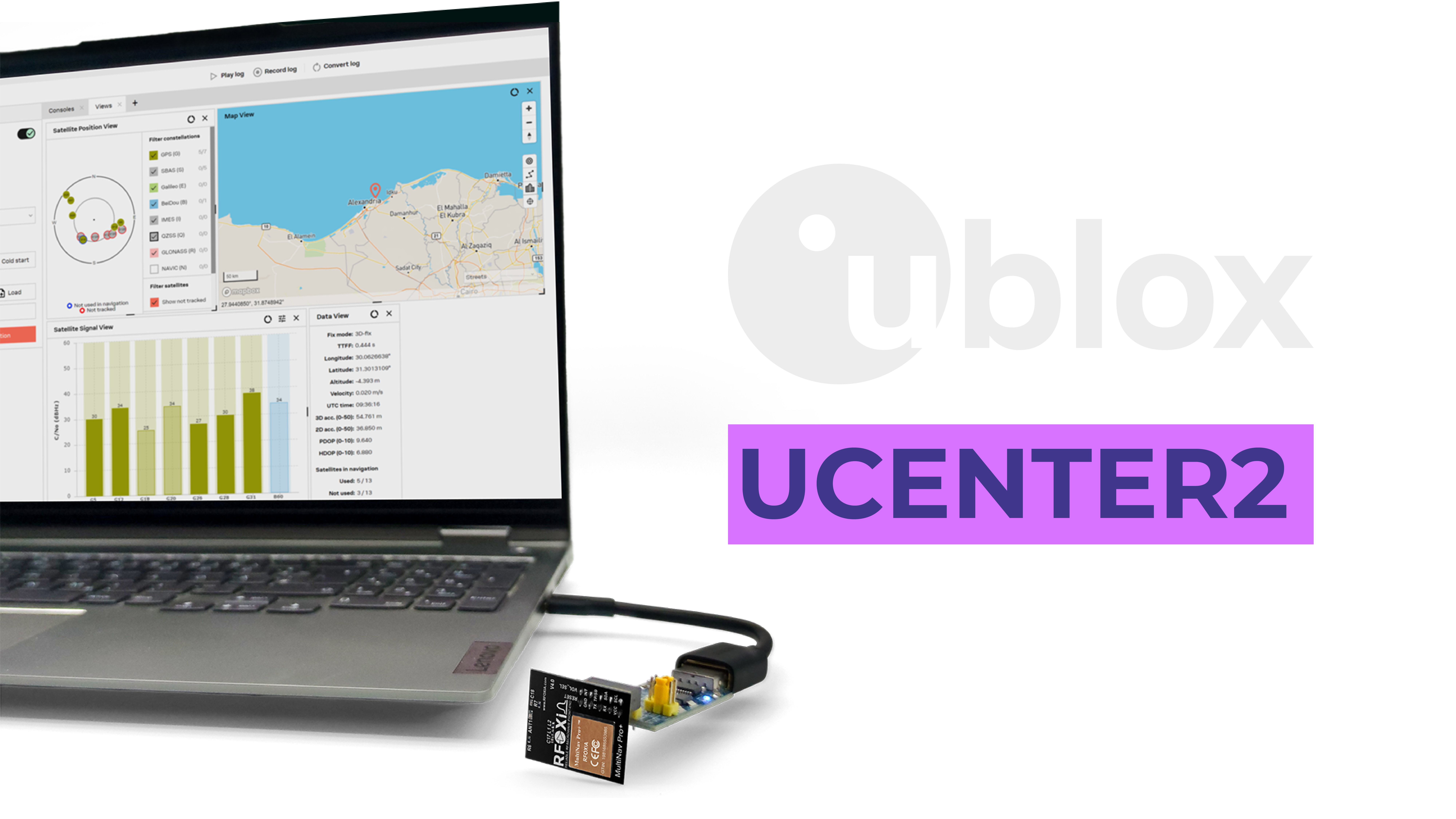
For development and debugging, u-blox's u-center software (Windows/Linux) connects to your MultiNav Pro+ and gives you a real-time visual dashboard of everything happening inside the GNSS receiver:
- Sky plot — shows every visible satellite, its elevation angle, and signal strength
- Signal strength bar charts — identify weak signals or multipath interference at a glance
- Position accuracy estimate — see your real-time CEP value
- Speed and heading vectors — essential for drone tracking development
- Data logging — record GNSS sessions for post-processing or analysis
- Configuration panel — change fix rate, constellation selection, NMEA output sentences, and more
Connect your MultiNav Pro+ to a laptop via a USB-to-UART adapter (while simultaneously running Raspberry Pi or separately for bench testing) and you have a professional GNSS development environment that commercial GPS developers use.
This is not a feature you get with a $5 GPS breakout board.
Real-World Use Cases for the MultiNav Pro+ with Raspberry Pi

This GPS module Raspberry Pi tutorial covers the technical setup, but what can you actually build with professional-grade GNSS at 18Hz and 1.5m accuracy?
Autonomous Drone Navigation
A Raspberry Pi 4 running a ROS2 navigation stack combined with the MultiNav Pro+ at 18Hz gives you smooth GPS velocity estimates and accurate position hold. Standard 1Hz GPS creates choppy, oscillating behavior in position-hold mode. At 18Hz, your Kalman filter has 18x more data points per second — position estimation becomes dramatically more stable.
Precision Asset Tracking
For tracking vehicles, shipping containers, livestock, or field equipment — 1.5m accuracy means you know which side of a road or fence line something is on. With a Raspberry Pi Zero 2W, a MultiNav Pro+, and a cellular module, you have a sub-$100 professional tracker.
Environmental Data Logger with GPS Stamps
Combine the MultiNav Pro+ with RFOXiA's Sensors Module (temperature, humidity, pressure, air quality, accelerometer, gyroscope, magnetometer) on a Raspberry Pi, and every data point is GPS-stamped with sub-2-meter location accuracy. This is the foundation of the RFOXiA Data Network — a distributed sensor grid where contributors earn daily rewards for verified outdoor data streaming.
Wearable Navigation Devices
For search and rescue teams, hikers, or field researchers — a Pi Zero 2W with MultiNav Pro+ and a small OLED screen fits in a shirt pocket and delivers professional-grade navigation without a phone signal.
Agricultural Precision Systems
Row guidance, spray mapping, yield monitoring — all require sub-2-meter GPS accuracy to be meaningful. The MultiNav Pro+ at $49 brings this capability to maker-built agricultural robots and sensor platforms.
Research and Survey Tools
University researchers building custom data collection platforms need documented, repeatable accuracy. The MultiNav Pro+'s u-blox pedigree and 1.5m CEP specification is citable in research contexts where a generic module is not.
Configuring Fix Rate: Getting the Full 18Hz
By default, the MultiNav Pro+ may output at a lower fix rate depending on firmware configuration. To unlock 18Hz, you send a UBX configuration command via UART:
import serial
import time

ser = serial.Serial('/dev/serial0', 9600, timeout=1)

# UBX-CFG-RATE command to set measurement rate to 55ms (approximately 18Hz)
# Measurement period in ms: 55ms = ~18Hz
ubx_rate_cmd = bytes([
    0xB5, 0x62,       # UBX header
    0x06, 0x08,       # CFG-RATE class/ID
    0x06, 0x00,       # Payload length (6 bytes)
    0x37, 0x00,       # measRate: 55ms (0x0037)
    0x01, 0x00,       # navRate: 1 (solution every measurement)
    0x01, 0x00,       # timeRef: 1 (GPS time)
    0x4D, 0xDB        # Checksum (CK_A, CK_B)
])

ser.write(ubx_rate_cmd)
time.sleep(0.1)
print("Fix rate configured to 18Hz")
After sending this command, your NMEA stream will update at 18Hz. Make sure your parsing loop runs faster than 55ms between iterations — the 10ms sleep in the earlier example handles this comfortably.
Integrating with the Full RFOXiA Ecosystem
One of the unique advantages of choosing the MultiNav Pro+ for your GPS module Raspberry Pi tutorial project is that it is not a standalone component — it is part of a complete wireless development ecosystem.
Pair it with:
- RFOXiA BLE Module (MultiNav Pro+ BLE) — add 5km ground-to-ground or 15-20km man-to-drone long-range wireless to your GPS-equipped Raspberry Pi project
- RFOXiA Sensors Module — add seven environmental sensors (temperature, humidity, pressure, air quality, accelerometer, gyroscope, magnetometer) to your GPS node
- RFOXiA Power/Program Kit — add supercapacitor-based power management for 24-hour runtime from a 5-minute charge in field deployments
- RFOXiA Connect App — view live GPS tracks from your Raspberry Pi node on a mobile map with no internet connection required
The complete Developer Bundle combines all four modules at a price that would be impossible from any other vendor at equivalent specification levels.
Get your MultiNav Pro+ and see how it fits into a complete build: RFOXiA Accurate GNSS Module
Troubleshooting Common GPS Module Raspberry Pi Tutorial Issues
No Data Appearing
- Confirm UART is enabled and shell console is disabled via raspi-config
- Verify TX→RX and RX→TX crossover wiring
- Confirm baud rate matches module default (9600 baud)
- Check 3.3V power is present on VCC pin
Fix Not Acquired
- Move outdoors or to a window — GNSS signals do not penetrate buildings well
- Wait for cold fix: MultiNav Pro+ first fix in ~1 second with clear sky, but dense urban environments may take longer
- Use u-center to visualize satellite signal strengths and identify obstruction issues
Garbled Data
- Check for electrical noise from nearby motors or switching power supplies — the MultiNav Pro+'s integrated RF filter helps, but severe EMI sources need physical separation
- Verify wiring has no loose connections
- Confirm baud rate configuration matches
Position Jumping at 18Hz
- This is normal for raw NMEA — implement a Kalman filter or simple moving average for smoother position estimates in navigation applications
- Libraries like
filterpyin Python make Kalman filtering straightforward
Why the MultiNav Pro+ Is the Right GPS Module for Serious Raspberry Pi Projects
The GPS module Raspberry Pi tutorial ecosystem is full of options. You can spend $8 on a module that technically produces NMEA sentences. Or you can build with hardware that performs at the level your project actually demands.
The MultiNav Pro+ at $49 delivers:
- 18Hz fix rate (18x faster than typical modules)
- Sub-1.5 meter real-world accuracy
- Four-constellation simultaneous reception
- u-blox MIA-M10Q chip with professional pedigree
- Integrated RF filtering for noisy environments
- Open-source C driver library and Arduino compatibility
- FCC certified for legal deployment
- Part of a complete wireless ecosystem with BLE, sensors, power management, and mobile app support
For drone builders, autonomous vehicle developers, field researchers, agricultural tech builders, and anyone building IoT sensor networks — this is not a luxury choice. It is the minimum viable hardware for a project that works in the real world.
Conclusion: Build Better With Professional GNSS
This GPS module Raspberry Pi tutorial walked you through everything from hardware selection rationale to wiring diagrams, Python code for UART parsing, fix rate configuration, u-center satellite visualization, and real-world application scenarios. The technical steps are straightforward. The hardware does what it says.
The MultiNav Pro+ is available now at $49, FCC certified, and ready to ship. If you are serious about building location-aware projects that perform, start with hardware that performs.
Get the RFOXiA Accurate GNSS Module →
And if you want the complete picture — long-range wireless, environmental sensing, professional power management, AI firmware development, and a community of builders working on exactly the kind of projects you are building — explore the RFOXiA Club at rfoxia.com. First-time signups receive a $10 welcome credit toward your first hardware order.
Build something that matters.
Written by: Moamen Mohamed LinkedIn