
How to Improve GPS Accuracy Drone Builds: The Complete Guide
How to Improve GPS Accuracy Drone Performance from Meter-Level to Mission-Ready
If you have ever watched your drone drift sideways in a hover, overshoot a waypoint, or return to a home position three meters from where it took off, you already understand the cost of bad GPS data. The question every serious drone builder eventually asks is straightforward: how to improve GPS accuracy drone performance beyond the factory-default mediocrity baked into most flight controllers.
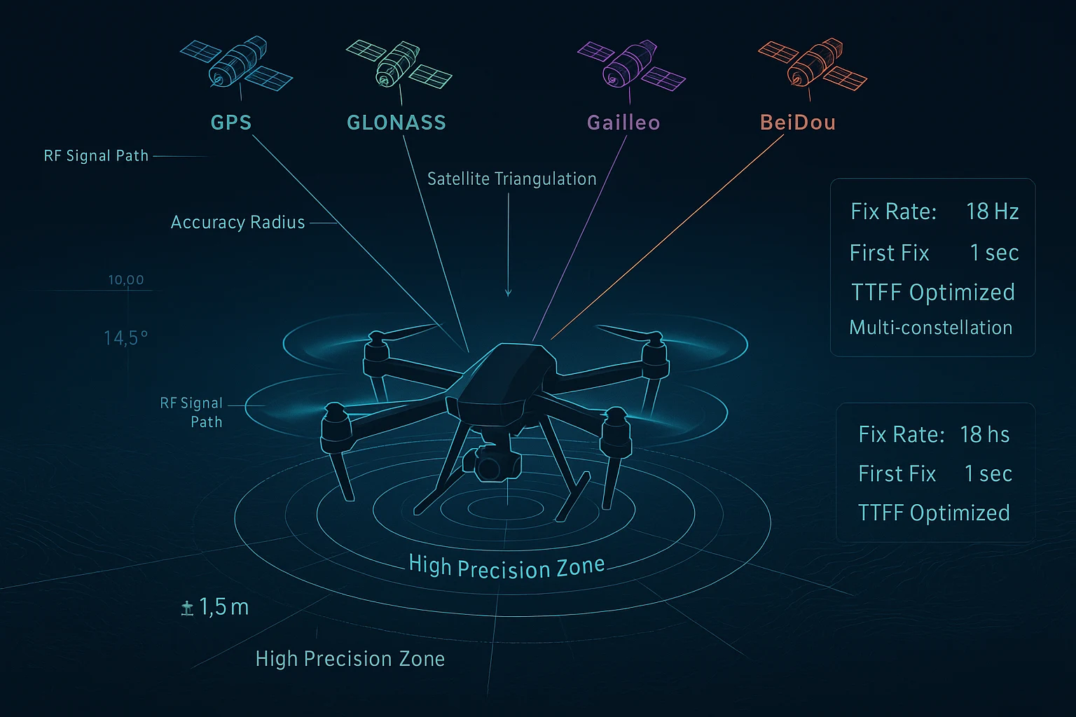
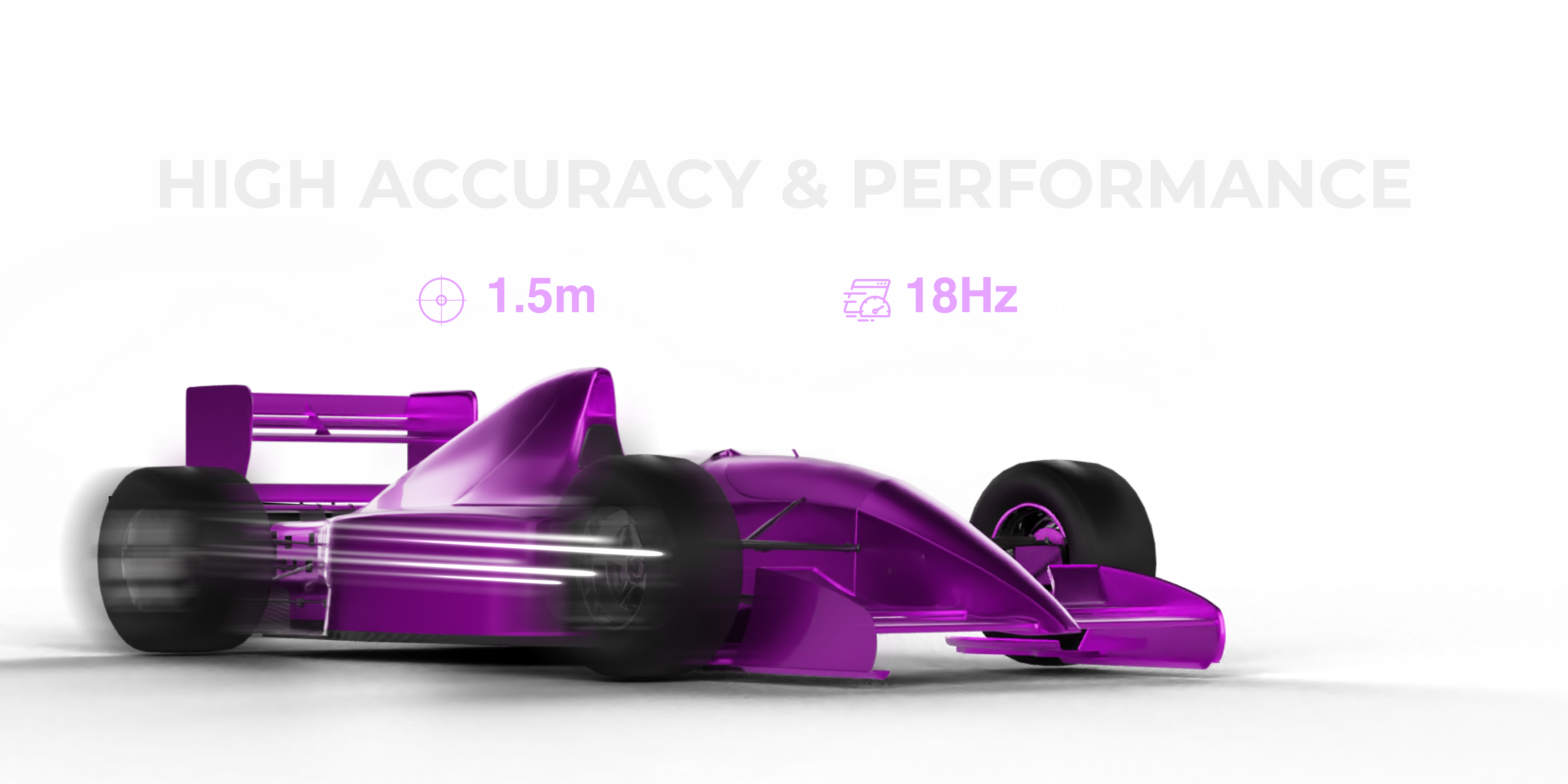
The answer is not found in software tuning alone. It starts with the hardware doing the measuring. A GNSS module capable of 1.5-meter accuracy, an 18Hz fix rate, and concurrent multi-constellation tracking changes what is possible on a drone — whether you are mapping agricultural land, running autonomous inspection flights, filming cinematically, or racing FPV across an open field.
This guide walks through everything: why standard GPS modules underperform, what the key specifications actually mean in real-world flight, and how to select and integrate a GNSS module that genuinely elevates your drone's navigation capability.
Why Most Drone Builders Struggle with GPS Accuracy
Most off-the-shelf GPS modules shipped with entry-level and mid-tier flight controllers are designed to hit a price point, not a performance target. They are typically single-constellation receivers — tracking GPS only — with fix rates of 1Hz to 5Hz and CEP (Circular Error Probable) accuracy figures in the 2.5 to 5 meter range under ideal conditions.
Under real-world conditions — urban canyons, tree canopy, electromagnetic interference from motors and ESCs, or simply a partly cloudy sky — those same modules degrade further. You end up with position jitter, altitude drift, and slow response to movement that makes autonomous flight unpredictable and manual flight frustrating.
Here is what is actually limiting your drone's GPS performance:
Single-constellation dependency. When your receiver only talks to GPS satellites, you are limited to whatever geometry and signal availability that constellation provides at any given moment. A bad sky view can mean fewer than 6 satellites visible — far below the 10-15 you would have with four constellations active.
Slow fix rates. A 1Hz fix rate means your flight controller gets a position update once per second. At 15 meters per second cruise speed, that is a 15-meter blind spot between updates. Even at 5Hz, autonomous navigation becomes rough. Agile platforms and fast-moving applications need 10Hz minimum — and ideally 18Hz.
Weak filtering. Consumer GNSS modules rarely include sophisticated RF filtering. Harmonics from motors, video transmitters, and even the switching frequencies of BECs can corrupt GNSS signals at the receiver input, degrading accuracy without any visible indication.
Poor antenna integration. Ceramic patch antennas vary dramatically in gain and radiation pattern. A poorly integrated antenna can add 1-2 meters of effective error on top of the receiver's base accuracy.
Understanding these failure points shows you exactly where to improve. And for each one, there is a hardware answer.
The Specifications That Actually Matter
When evaluating how to improve GPS accuracy drone hardware, these are the specifications worth caring about:
Positional Accuracy (CEP)
Expressed as meters CEP (Circular Error Probable), this tells you the radius within which 50% of position fixes will fall. A 1.5-meter CEP means that half of all position reports place you within 1.5 meters of your true location. For practical purposes, consistent 1.5-meter accuracy is professional grade — sufficient for precision agriculture, inspection, and autonomous delivery.
Fix Rate (Hz)
Fix rate is how many times per second the receiver calculates and outputs a position solution. Higher is better for agile platforms. 18Hz means position updates 18 times per second — fast enough for high-speed FPV, dynamic autonomous missions, and responsive altitude hold.
First Fix Time (TTFF)
Time to First Fix matters for field operations. Waiting three minutes for a GPS lock on a busy shoot day is genuinely costly. A module with 1-second hot start reacquisition and rapid cold start performance keeps your operations moving.
Constellation Support
Every additional constellation adds visible satellites. More satellites means better geometry (lower PDOP), more redundancy, and more signal to average against multipath errors. Concurrent GPS + GLONASS + Galileo + BeiDou tracking is the gold standard.
RF Filtering
Active RF filtering at the antenna input rejects interference from the drone's own electronics. This is a hardware feature, not a firmware setting, and it separates purpose-built GNSS modules from commodity receivers.
Introducing the MultiNav Pro+: Built for Drone Precision
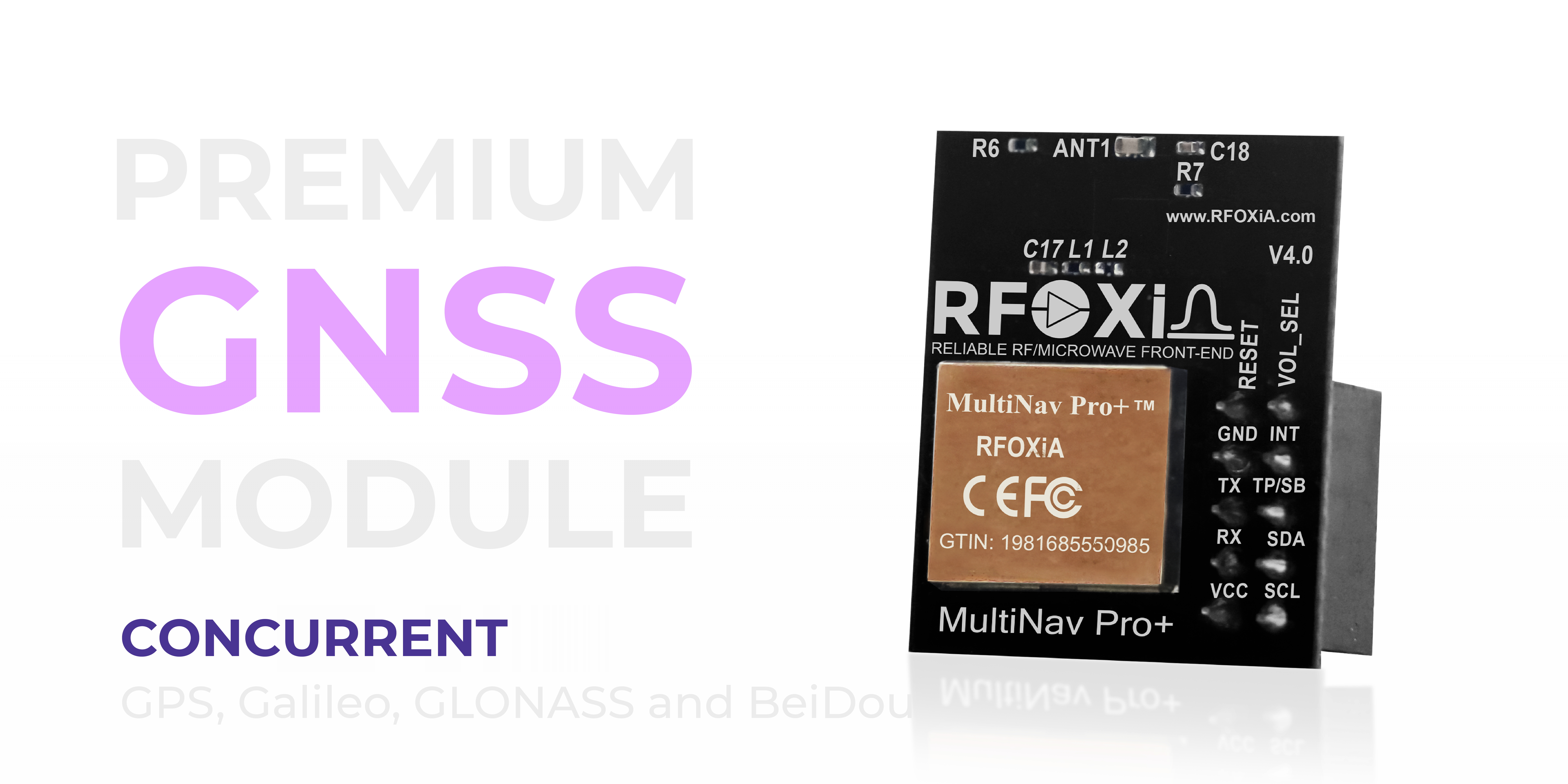
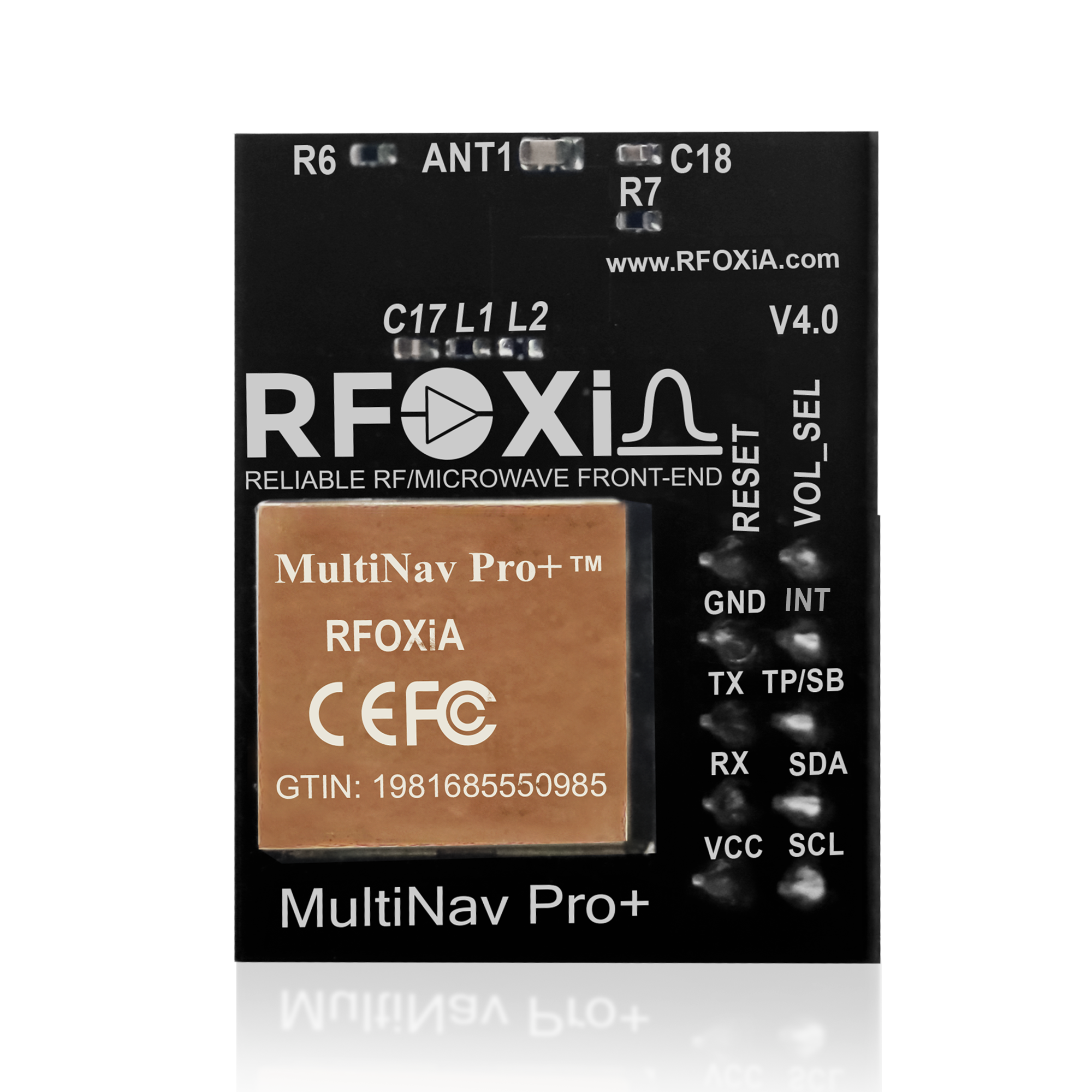
The RFOXiA MultiNav Pro+ is a professional GNSS module engineered specifically for applications where accuracy and update rate are non-negotiable. It is built around the u-blox MIA-M10Q — one of the most capable GNSS chips available for embedded applications — and adds RFOXiA's proprietary RF/microwave microstrip filtering, integrated high-gain chip antenna, and a compact 26mm × 22mm form factor that fits any drone build.
This is not a generic breakout board. Every design decision targets real-world drone performance.
Key Specifications at a Glance
- Accuracy: Less than 1.5 meters CEP
- Fix Rate: Up to 18Hz
- First Fix: 1 second (hot start)
- Constellations: GPS, Galileo, GLONASS, BeiDou — concurrent
- Chip: u-blox MIA-M10Q
- Interfaces: UART (TX/RX) and I2C (SCL/SDA)
- Voltage: 1.8V and 3.3V compatible
- Current Draw: 25-30mA
- Size: 26mm × 22mm
- FCC Certified: Yes
How to Improve GPS Accuracy Drone Hardware Step by Step
Step 1: Replace the Receiver — Choose Multi-Constellation
The single highest-impact change you can make to improve GPS accuracy on a drone is upgrading to a multi-constellation receiver with verified sub-2-meter accuracy.
With the MultiNav Pro+ tracking all four major GNSS constellations simultaneously, your drone has access to 20-35 satellites at any given moment depending on sky visibility. That redundancy means:
- Lower PDOP (Position Dilution of Precision) — better geometry
- Faster initial lock
- Maintained accuracy even when individual satellites are obscured
- Robust performance in partially challenging environments
At 18Hz output, your flight controller receives position updates fast enough to command precise corrections on agile platforms — a critical factor for autonomous flight modes and position hold in wind.
Step 2: Prioritize RF Signal Integrity
A GNSS module installed poorly inside an electrically noisy drone is only as good as the interference allows. The MultiNav Pro+ addresses this with proprietary RF/microwave microstrip filter technology that rejects interference at the receiver input — before it corrupts the signal.
Beyond the module itself, best practices for RF integrity on a drone include:
- Mounting the GNSS module as far from the power distribution board and ESCs as physically possible
- Using a mast or standoff to elevate the module above the frame
- Routing GNSS cables away from high-current motor and battery cables
- Avoiding shared ground planes with switching power supplies
The combination of the module's built-in filtering and thoughtful physical installation eliminates the two primary sources of GNSS degradation on multirotors.
Step 3: Match Form Factor to Your Build
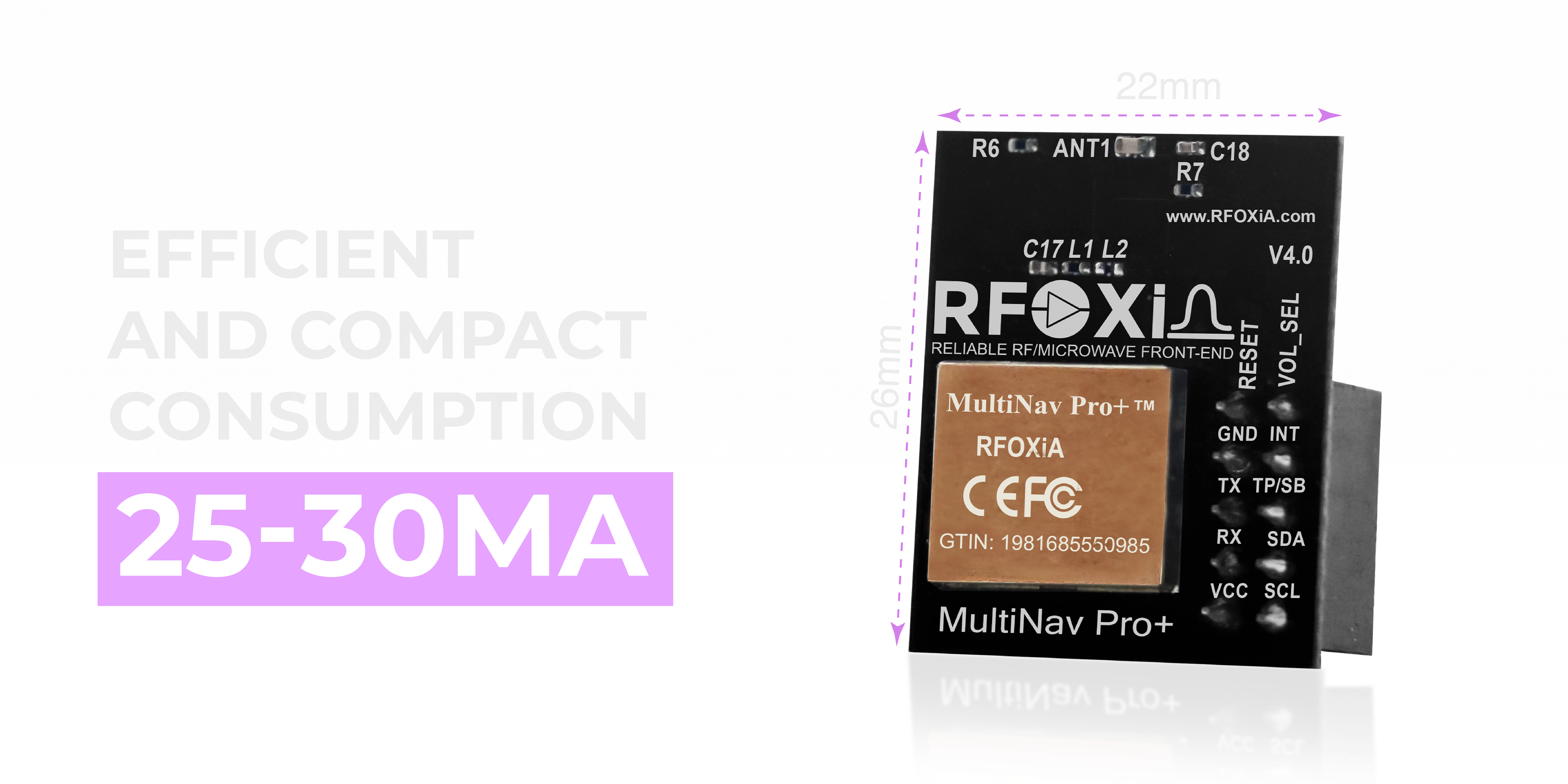
At 26mm × 22mm and 25-30mA current draw, the MultiNav Pro+ adds essentially zero weight and power penalty to any drone build — from micro-class 2.5-inch freestyle quads to large X8 octocopters. The compact form factor means you can mount it optimally for antenna sky view rather than making compromises for size.
For long-endurance builds, 25-30mA is a negligible contribution to total system current. You get professional navigation data without measurable impact on flight time.
Step 4: Integrate Cleanly with Your Flight Controller
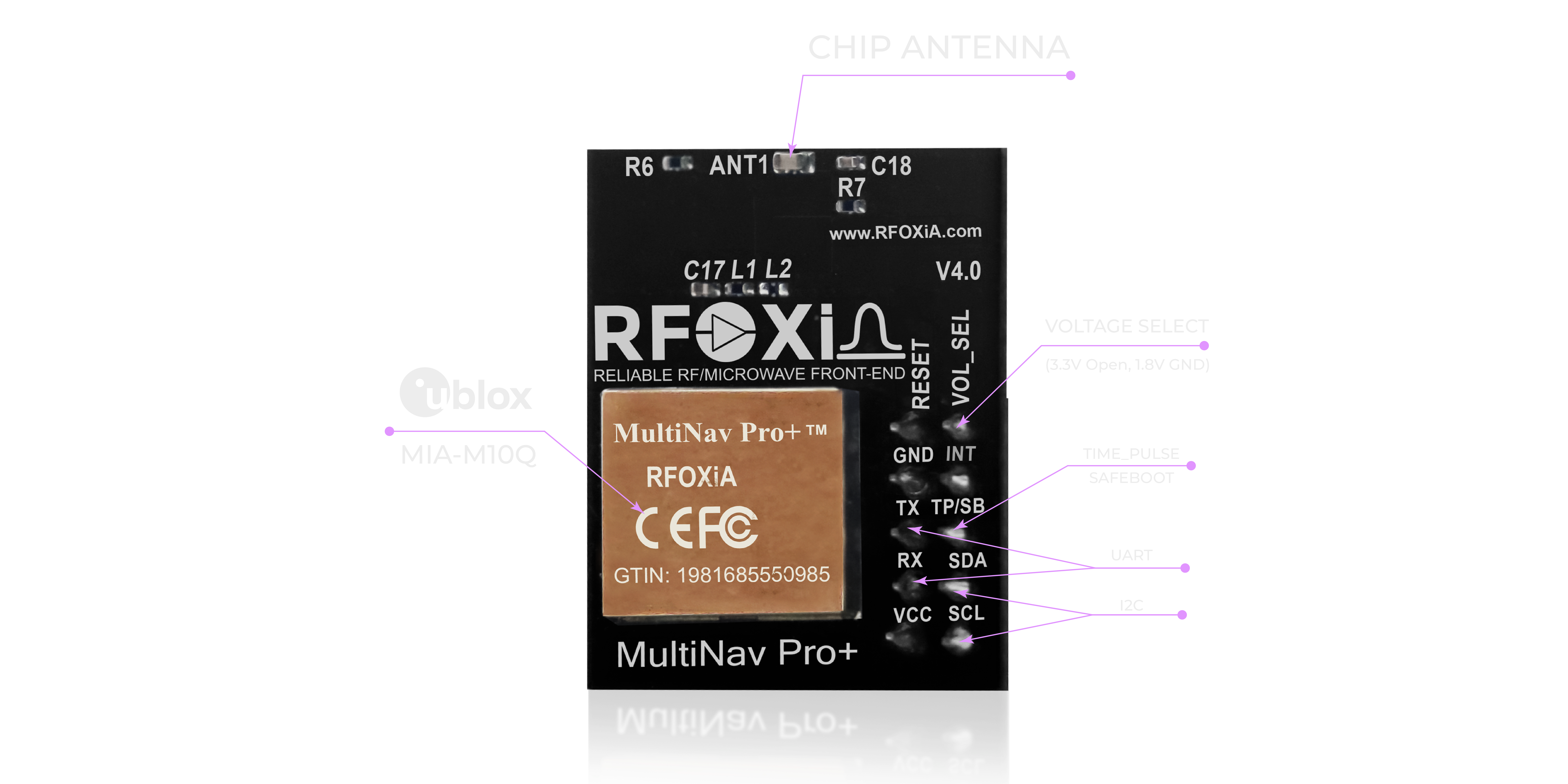
The MultiNav Pro+ supports both UART and I2C interfaces, making it compatible with virtually every flight controller on the market — Betaflight, ArduPilot, PX4, iNav, and custom firmware stacks.
UART connection is the standard for most flight controllers. Connect TX from the module to the flight controller's RX pin on any available UART port, and RX to TX. Configure the port for GPS at 38400 or 115200 baud depending on your fix rate target.
I2C connection is useful when UART ports are exhausted or when daisy-chaining multiple sensors on a shared bus. The module supports 1.8V and 3.3V logic levels, removing any need for level-shifting hardware when interfacing with modern flight controllers.
Step 5: Use the Open-Source Library for Custom Builds
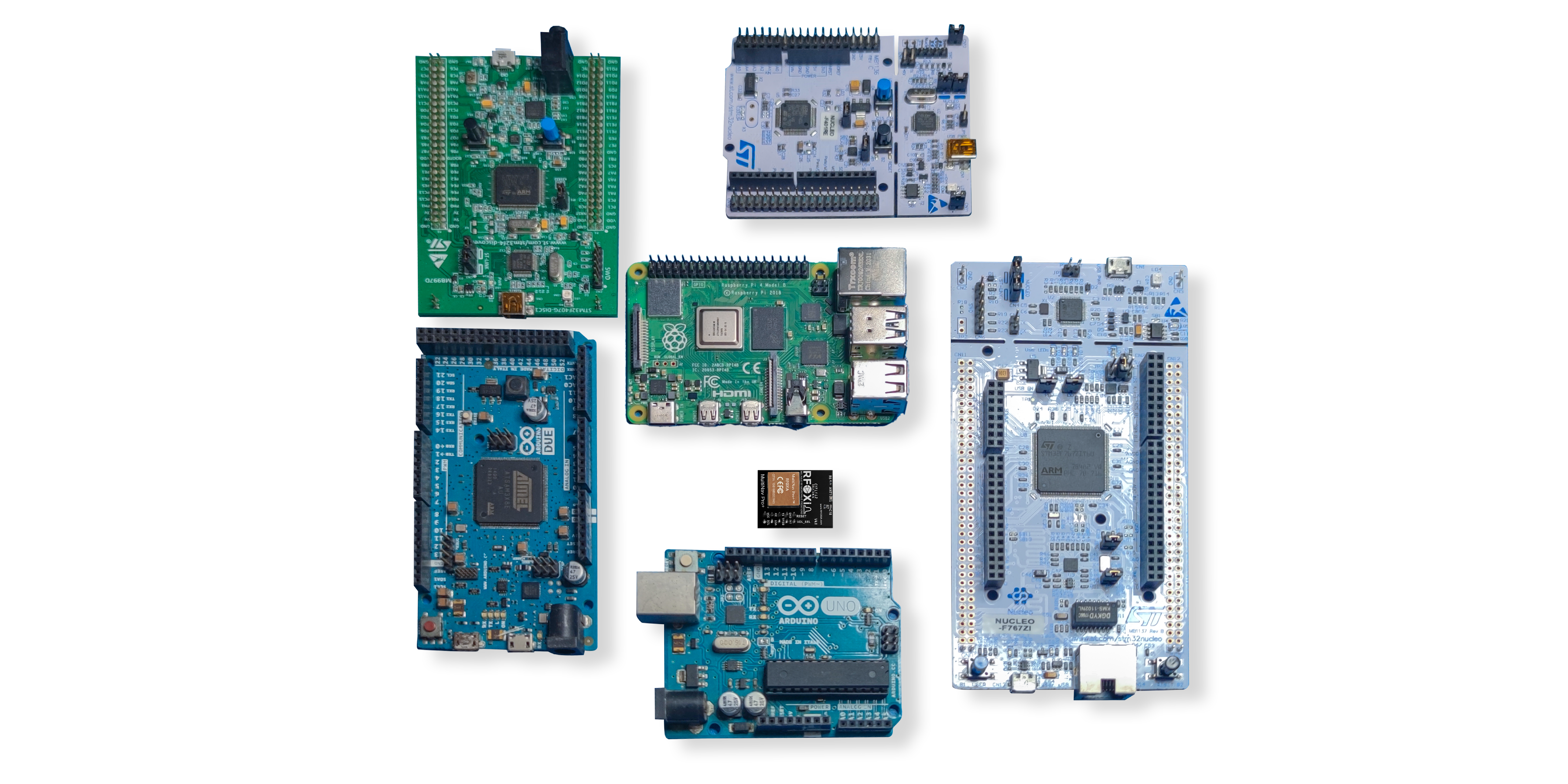
For builders developing custom flight control firmware, autonomous navigation stacks, or companion computer applications, the MultiNav Pro+ ships with a fully open-source C language library. It implements the NMEA standard protocol command set and imports directly into Arduino IDE, PlatformIO, or any GCC-based toolchain.
This is not a minimal wrapper — it is a complete library covering position, velocity, heading, satellite count, PDOP, and fix quality data. Integration into a custom project is a matter of hours, not days.
For ArduPilot and PX4 users, the module outputs standard NMEA sentences recognized natively by both autopilots. Plug in, configure the port, and your ground station will show full satellite and accuracy data immediately.
Step 6: Evaluate Performance with u-Center
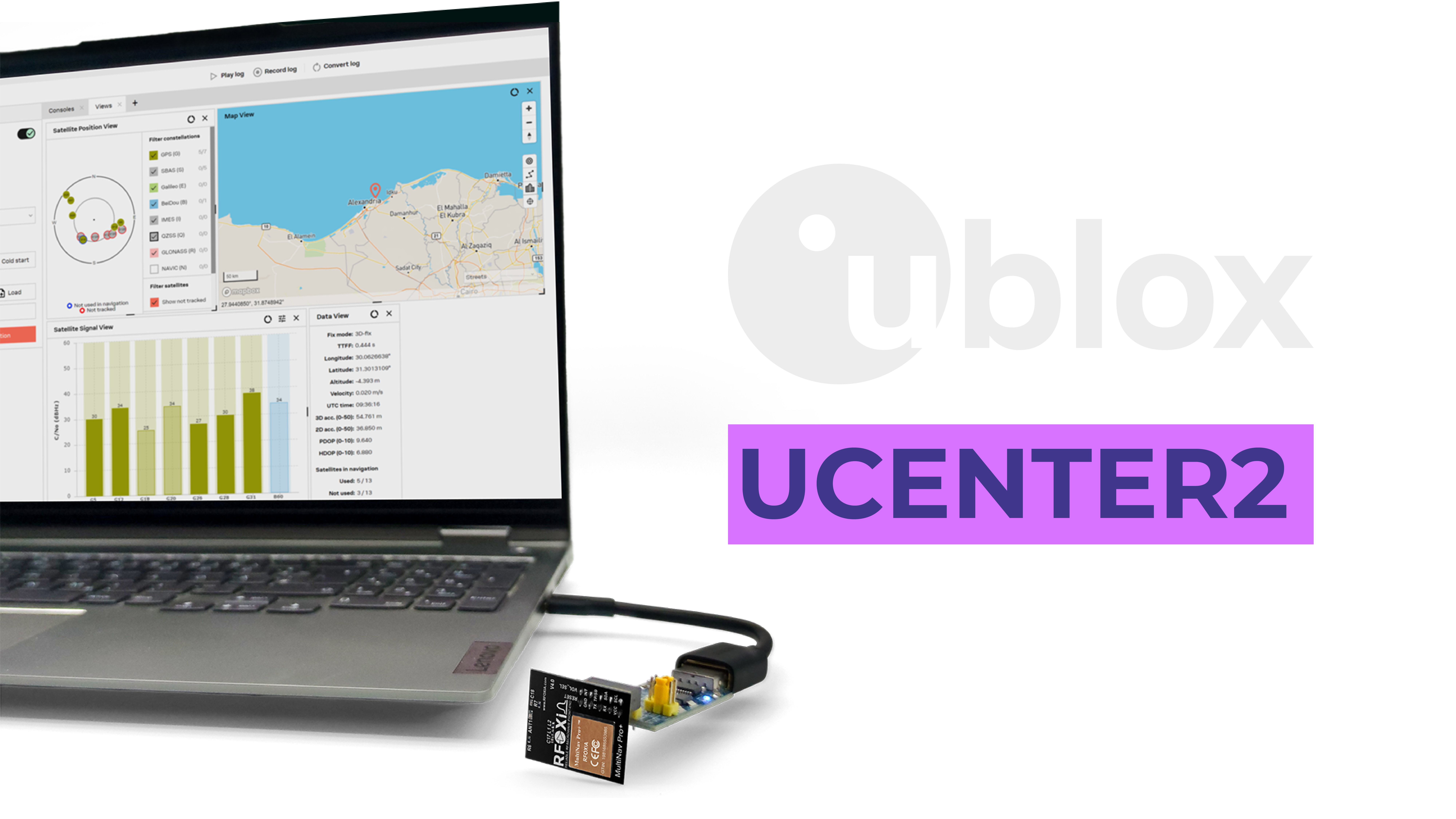
u-Center is u-blox's free desktop application for evaluating and configuring GNSS receivers. Because the MultiNav Pro+ is based on the MIA-M10Q, it is fully compatible with u-Center's complete feature set.
With u-Center you can:
- Visualize sky view and each satellite's signal strength in real time
- Log position data for accuracy analysis
- Configure output rate, protocol, and message types
- Evaluate multipath and jamming indicators
- Assess PDOP and fix quality before committing to a flight
For pre-flight checks on critical missions, connecting the module via USB and running a five-minute u-Center evaluation is a professional practice that verifies the module is performing to specification in the specific location and conditions of your operation.
Real-World Applications That Demand This Level of Accuracy

Knowing how to improve GPS accuracy drone performance matters most when the mission actually requires it. Here are the use cases where the MultiNav Pro+ earns its place:
Precision Agriculture: Spray drones and mapping UAVs need sub-2-meter accuracy to maintain consistent swath overlap and avoid double-spraying or missing coverage. At 1.5-meter CEP, the MultiNav Pro+ meets this requirement without RTK hardware.
Infrastructure Inspection: Power line, bridge, and tower inspection drones operate close to structures where GPS degradation is common. High fix rates and multi-constellation support maintain position hold in partially obstructed sky conditions.
Autonomous Delivery: Last-meter delivery accuracy depends directly on GNSS performance in urban environments. The MultiNav Pro+ handles urban canyons better than single-constellation alternatives due to increased satellite availability from four constellations.
FPV and Freestyle: Return-to-home reliability matters when a long-range freestyle session pushes the drone to the edge of the pilot's sight. A high-accuracy, high-fix-rate GNSS module means RTH brings the drone back to within arm's reach of the launch point.
Search and Rescue: SAR drones coordinate with ground teams using GPS coordinates. 1.5-meter accuracy means the drone's reported position is actionable — the team can navigate to a target the drone has marked with confidence.
Research and Data Collection: Researchers collecting geospatially referenced sensor data need position accuracy that matches or exceeds sensor resolution. The MultiNav Pro+ provides professional-grade location tagging for scientific datasets.
When paired with the RFOXiA Accurate GNSS Module in RFOXiA's full developer ecosystem, researchers can also contribute verified geospatial sensor data to the RFOXiA data network and earn daily rewards — turning deployed hardware into a passive revenue stream.
Integration with the RFOXiA Ecosystem
The MultiNav Pro+ is designed to work as a standalone upgrade for any drone build. But it is also engineered as part of RFOXiA's complete wireless development ecosystem — which means it pairs natively with the RFOXiA Sensors Module, BLE Module, Power/Program Kit, and the RFOXiA Connect mobile app.
When integrated into a full RFOXiA stack, your drone's GPS position data becomes part of a live data session visible on the RFOXiA Connect app — with real-time map tracking, sensor overlays, and session logging. The BLE Module handles the communication link at ranges up to 20km man-to-drone, and the Sensors Module adds environmental context to every logged position point.
For developers building custom autonomous platforms, the AI Firmware Builder in RFOXiA Club generates production-ready firmware for MultiNav Pro+ integration — describe your application in plain language, and receive complete, commented source code ready to flash.
Explore the full module and bundle options at the RFOXiA Accurate GNSS Module product page.
Common Mistakes That Undermine GPS Accuracy — and How to Avoid Them
Even with a high-performance GNSS module installed, build and configuration errors can negate the hardware's capabilities.
Mounting too close to noise sources. ESCs and power distribution boards radiate significant RF noise. Mount the GNSS module as far as possible — ideally on a dedicated mast at the top of the frame.
Skipping compass calibration. GPS position is most useful when paired with an accurate heading reference. Always calibrate the onboard compass after any frame or motor change, and keep the GNSS module away from magnetic field sources like large motor magnets and steel hardware.
Using incorrect baud rate. At 18Hz output, the module generates more data per second. Ensure the flight controller UART is configured for 115200 baud to handle the full data rate without buffer overruns that drop fixes.
Flying before adequate satellite lock. Even a 1-second first fix is not the same as a stable, high-quality lock. Best practice is to wait for HDOP below 1.5 and satellite count above 12 before arming for an autonomous mission.
Ignoring flight controller GPS configuration. ArduPilot and PX4 both have GPS configuration parameters for protocol type, minimum satellite count for arming, and GPS glitch detection thresholds. Configure these to match your module's output format and your mission requirements.
Why 18Hz Fix Rate Changes What Is Possible
The conversation about how to improve GPS accuracy drone performance often focuses on positional error — the accuracy number in meters. But fix rate deserves equal attention, especially for dynamic platforms.
At 1Hz, a flight controller commands corrections based on position data that may already be 1 second old. At typical drone speeds, that is meters of uncompensated drift per update cycle. The flight controller is always reacting to the past.
At 18Hz, position data is fresh 18 times per second. The flight controller operates on near-present-state information, enabling tighter position loops, faster response to disturbances, and smoother autonomous path following. The practical difference between 1Hz and 18Hz GPS on a drone is visible — hover stability, waypoint tracking accuracy, and RTH precision all improve measurably.
For FPV pilots enabling GPS rescue modes, 18Hz means the drone responds to position corrections fast enough to arrest drift before it becomes a flyaway. For autonomous mapping, it means position logs dense enough to reconstruct flight paths with sub-meter interpolation accuracy.
Pricing and Availability
The RFOXiA MultiNav Pro+ is priced at $49 — a price point that reflects professional hardware made accessible to builders without enterprise budgets. It is FCC certified, ships ready to integrate, and comes with the open-source driver library and quick-start documentation.
For builders looking to upgrade a single drone, the standalone module is the direct path. For those building a complete wireless development platform — with long-range communication, sensor fusion, professional power management, and AI-assisted firmware development — the Developer Bundle combines the MultiNav Pro+ with the BLE Module, Sensors Module, and Power/Program Kit at $199.
Learn more and order directly at the RFOXiA Accurate GNSS Module product page.
Conclusion
Knowing how to improve GPS accuracy drone builds requires understanding what actually limits performance: constellation coverage, fix rate, RF signal integrity, and antenna quality. Swapping a generic single-constellation module for a purpose-built professional receiver addresses all four failure points simultaneously.
The RFOXiA MultiNav Pro+ delivers 1.5-meter accuracy, 18Hz fix rate, concurrent four-constellation tracking, and advanced RF filtering in a 26mm × 22mm package that weighs almost nothing and draws less than 30mA. It integrates via UART or I2C into any flight controller, ships with a complete open-source library, and is compatible with u-Center for professional pre-flight evaluation.
For drone builders who want navigation data they can actually trust — on mapping missions, autonomous flights, long-range FPV, or precision inspection work — the hardware decision is clear. Start with the right GNSS module, and every other layer of your navigation stack performs better.
Written by: Moamen Mohamed LinkedIn