
Multipath GPS Error Solution: Achieving Sub-1.5m Accuracy in Real-World Conditions
The Multipath GPS Error Solution Every Developer Has Been Searching For
If you have ever built a drone, a precision tracking system, or any GPS-dependent application, you already know the frustration. Your coordinates drift. Your position jumps erratically in urban canyons. Your altitude readings fluctuate without explanation. The culprit, more often than not, is multipath GPS error — and finding a genuine, hardware-level multipath GPS error solution has historically meant either accepting poor performance or spending thousands of dollars on military-grade receivers.
That changes with the RFOXiA Accurate GNSS Module.
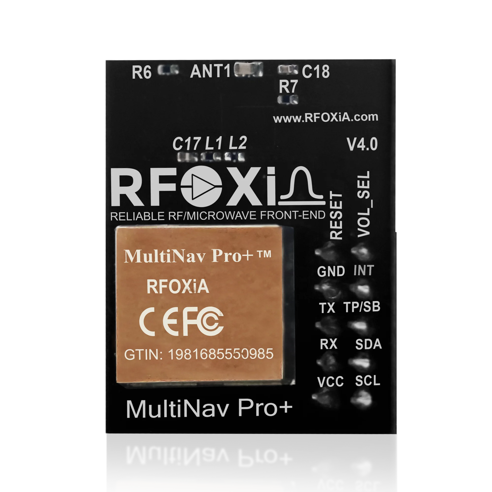
In this post, we are going to break down exactly what multipath GPS error is, why it destroys precision in real-world deployments, and how the MultiNav Pro+ GNSS Module from RFOXiA delivers a hardware-engineered solution at a price every developer, drone builder, and IoT engineer can actually afford.
What Is Multipath GPS Error and Why Does It Ruin Your Build?
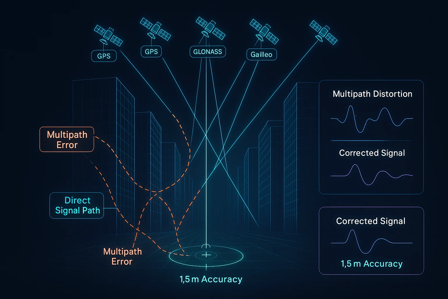
GPS and GNSS systems work by measuring the time it takes for signals to travel from satellites in orbit down to your receiver. The math is straightforward — distance equals the speed of light multiplied by signal travel time. When that signal travels in a perfectly straight line from satellite to antenna, accuracy is excellent.
Multipath error happens when that signal does not travel in a straight line. Instead, it bounces off buildings, terrain, vehicles, water surfaces, or even the airframe of your drone before reaching the receiver. The receiver picks up both the direct signal and one or more reflected copies of that same signal. Because the reflected signals have traveled a longer path, they arrive slightly later — but the receiver cannot always tell the difference between the direct signal and a reflected echo.
The result is position error. Sometimes a few meters. Sometimes tens of meters. In dynamic environments, this error is not static — it shifts continuously as the geometry between satellites, reflective surfaces, and your receiver changes.
For a drone doing precision agriculture, a tracking module following a delivery vehicle, or a research buoy monitoring ocean conditions, multipath GPS error is not a minor inconvenience. It is a fundamental failure of your system's core function.
Common Scenarios Where Multipath Destroys Accuracy
- Urban drone operations — Glass facades, steel structures, and concrete walls create a dense multipath environment that can push position error to 10 meters or more.
- Warehouse and indoor-adjacent applications — Metal roofing and walls reflect signals unpredictably.
- Vehicle and automotive tracking — The vehicle body itself creates reflections, compounded by roadside infrastructure.
- Marine and waterfront environments — Water surfaces are excellent reflectors, causing severe multipath in harbor and coastal applications.
- Mountainous terrain — Rock faces and valley walls create strong reflections that traditional receivers cannot filter.
- FPV and racing drones — High-speed movement through mixed environments means the multipath profile changes faster than slow receivers can adapt.
Why Most GNSS Modules Fail to Solve Multipath
The market is full of GNSS modules. A basic search returns dozens of options at low price points. The problem is that most of them use entry-level chipsets with minimal signal processing, single-constellation support, and no meaningful RF filtering on the board itself.
A module that only receives GPS signals (the American system) is working with a limited satellite geometry at any given moment. Fewer satellites in view means weaker dilution of precision (DOP) values — and weaker DOP means multipath signals have a greater influence on your position calculation.
The physics of multipath rejection come down to three things: constellation diversity (more satellites in view from different angles means multipath signals from any one direction are diluted), chipset signal processing quality (how intelligently the receiver distinguishes direct from reflected signals), and RF board design (how cleanly the analog signal is handled before it ever reaches the digital processing stage).
Cheap modules cut corners on all three. That is not a criticism — it is a market reality. Entry-level modules are built for cost, not performance.
The MultiNav Pro+ was built for performance.
How the MultiNav Pro+ Delivers a Real Multipath GPS Error Solution
1. Concurrent Multi-Constellation GNSS Reception
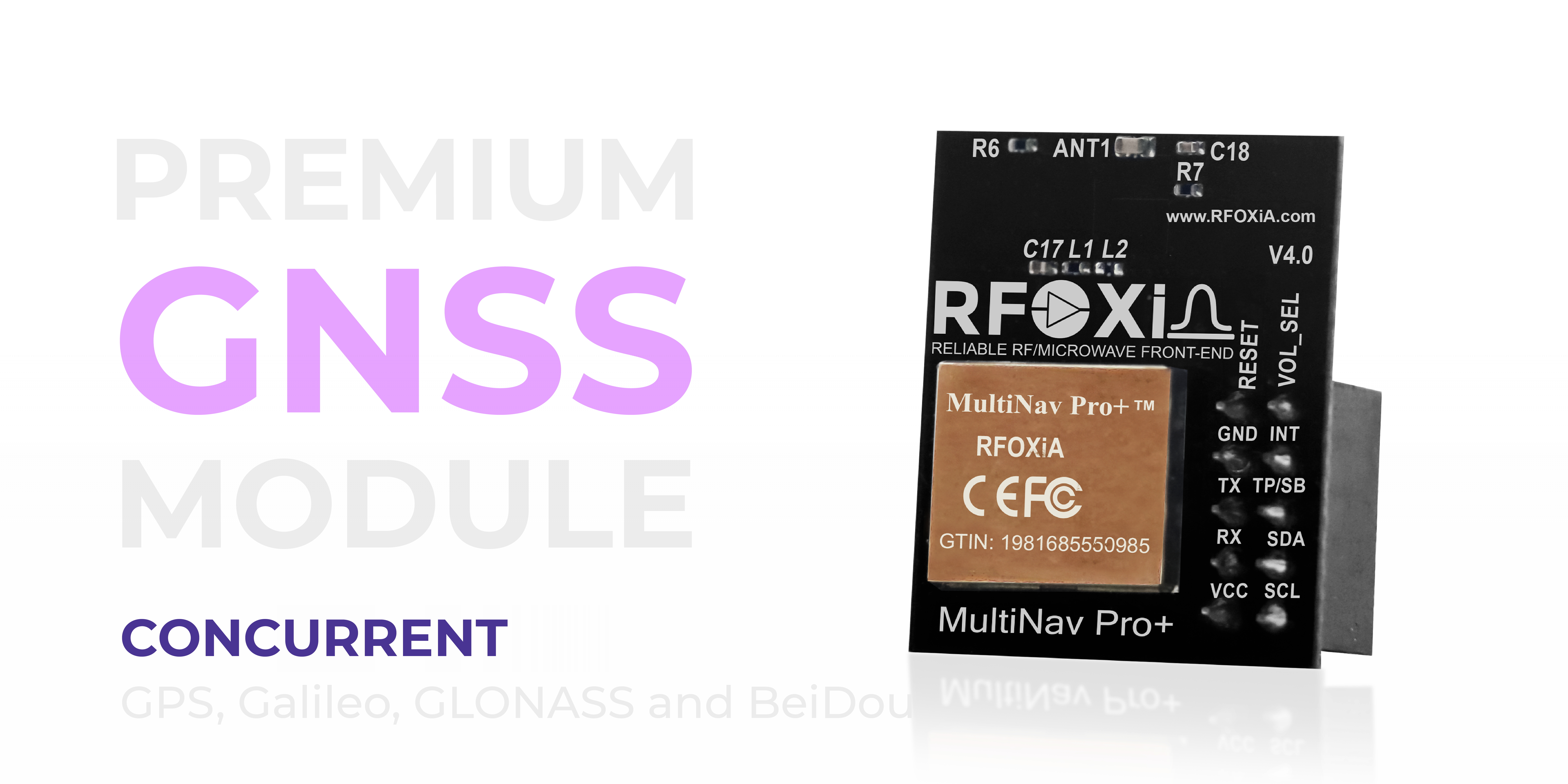
The MultiNav Pro+ receives GPS, Galileo, GLONASS, and BeiDou simultaneously — all four major global navigation satellite systems running at the same time, not switching between them.
This is the foundation of multipath resistance. When your receiver is tracking 20 to 30 satellites across four constellations at once, the geometry of the satellite field becomes extremely diverse. Multipath signals from any particular surface reflection affect only a small subset of the total satellite signals being processed. The receiver's position solution is mathematically robust because it is averaging across a large, geometrically diverse set of measurements.
A single-constellation receiver might be tracking 8 to 12 satellites. A quad-constellation receiver like the MultiNav Pro+ is tracking significantly more, from more directions across the sky. This geometric diversity is one of the most powerful passive multipath GPS error solutions available in hardware design.
2. u-blox MIA-M10Q Chipset — Designed for Signal Integrity
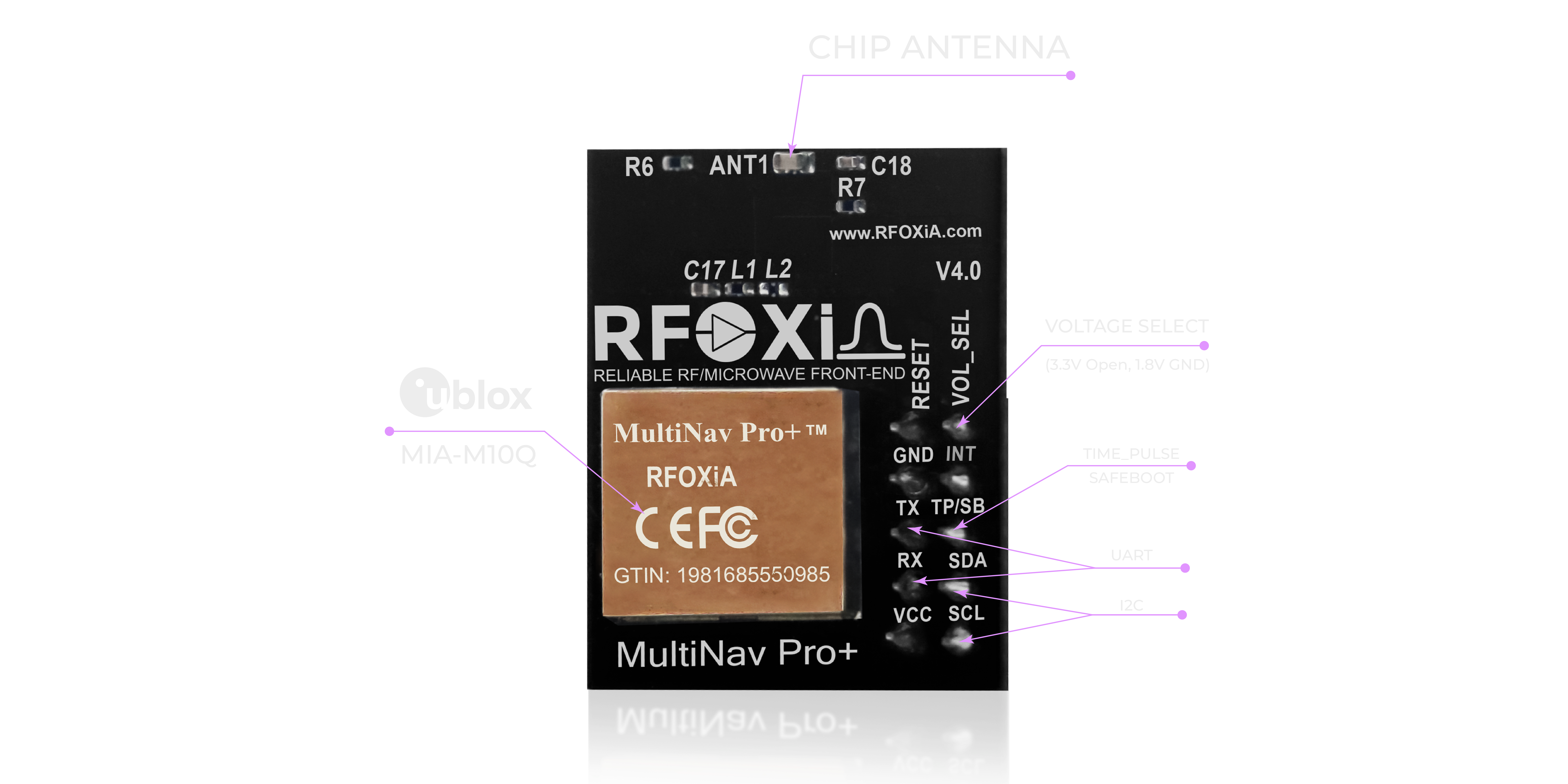
The MultiNav Pro+ is powered by the u-blox MIA-M10Q — one of the most advanced low-power GNSS chipsets available to the engineering community. u-blox is the global leader in precision GNSS chip design, and the MIA-M10Q represents their latest generation of positioning technology.
The MIA-M10Q includes advanced signal processing algorithms that actively work to reject reflected signals. It applies sophisticated correlation techniques to identify and down-weight signals that show characteristics of multipath — longer code phase delays, carrier phase inconsistencies, and abnormal signal strength patterns that are signatures of reflected rather than direct signals.
This is not a software patch — it is chip-level signal architecture designed from the ground up to deliver position accuracy in challenging environments.
3. Proprietary RF/Microwave Microstrip Filter Technology
Most low-cost GNSS modules put a chipset on a PCB with minimal attention to the RF signal path. The analog RF signal coming from the antenna passes through traces, connectors, and passive components that introduce noise, impedance mismatches, and interference pickup before it ever reaches the digital processing stage.
RFOXiA's expertise is RF engineering. The MultiNav Pro+ PCB incorporates proprietary RF/microwave microstrip filter technology that minimizes interference at the hardware level — before the signal reaches the chip. This means the MIA-M10Q is receiving a cleaner input signal, which directly translates to better multipath discrimination and higher position accuracy.
This is the RFOXiA advantage. When your core competency is RF design, your GNSS module reflects that in the board layout, trace geometry, impedance control, and filtering architecture.
The Specifications That Matter
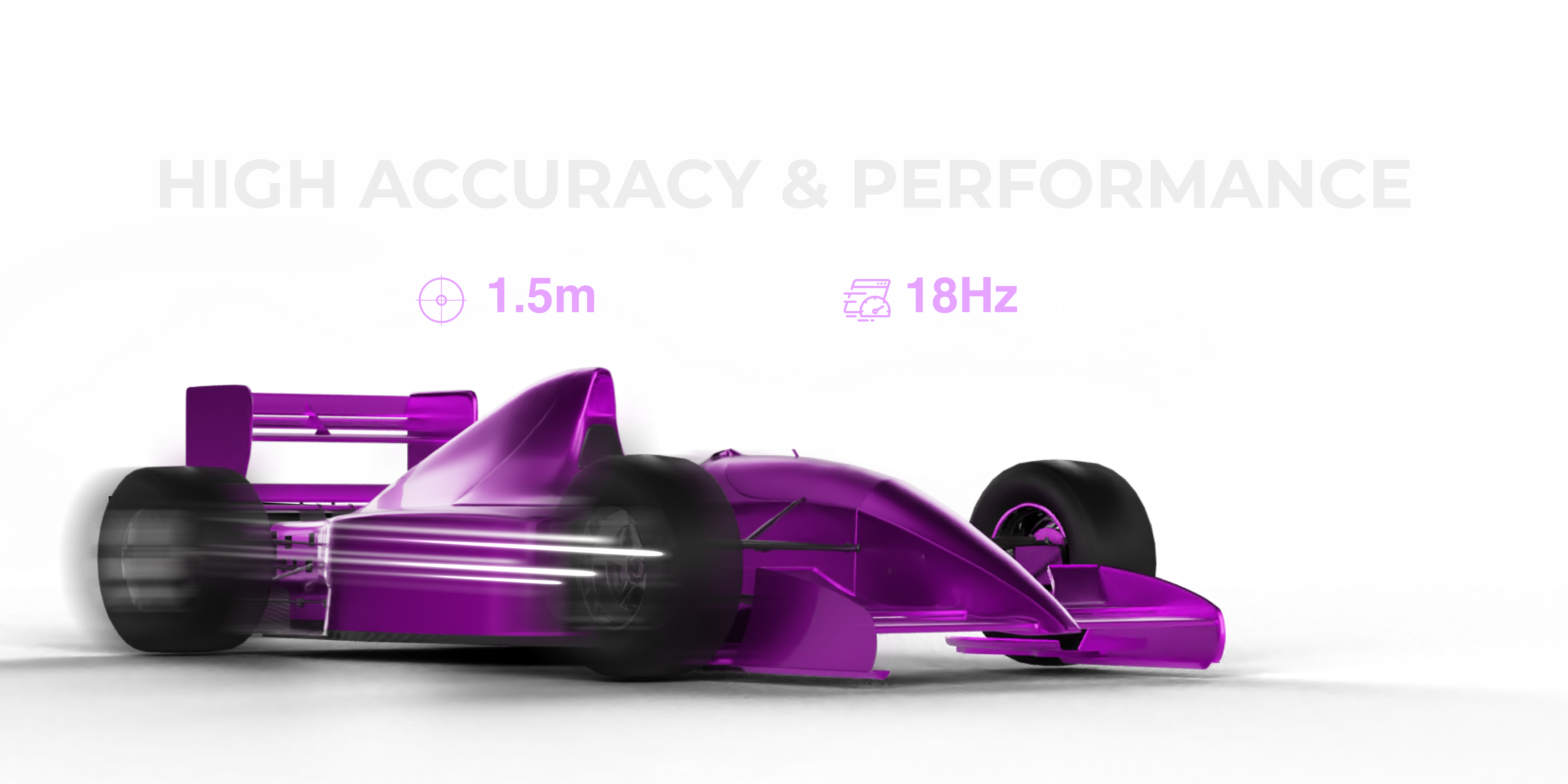
1.5-Meter Accuracy
The MultiNav Pro+ achieves less than 1.5 meters of position error under standard open-sky conditions. For reference, most consumer-grade single-constellation modules operate at 2.5 to 5 meters of error in ideal conditions — and significantly worse in multipath environments. The MultiNav Pro+ maintains its 1.5-meter specification in real-world conditions because of the constellation diversity and RF design described above.
18Hz Fix Rate
At 18 updates per second, the MultiNav Pro+ delivers position data faster than virtually any other module at this price point. Most budget GNSS modules operate at 1Hz or 5Hz — meaning they update position once per second or five times per second.
For a drone flying at 60 kilometers per hour, a 1Hz update means your position data is already 16 meters stale by the time the next fix arrives. At 18Hz, that staleness drops to under one meter. For precision drone operations, FPV racing, or any fast-moving platform, 18Hz is not a luxury — it is a requirement.
First Fix in 1 Second
Cold start acquisition in one second means your system is operational immediately after power-on. No waiting for satellite acquisition. No delays at the start of a mission. The MultiNav Pro+ is ready when you are.
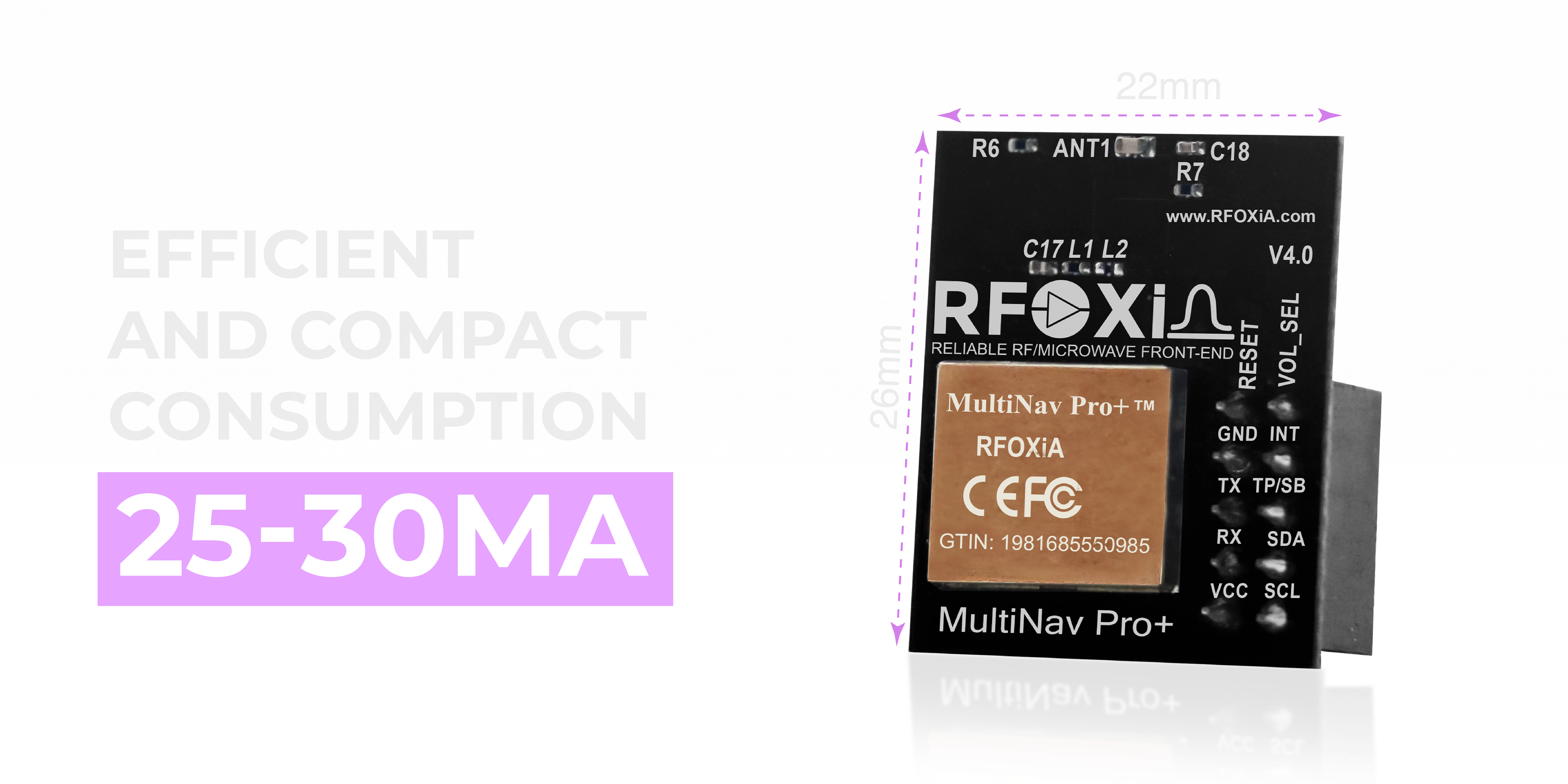
Compact Enough for Any Platform
The MultiNav Pro+ measures just 26mm x 22mm. At that footprint, it integrates cleanly into:
- Micro and mini drone frames where every millimeter of space matters
- Wearable tracking devices and personal safety hardware
- Asset tracking modules embedded in cargo containers or vehicles
- Compact IoT sensor nodes deployed in the field
- Research instruments with tight PCB real estate
Despite the small form factor, power consumption is kept to 25 to 30 milliamps during active tracking — efficient enough to run continuously on battery-powered deployments without dominating the power budget.
The integrated chip antenna eliminates the need for an external antenna in most applications, further simplifying integration and reducing the physical volume of your design.
Developer-First Interface Design
UART and I2C Support
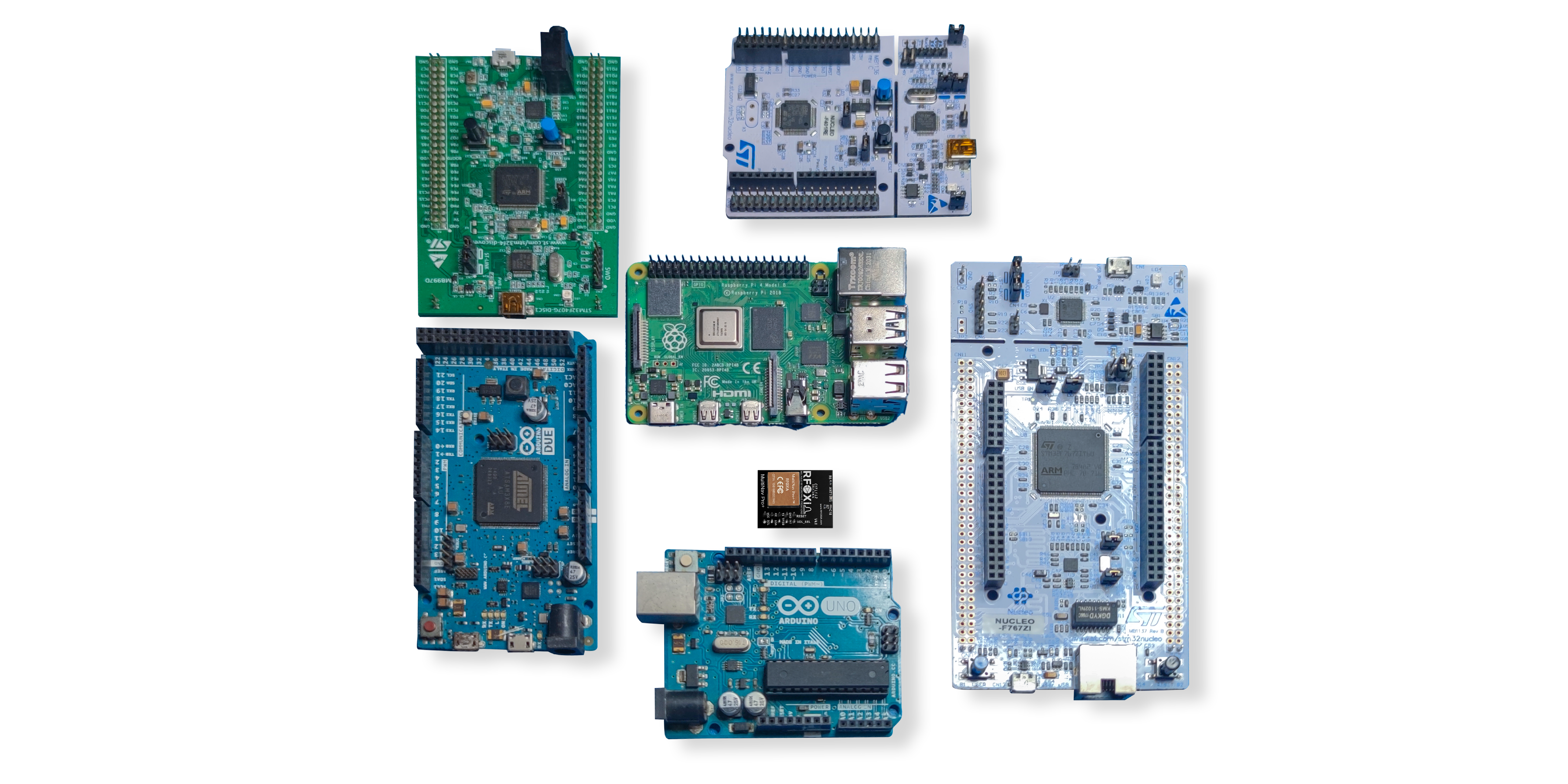
The MultiNav Pro+ supports both UART (TX/RX) and I2C (SCL/SDA) interfaces. This gives you flexibility to integrate with virtually any microcontroller, single-board computer, or custom PCB without adapter hardware or level-shifting complexity.
Voltage compatibility covers both 1.8V and 3.3V logic levels, making the module compatible with modern low-voltage processors without additional components.
Open-Source C Library
RFOXiA ships the MultiNav Pro+ with a fully open-source C language driver library. The library implements the NMEA standard protocol commands that you would expect from any professional GNSS module — position, velocity, time, satellite status, dilution of precision, and more.
Importing into Arduino IDE takes minutes. The same library works in any C-compatible toolchain — STM32CubeIDE, PlatformIO, Zephyr RTOS, bare-metal embedded projects, or Linux-based systems via serial port.
u-center Software Support
Because the MultiNav Pro+ is built on the u-blox MIA-M10Q, it is fully compatible with u-blox's u-center software — a powerful graphical interface for GNSS evaluation, configuration, and debugging.
u-center gives you a visual satellite sky view showing exactly which satellites are being tracked and from which directions. You can see signal strength bars for each satellite, watch your position solution in real time on a map, log raw NMEA or UBX binary data to disk for post-processing analysis, and configure the receiver's settings including update rate, constellation enable/disable, power mode, and more.
For developers who are debugging a multipath GPS error problem in a specific deployment environment, u-center is an invaluable diagnostic tool. You can see exactly how many satellites are visible, what DOP values look like, and how the position solution behaves over time — all without writing a single line of code.

Where the MultiNav Pro+ Belongs: Real-World Use Cases
The multipath GPS error solution capabilities of the MultiNav Pro+ make it the right choice across a wide range of professional and development applications.
Drone Operations
For autonomous drones, precision agriculture platforms, and delivery systems, sub-1.5-meter accuracy is a mission-critical requirement. At 18Hz, the MultiNav Pro+ keeps position data current even at high flight speeds. Quad-constellation reception maintains accuracy over both urban environments and remote agricultural land where satellite geometry varies.
FPV and Racing Drones
FPV pilots who want GPS-assisted features — return to home, position hold, geofencing, lap timing with GPS reference — benefit from the 18Hz update rate and fast first fix. No waiting on the flight line for satellite acquisition.
IoT and Asset Tracking
Tracking modules for vehicles, containers, equipment, and personnel need reliable position data in varied and often challenging environments. The MultiNav Pro+ provides that reliability in a compact, low-power package that integrates into existing IoT hardware designs without redesigning the entire power or interface architecture.
Wearable and Personal Devices
With a 26mm x 22mm footprint and sub-30mA power consumption, the MultiNav Pro+ fits inside wearable form factors for personal safety devices, athlete performance monitoring, and outdoor navigation products.
Research and Environmental Monitoring
Researchers deploying instruments in the field need GPS-verified location data to give their measurements geographic context. The MultiNav Pro+ pairs directly with RFOXiA's Sensors Module to create verified, location-stamped environmental data nodes — an architecture that also feeds the RFOXiA data monetization network.
Automotive and Robotics
Ground vehicles and mobile robots operating in complex environments — warehouse corridors, urban streets, research campuses — benefit from the multipath resistance that comes from quad-constellation reception and advanced chipset signal processing.

Integrating the MultiNav Pro+ into the RFOXiA Ecosystem
The MultiNav Pro+ does not exist in isolation. It is one component in a complete, vertically integrated wireless development ecosystem built by RFOXiA.
When paired with the MultiNav Pro+ BLE Module, your drone or ground platform gains both precision location tracking and 5km to 50km wireless communication range — simultaneously. The RFOXiA Connect app displays live GPS position on a map alongside real-time sensor data and provides a PS5-style controller interface, all without internet connectivity.
When paired with the Sensors Module, the MultiNav Pro+ provides the GPS coordinate that validates sensor data for the RFOXiA data monetization network — turning your hardware deployment into a node that earns passive income from verified environmental data contributions.
For developers who want the complete package, the RFOXiA Accurate GNSS Module is available individually at $49, or as part of the Developer Bundle alongside the BLE Module, Sensors Module, and Power/Program Kit — the only kit on the market that combines long-range wireless, precision GNSS, multi-sensor environmental monitoring, and professional power management in one integrated ecosystem.
Technical Specifications Summary
| Specification | Value |
|---|---|
| Position Accuracy | < 1.5 meters |
| Fix Rate | 18Hz |
| First Fix | 1 second |
| Constellations | GPS, Galileo, GLONASS, BeiDou (concurrent) |
| Chipset | u-blox MIA-M10Q |
| Antenna | Integrated chip antenna |
| Interfaces | UART (TX/RX), I2C (SCL/SDA) |
| Voltage | 1.8V and 3.3V |
| Power Consumption | 25 to 30mA |
| Dimensions | 26mm x 22mm |
| Software | Open-source C library, u-center compatible |
| Certification | FCC certified |
| Price | $49 |
Why FCC Certification Matters for Your Project
Every RFOXiA module — including the MultiNav Pro+ — is FCC certified. This is not a detail to overlook.
FCC certification means the module has been tested to meet strict electromagnetic compatibility and emissions standards by an accredited third-party laboratory. For developers building commercial products, FCC certification on a component module dramatically simplifies the path to your own product's regulatory approval. For deployers using equipment in the United States, FCC certification is a legal requirement for many use cases.
At $49, the MultiNav Pro+ delivers FCC-certified precision GNSS with professional-grade multipath rejection capabilities. The next step up to professional survey-grade receivers starts at $500 and often exceeds $2,000.
Additional Multipath Mitigation Strategies to Combine With Your Hardware
While the MultiNav Pro+ provides significant hardware-level multipath GPS error solution capability, combining it with good deployment practices maximizes your system's performance.
Antenna placement — Position the module with clear sky view in all directions. Avoid placing it in the shadow of carbon fiber structures, metal plates, or other conductive materials that create strong reflections.
Ground plane design — If integrating onto a custom PCB, provide an adequate ground plane beneath the chip antenna. The ground plane affects the antenna's radiation pattern and helps reject signals arriving from low elevation angles — where multipath is most common.
Elevation masking — Most GNSS chipsets, including the MIA-M10Q accessible through u-center, allow you to set an elevation mask that ignores satellites below a certain angle above the horizon. Satellites at low elevation angles have their signals traveling through more atmosphere and are more susceptible to ground-level multipath. Setting a 10 to 15 degree elevation mask eliminates the worst multipath contributors.
Averaging for static applications — For fixed installations where high-frequency updates are not required, position averaging over multiple seconds dramatically reduces multipath error. A GPS node deployed for environmental monitoring can average positions over 30 to 60 seconds and achieve sub-meter effective accuracy.
Multi-constellation diversity — This is already handled for you by the MultiNav Pro+. The quad-constellation design is the single most impactful passive multipath mitigation technique available at the hardware level.
Conclusion: The Multipath GPS Error Solution Built for Real Builders
Multipath GPS error is a real physical phenomenon that affects every GNSS deployment in the real world. The solution is not a firmware trick or a post-processing algorithm tacked onto an inadequate module — it is hardware designed from the ground up to receive more satellites from more directions, process those signals with a professional-grade chipset, and deliver clean RF input through thoughtful board design.
That is exactly what the MultiNav Pro+ delivers. Sub-1.5-meter accuracy. 18Hz updates. Quad-constellation concurrent reception. u-blox MIA-M10Q processing. Proprietary RF filtering. Open-source drivers. FCC certified. All in a 26mm x 22mm module at $49.
For drone builders, IoT engineers, researchers, and hardware developers who need precision location data they can actually rely on in the real world, the MultiNav Pro+ is the multipath GPS error solution that makes every other module look like a compromise.
Ready to build with precision? Explore the RFOXiA Accurate GNSS Module and see how it fits into your next project — or discover the complete RFOXiA Developer Bundle to get long-range wireless, precision GNSS, environmental sensing, and professional power management in one integrated ecosystem.
Written by: Moamen Mohamed LinkedIn