
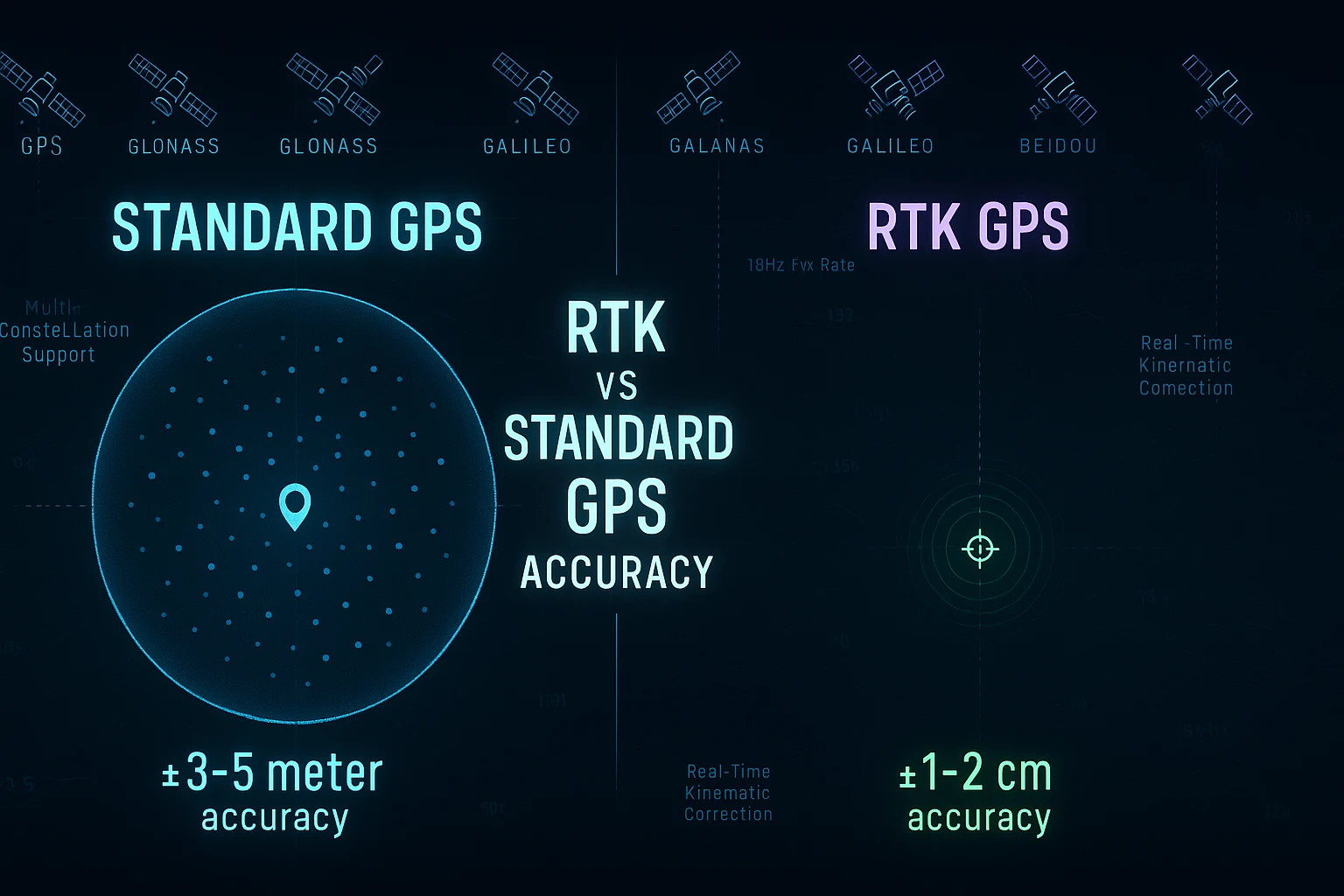
RTK vs Standard GPS Accuracy: Which Do You Actually Need?
RTK vs Standard GPS Accuracy — Understanding the Real Difference for Builders, Drone Pilots, and IoT Developers
If you've spent any time researching positioning technology for your drone, robotics project, or IoT deployment, you've probably stumbled into the RTK vs standard GPS accuracy debate. It sounds technical. It can get expensive fast. And it's often marketed in a way that makes you feel like anything less than centimeter-level RTK precision is somehow inadequate.
The truth is more nuanced — and a lot more useful for the majority of builders, engineers, and developers working on real-world applications.
This guide breaks down what RTK actually is, how it compares to high-quality standard GNSS, where each makes sense, and why for many professional applications — including fast-moving drone platforms, environmental sensing, and IoT deployments — a precision-grade standard GNSS module with a high fix rate and multi-constellation support is not just good enough, it's the smarter engineering choice.
What Is Standard GPS Accuracy?
Standard GPS, as most people use the term, refers to single-point GNSS positioning. Your receiver picks up signals from satellites overhead, calculates its position using time-of-flight measurements, and delivers a location fix.
The theoretical accuracy of standard GPS (using only the GPS constellation) is around 3–5 meters under good sky conditions. In practice, consumer-grade modules often deliver 5–10 meter accuracy due to atmospheric interference, multipath reflections, receiver quality, and antenna design.
But here's where the conversation gets interesting: not all "standard" GNSS is created equal.
A high-quality GNSS module using concurrent multi-constellation reception — simultaneously tracking GPS, Galileo, GLONASS, and BeiDou — can achieve significantly better accuracy than single-constellation GPS. More satellites in view means better geometry, better averaging, and dramatically improved reliability in challenging environments.
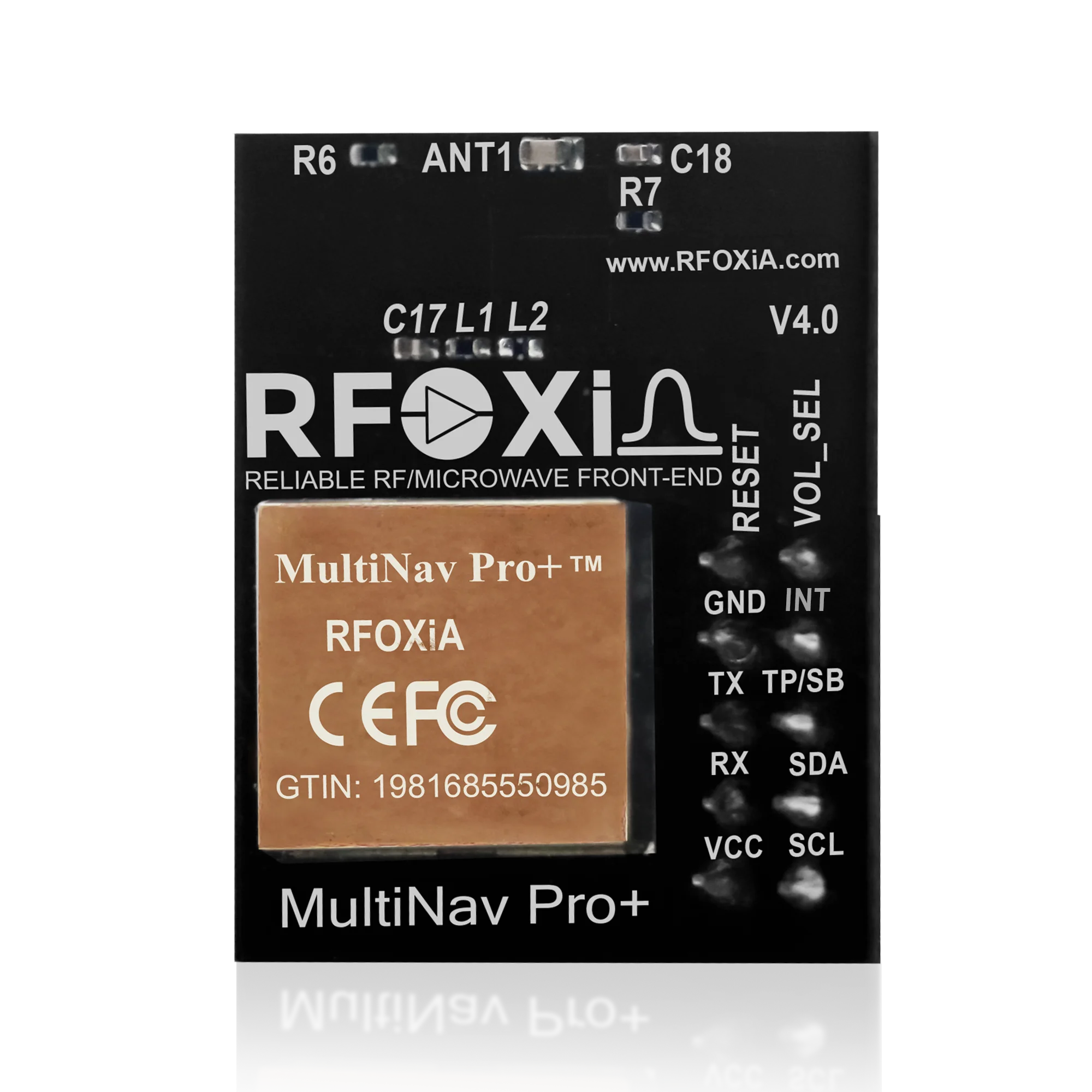
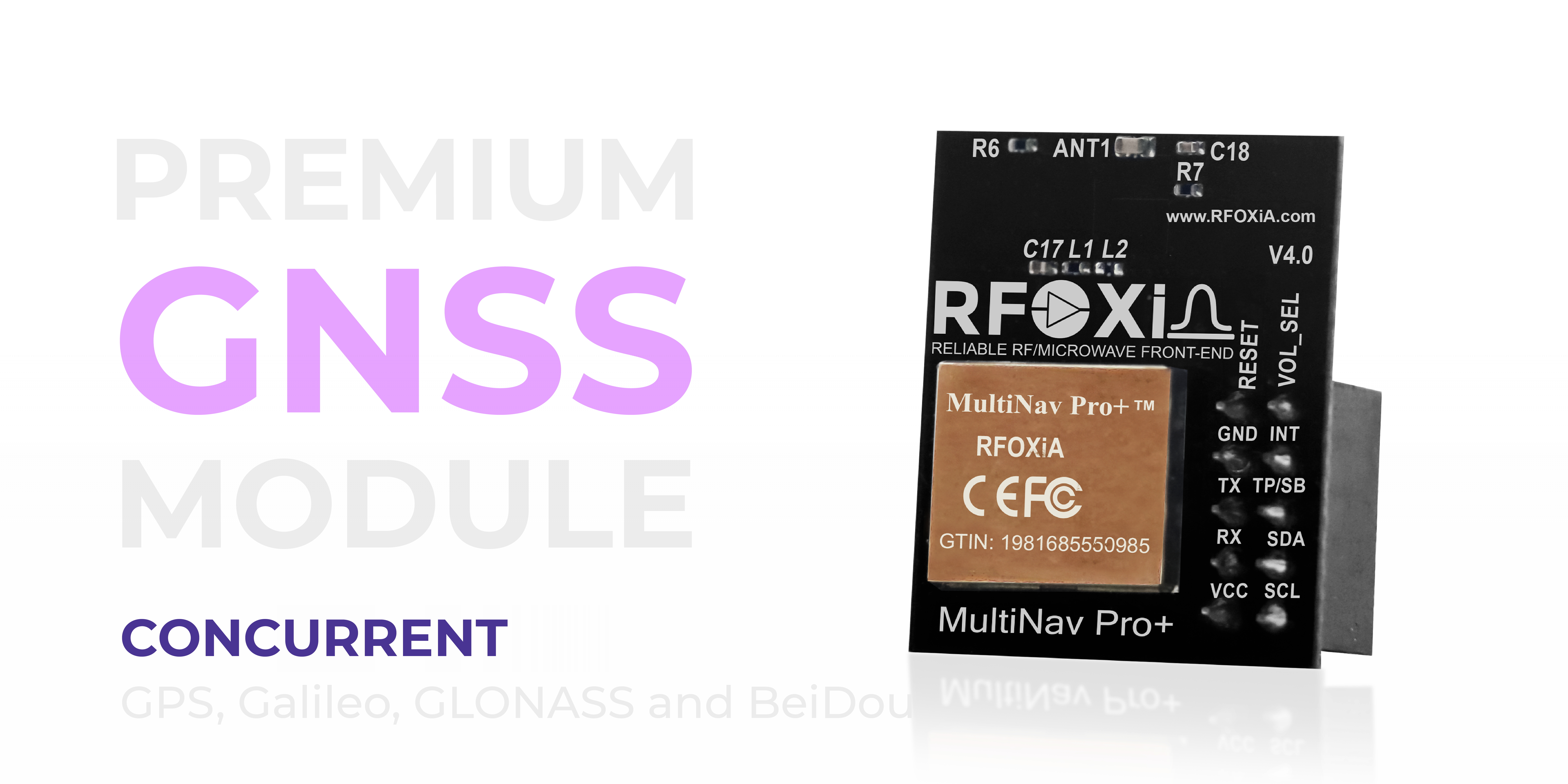
The MultiNav Pro+ GNSS Module from RFOXiA, for example, achieves 1.5-meter accuracy using concurrent four-constellation support and advanced RF filtering — without any RTK infrastructure. That positions it in a different category from both basic consumer GPS and the complex, expensive RTK systems that dominate professional surveying.
What Is RTK GPS and How Does It Work?
RTK stands for Real-Time Kinematic. It's a differential GNSS technique that uses a fixed base station broadcasting real-time correction data to a rover (your moving receiver). By comparing what the base station sees versus what the rover sees, the system can eliminate most sources of error and achieve centimeter-level positioning accuracy — typically 1–2cm horizontal.
RTK is genuinely impressive technology. For applications like precision agriculture (sub-row planting), land surveying, construction layout, or any application where you need to know your position within a few centimeters, RTK is the correct tool.
But RTK comes with significant trade-offs:
- Cost: RTK receiver hardware starts at $500–$1,500 for the rover alone. A complete base station + rover system typically costs $2,000–$10,000+.
- Infrastructure dependency: RTK requires either your own base station or a subscription to an NTRIP correction network. In remote areas, those networks may not exist.
- Complexity: Setting up and maintaining RTK requires technical expertise. Base station placement, baseline distance management, and initialization times add operational overhead.
- Fix rate limitations: Many RTK systems operate at lower fix rates (1–10Hz) unless you invest in premium hardware. Fast-moving platforms can outrun the correction update cycle.
- Weight and power: RTK receivers with integrated base stations add significant weight and power draw to airborne platforms.
RTK vs Standard GPS Accuracy: A Direct Comparison
| Factor | Basic GPS | High-Quality Standard GNSS | RTK GNSS |
|---|---|---|---|
| Typical Accuracy | 3–10m | 1–2m | 1–2cm |
| Cost | $5–$30 | $49–$150 | $500–$10,000+ |
| Infrastructure Required | None | None | Base station or NTRIP network |
| Fix Rate | 1–5Hz | Up to 18Hz | 1–10Hz (varies) |
| Multi-constellation | Rarely | Yes (best modules) | Yes |
| Complexity | Low | Low | High |
| Weight/Power | Low | Low | Higher |
The table makes the core question clear: the RTK vs standard GPS accuracy decision is really a question of whether you need centimeter precision or meter-level precision — and what you're willing to pay and manage to get it.
When Does RTK Make Sense?
RTK is the right answer when:
- You're doing land surveying and need legal-grade positional accuracy
- You're deploying precision agriculture automation that needs sub-row accuracy
- You're doing construction staking or civil engineering layout
- You're mapping with photogrammetry and need centimeter-level ground control points
- You have the budget, the infrastructure, and the technical team to support RTK operations
For these use cases, RTK earns its cost and complexity. The centimeter-level accuracy is genuinely necessary, and the investment is justified.
When Standard High-Precision GNSS Is the Right Answer
Here's where most of the RTK marketing misleads developers and makers: a significant number of real-world applications simply don't require centimeter accuracy, and for those applications, a high-quality standard GNSS module outperforms RTK on every dimension except raw position precision.
Consider these scenarios:
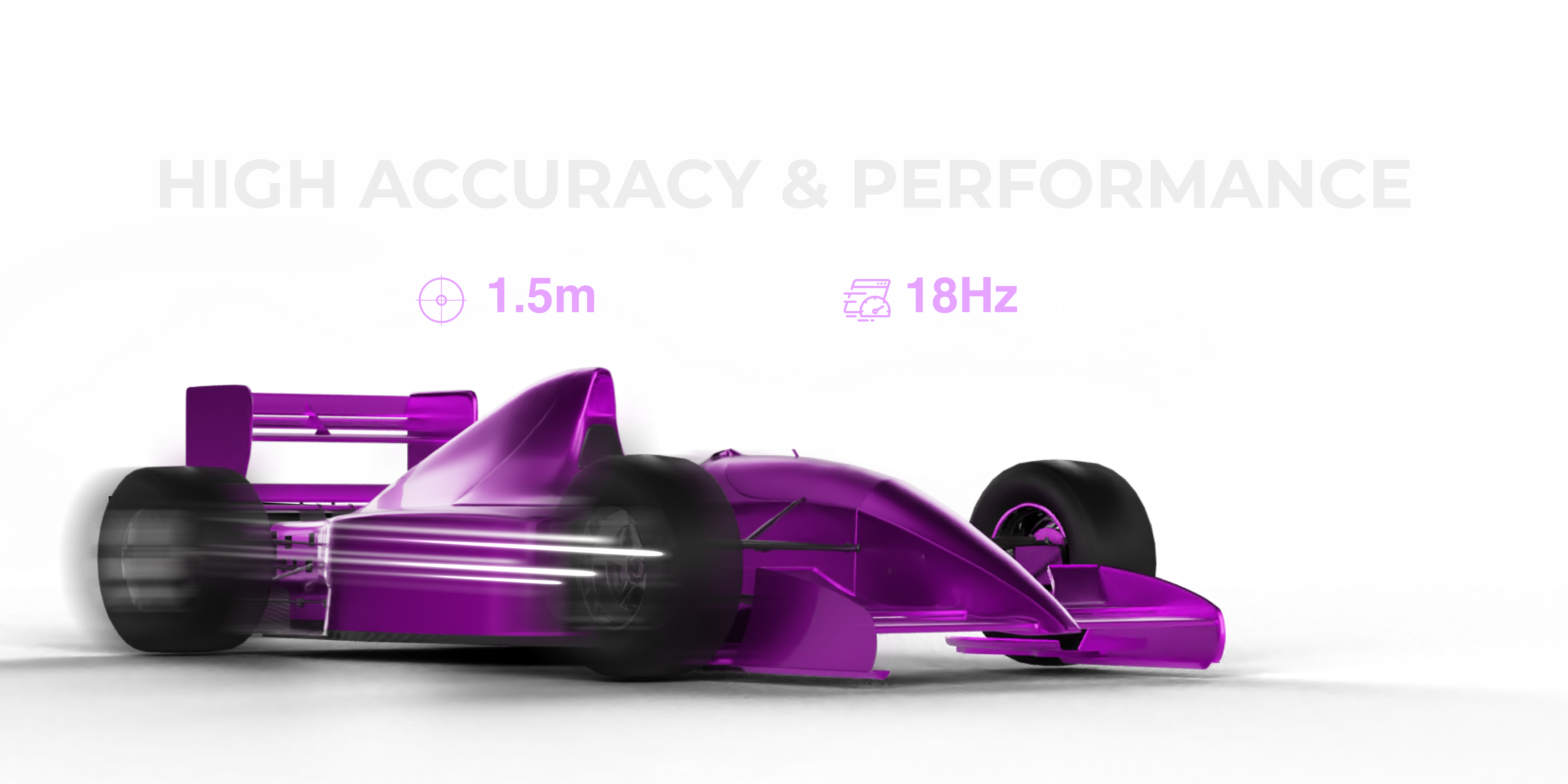
Drone tracking and control: If you're tracking a drone's position for flight logging, telemetry, or displaying position on a map, 1.5m accuracy is indistinguishable from centimeter accuracy in practical use. What matters more is fix rate — how often the position updates. A module that delivers 18Hz updates at 1.5m accuracy gives you far smoother, more responsive tracking data than an RTK system updating at 5Hz.
IoT asset tracking: Whether you're tracking vehicles, shipping containers, or field equipment, knowing a position within 1.5 meters is entirely sufficient. The cost difference between a $49 precision GNSS module and a $2,000 RTK system is not justified for asset tracking applications.
Environmental monitoring and data networks: Location tagging of sensor data — temperature, humidity, air quality readings — needs to be accurate enough to place the sensor on the correct street block or field zone. Sub-2-meter accuracy does this perfectly.
FPV and autonomous drone navigation: For real-time flight data, again, fix rate matters more than absolute position accuracy. A fast, reliable fix from a compact module is more operationally useful than a slower centimeter-accurate RTK fix.
Research and education: Budget is always a constraint. Getting research-grade GNSS data at 1.5m accuracy for $49 versus spending $3,000+ on RTK infrastructure is a significant advantage for university labs, independent researchers, and field teams.
The Fix Rate Advantage: Why 18Hz Changes Everything
One of the most underappreciated specifications in GNSS hardware is fix rate — the number of position updates per second.
Most consumer GPS modules operate at 1Hz. Some step up to 5Hz. A handful of professional modules reach 10Hz. The MultiNav Pro+ delivers 18Hz — eighteen position updates per second.
Why does this matter?
For fast-moving platforms like racing drones, autonomous vehicles, or any tracked object moving faster than walking pace, a 1Hz GPS fix means you're only getting a position update once per second. At 30 meters per second (a modest drone speed), that's 30 meters of movement between position updates. Path reconstruction is rough. Telemetry looks choppy. Autonomous control loops struggle with stale data.
At 18Hz, you're getting a fresh position every 55 milliseconds. Tracking is smooth. Telemetry is responsive. Control loops have fresh data. For dynamic platform applications, this is not a minor upgrade — it fundamentally changes what the system can do.
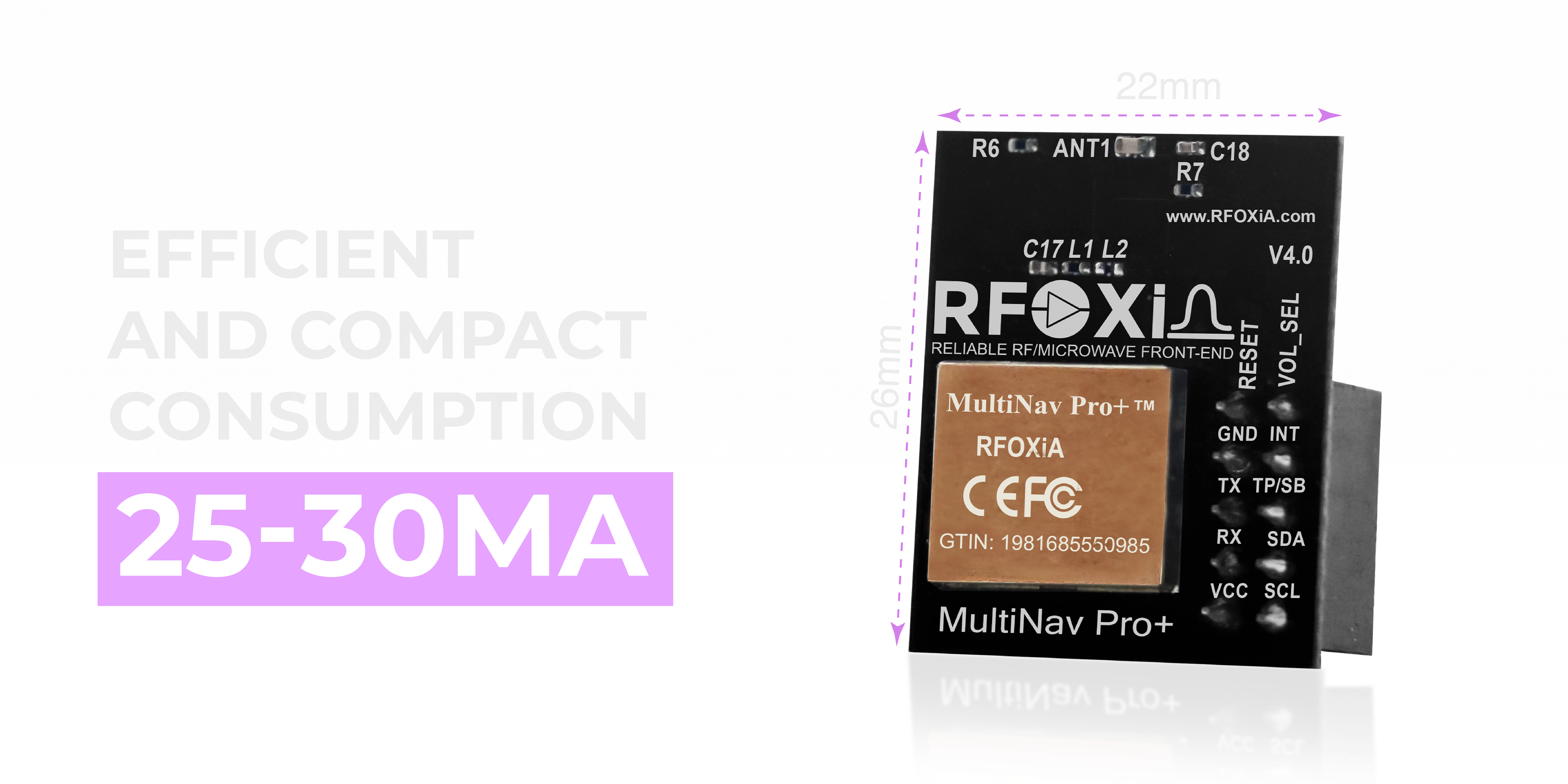
The MultiNav Pro+ achieves this 18Hz fix rate in a package measuring just 26mm x 22mm, drawing only 25–30mA — making it genuinely suitable for lightweight drone integration and battery-powered IoT deployments where power budget matters.
Multi-Constellation Support: The Quiet Advantage
The RTK vs standard GPS accuracy debate often ignores one of the biggest leaps in modern GNSS: multi-constellation reception.
GPS alone gives you access to roughly 6–12 satellites at any time depending on your location. Adding Galileo, GLONASS, and BeiDou can bring that count to 20–30+ visible satellites simultaneously.
More satellites means:
- Better geometric dilution of precision (GDOP) — the mathematical relationship between satellite geometry and position error
- More redundancy — losing a few satellites to obstruction doesn't degrade your fix
- Faster time to first fix (TTFF) — the MultiNav Pro+ achieves first fix in under 1 second
- Better performance in urban canyons, forests, and challenging environments
Concurrent four-constellation support — GPS, Galileo, GLONASS, and BeiDou simultaneously — is what enables the MultiNav Pro+ to hit 1.5m accuracy without any differential correction. The raw geometry improvement from four constellations provides much of what people assume requires RTK.
Interface and Integration: Where Simplicity Matters
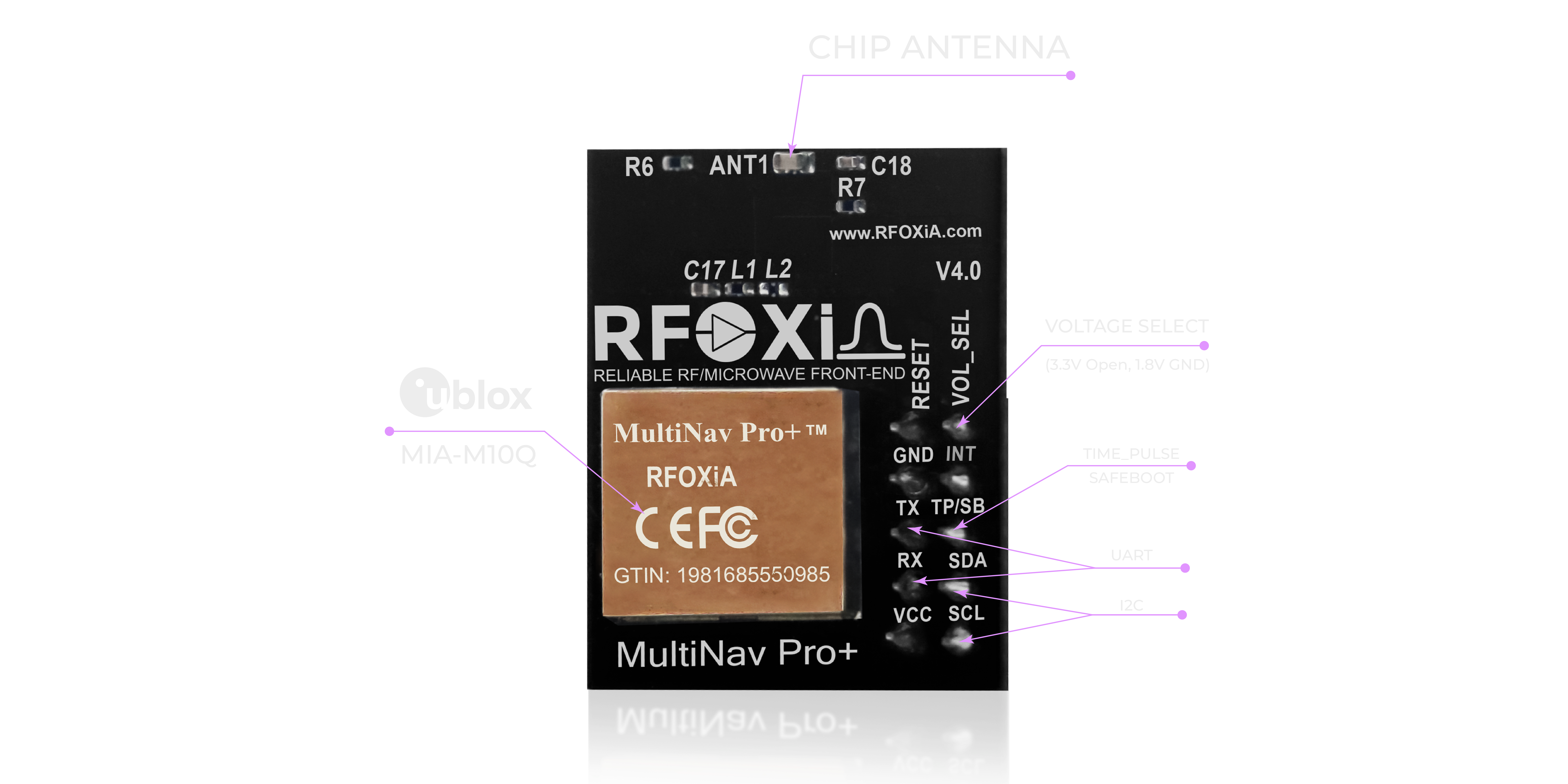
Getting a GNSS module into your project shouldn't require weeks of integration work. The MultiNav Pro+ supports both UART (TX/RX) and I2C (SCL/SDA) interfaces, operating at 1.8V or 3.3V logic levels — covering the full range of modern microcontrollers and development platforms.
RTK systems frequently add additional complexity at the integration layer: RTCM correction streams, base station communication links, initialization procedures, and float vs. fixed state management. For a developer who needs reliable positioning data in their project without becoming a GNSS expert, this complexity is a genuine barrier.
The MultiNav Pro+ is designed for rapid integration. UART or I2C. Standard NMEA output. Done.
Open Source Driver and Developer Tools
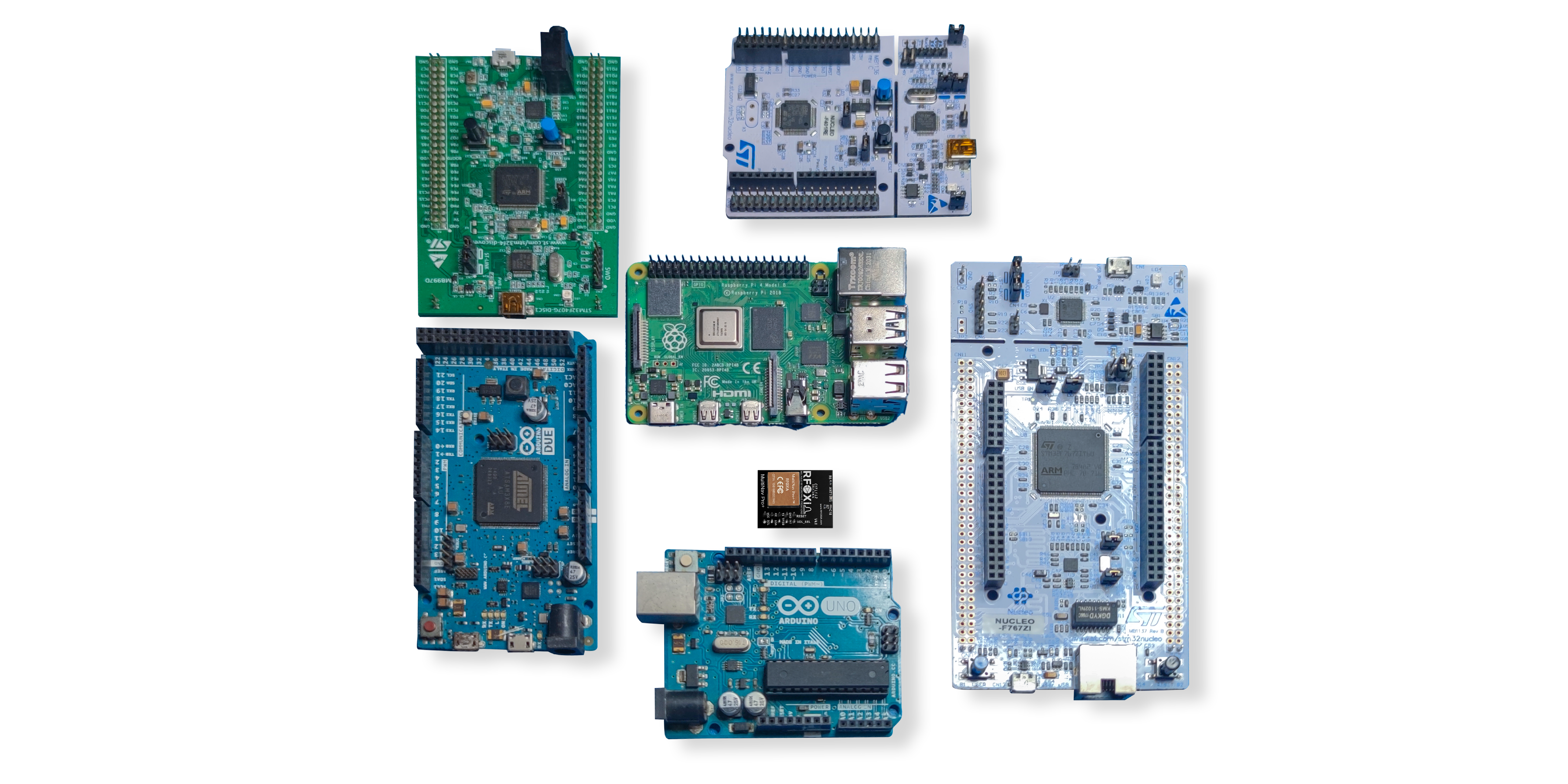
The MultiNav Pro+ ships with a fully open-source C language driver library that implements the standard NMEA protocol. Import it directly into Arduino IDE, PlatformIO, STM32CubeIDE, or any toolchain you're already using. Parse latitude, longitude, altitude, speed, heading, and fix quality with a few lines of code.
This open-source approach means:
- No vendor lock-in on the software side
- Full visibility into what the code is doing
- Easy customization for application-specific needs
- Community contributions and long-term maintainability
For builders who want to understand their tools — not just use black-box libraries — this matters.
U-Center Software: Visual Debugging and Configuration
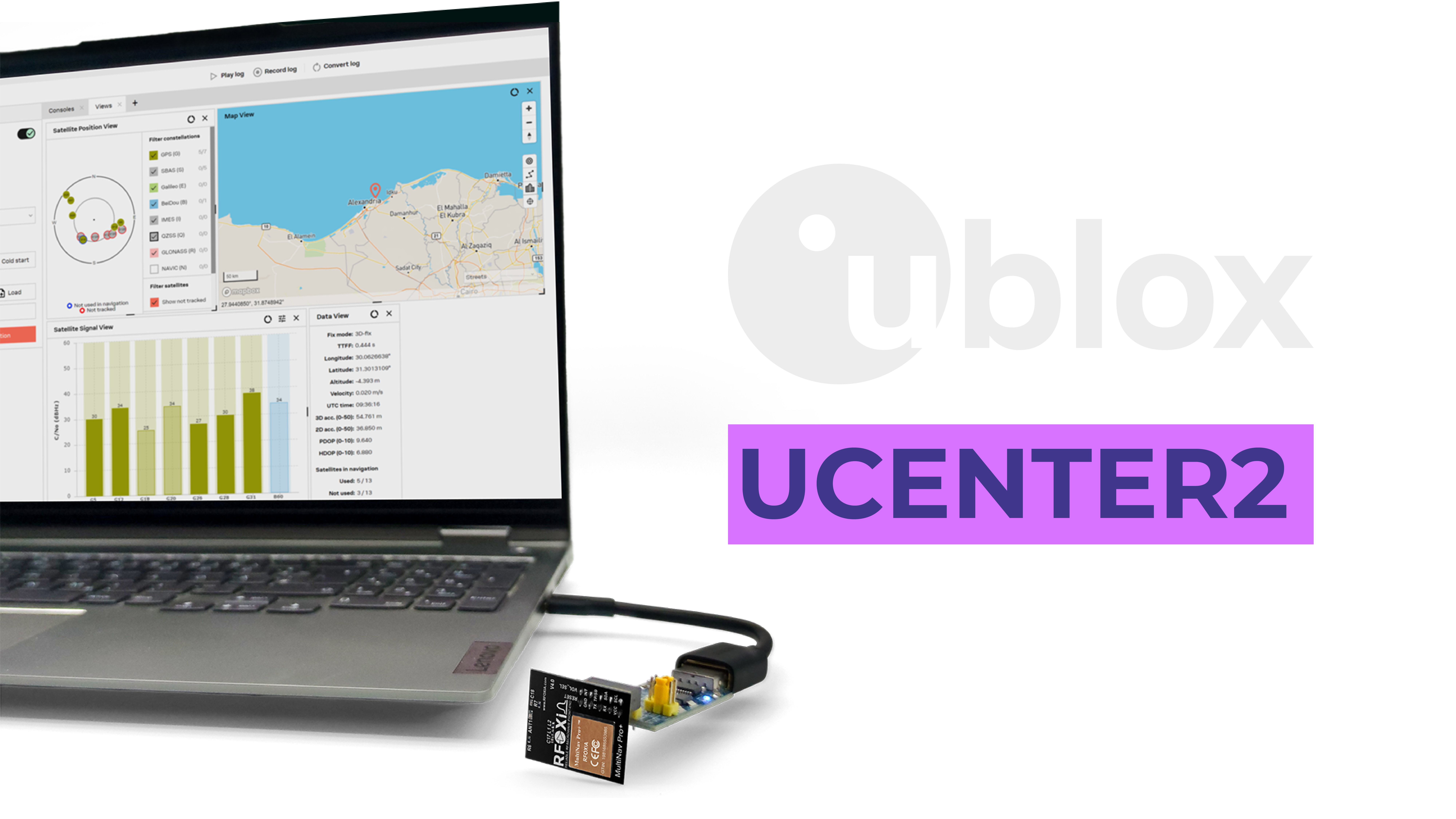
The MultiNav Pro+ is powered by the u-blox MIA-M10Q — one of the latest generation GNSS chips from u-blox, a company with a decades-long track record as the reference standard for professional GNSS modules.
This means you get access to u-center, u-blox's professional GNSS evaluation software. U-center gives you a graphical view of every satellite in view, real-time signal strength, position visualization, configuration management, and powerful data logging — all through a clean desktop GUI.
For developers testing deployments, diagnosing reception issues, or characterizing module performance in a specific installation, u-center is an invaluable tool that would cost thousands of dollars to replicate with custom test infrastructure.
Real-World Use Cases Where 1.5m Beats RTK in Practice
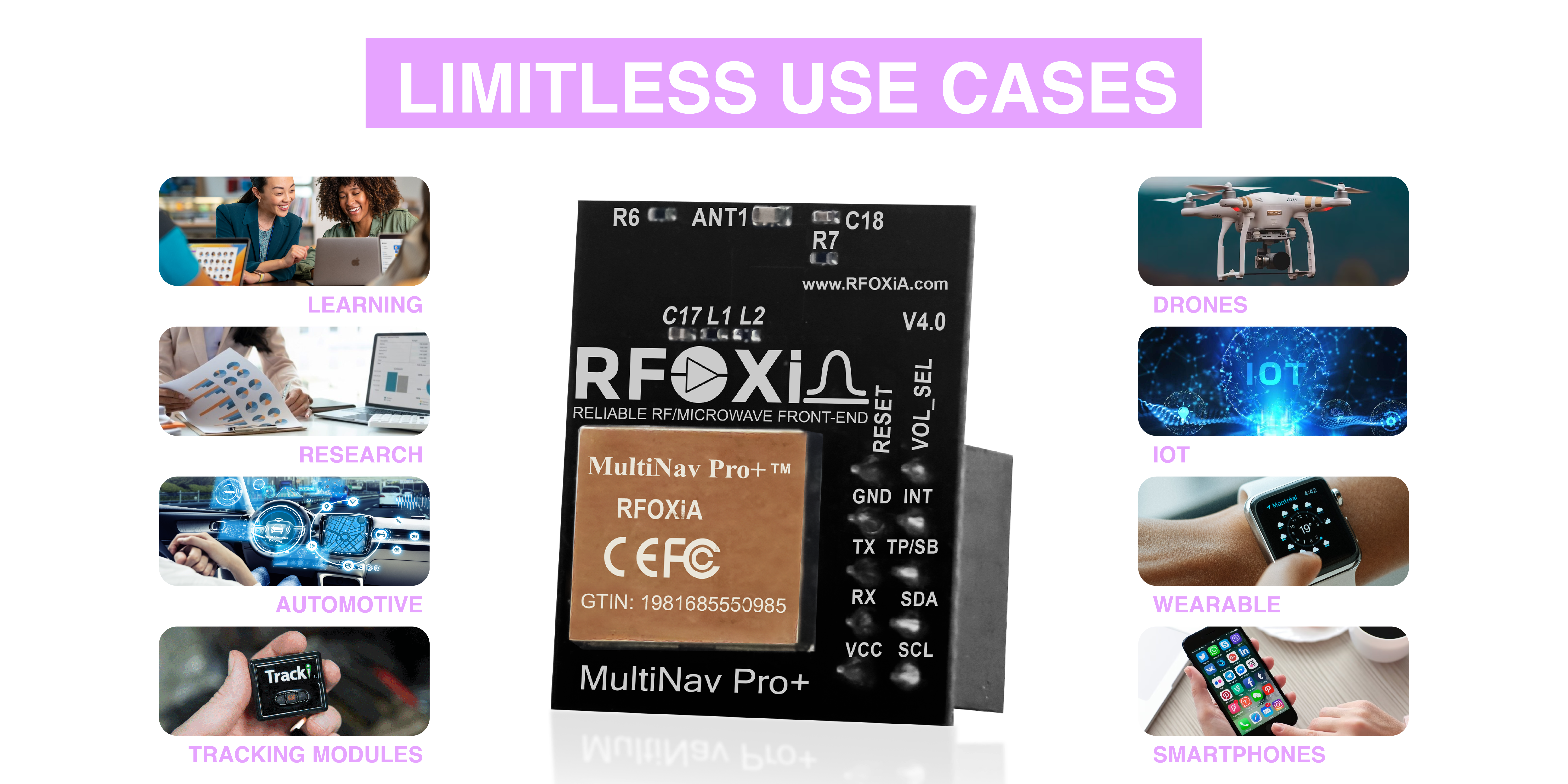
The MultiNav Pro+ isn't just a navigation component — it's a precision data source that works across an enormous range of applications:
- Drones: Real-time position telemetry, autonomous waypoint navigation, geo-fencing, return-to-home
- IoT deployments: GPS-verified node location for environmental data networks, tamper detection, field asset tracking
- Wearables: Athlete tracking, personal safety devices, outdoor adventure navigation
- Robotics: Outdoor navigation, field robots, autonomous vehicles at speeds where 18Hz matters
- Research: Field data collection, wildlife tracking, environmental monitoring with verified location stamps
- Automotive: Fleet tracking, data logging, positioning systems for test vehicles
- Smart city: Micro-mobility tracking, infrastructure monitoring, urban sensing with location context
For all of these applications, the combination of 1.5m accuracy, 18Hz fix rate, and four-constellation support from a $49 module represents extraordinary value. RTK would add cost, complexity, and infrastructure requirements without meaningful benefit to the application outcome.
The RFOXiA Ecosystem Advantage
The MultiNav Pro+ is not a standalone module. It's designed as part of the RFOXiA hardware ecosystem, where it works natively alongside the long-range BLE module, the 7-sensor environmental module, and the supercapacitor power kit.
This matters for developers who want to build complete wireless sensing and control systems — not just assemble point solutions from incompatible components. When your GNSS module and your long-range communication module share a common form factor, power architecture, and software ecosystem, integration time drops from weeks to days.
If you're building a drone with 15–20km wireless control range, real-time sensor data, and GPS tracking — all communicating back to a phone without any internet infrastructure — the GNSS module's 18Hz position data feeds directly into the RFOXiA Connect app's live map display. The system works as a cohesive whole, not a collection of parts.
Check out the RFOXiA Accurate GNSS Module to see the full specifications, integration documentation, and order directly.
Making the RTK vs Standard GPS Accuracy Decision
Here's a simple decision framework:
Choose RTK if:
- You need centimeter-level accuracy for legal, construction, or precision agriculture applications
- You have the budget ($2,000–$10,000+) and infrastructure (base station or NTRIP network)
- Your platform moves slowly enough that RTK's initialization time and lower fix rates are not a constraint
- You have the technical expertise to configure and maintain RTK systems
Choose high-quality standard GNSS (like MultiNav Pro+) if:
- Your application needs meter-level precision — not centimeter-level
- You're tracking fast-moving platforms where 18Hz fix rate matters more than absolute precision
- You're integrating into a drone, IoT device, or wearable where cost, weight, and power are constraints
- You're a developer or maker who needs professional-grade specs at an accessible price
- You're building in remote areas without RTK correction infrastructure
- You need something that works right out of the box without a 20-page commissioning procedure
For the vast majority of drone builders, IoT developers, robotics engineers, and field researchers, the RTK vs standard GPS accuracy question resolves to this: you don't need RTK, and a high-quality 1.5m module will perform better on the dimensions that actually matter for your application.
Specifications Summary: MultiNav Pro+
| Specification | Value |
|---|---|
| Accuracy | < 1.5 meters |
| Fix Rate | 18Hz |
| Time to First Fix | < 1 second |
| Constellations | GPS, Galileo, GLONASS, BeiDou (concurrent) |
| GNSS Chip | u-blox MIA-M10Q |
| Interfaces | UART (TX/RX), I2C (SCL/SDA) |
| Operating Voltage | 1.8V and 3.3V |
| Current Draw | 25–30mA |
| Dimensions | 26mm x 22mm |
| Antenna | Integrated high-gain chip antenna |
| Certifications | FCC certified |
| Price | $49 |
| Software | Open-source C library + u-center GUI |
Final Thoughts
The RTK vs standard GPS accuracy conversation is important — but it's often framed in a way that sells complexity and cost to people who don't need it. For the builders, engineers, and developers who are actually doing the work of creating wireless systems, autonomous platforms, and IoT deployments, a precision-grade standard GNSS module with a fast fix rate, multi-constellation support, and professional RF design is the right tool for the job.
The MultiNav Pro+ was built from that understanding: bring the specifications that actually matter to professional applications — 1.5m accuracy, 18Hz updates, four-constellation support, FCC certification — at a price that makes them accessible to everyone building something real.
If you're ready to integrate professional GNSS into your next project, explore the RFOXiA Accurate GNSS Module and see how it fits into the complete RFOXiA wireless development ecosystem.
Build more. Spend less on infrastructure. Ship faster.
Written by: Moamen Mohamed LinkedIn