
Sensor Data Stream Revenue: How the MultiNav Pro+ Sensors Module Turns Environmental Data Into Earnings
RFOXiA Integrated Sensors Module
Unlock Real Sensor Data Stream Revenue With Hardware That Works While You Sleep
What if the sensors you deploy for your next project could pay you back every single day? Not in theory. Not someday. Right now, with verified, GPS-confirmed environmental data that enterprise buyers are actively purchasing — and the hardware to make it happen costs $39.
That is the premise behind the RFOXiA MultiNav Pro+ Sensors Module, and it is not a gimmick. It is a fully engineered, FCC-certified, seven-sensor array that feeds directly into the RFOXiA data network — a live, growing ecosystem where hyper-local environmental data is aggregated, verified, and sold to agricultural technology companies, smart city operators, logistics firms, insurance companies, and university researchers who cannot get this resolution from any public API.
This article walks through everything you need to understand about the module, the science behind each sensor, how the I2C communication architecture works, why the compact form factor matters for serious deployments, and — critically — how sensor data stream revenue actually functions inside the RFOXiA ecosystem so you can calculate what deploying one of these modules could realistically earn you.
What Is the MultiNav Pro+ Sensors Module?
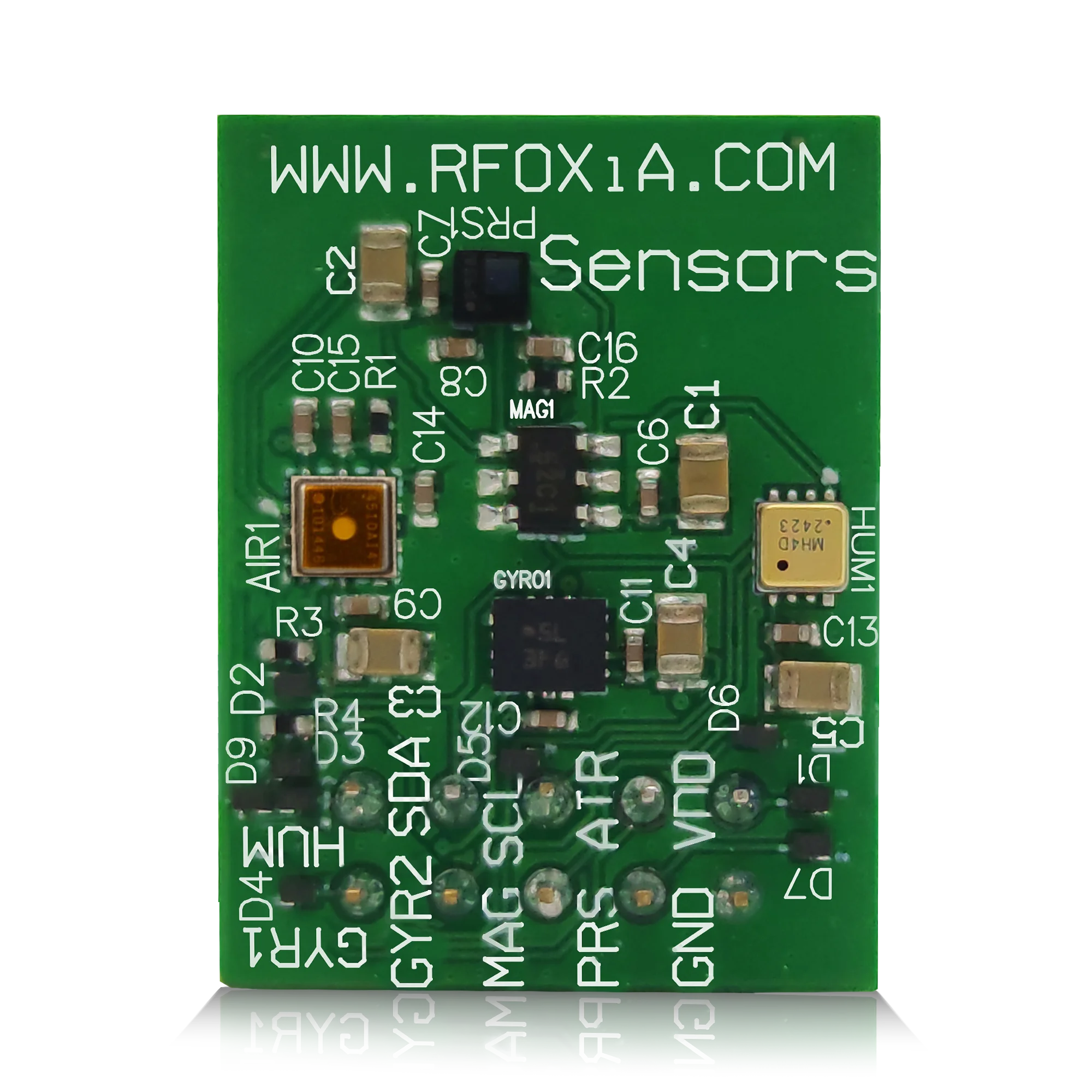
The MultiNav Pro+ Sensors Module is RFOXiA's all-in-one environmental and motion sensing board. Measuring just 24mm × 18mm, it packs seven discrete sensor functions onto a single compact PCB, all communicating over a shared I2C line with individual addresses. The result is a module that plugs cleanly into the rest of the RFOXiA ecosystem — or into your own embedded platform — and immediately begins streaming verified, real-time environmental data.
At $39, it sits in a market position that should not exist. Professional-grade sensors from Bosch, Texas Instruments, STMicroelectronics, MEMSVision, and Renesas — all on one board, FCC certified, ready to ship, with a full software ecosystem behind it. No comparable product combines this sensor density, this component quality, and this price point in a single integrated module.
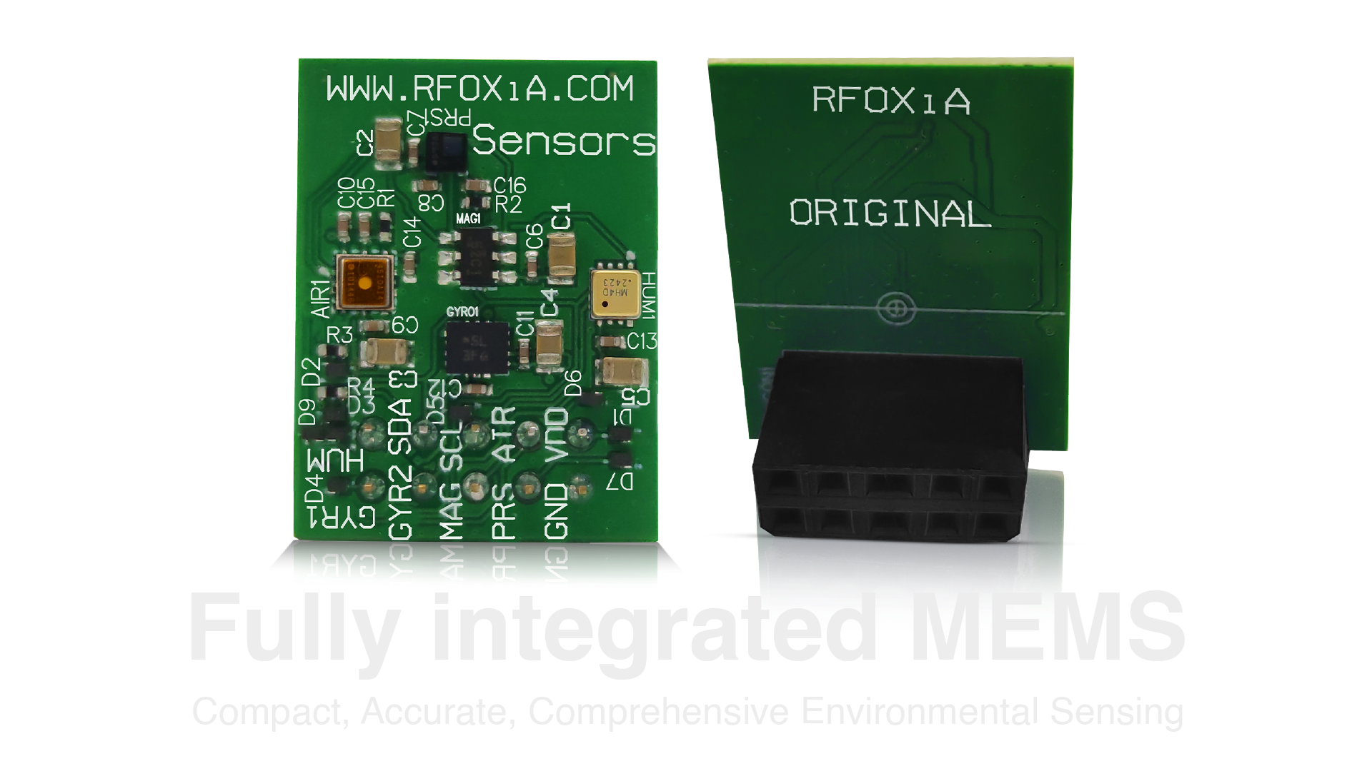
The seven sensors are:
- Accelerometer — measures linear acceleration across three axes
- Gyroscope — measures rotational velocity for attitude and orientation
- Magnetometer — measures magnetic field for heading and compass data
- Temperature — high-accuracy ambient temperature
- Humidity — relative humidity for environmental context
- Air Pressure — barometric pressure for altitude and weather correlation
- Air Quality — outdoor air quality index for pollution and particulate monitoring
Every one of these data points has a buyer. And the RFOXiA data network is designed to connect your sensor stream directly to that market.
The Sensor Stack: Component-Level Engineering Breakdown
The decision to source components from industry-leading manufacturers was deliberate. Each sensor was selected for accuracy, reliability, power efficiency, and compatibility with the shared I2C architecture. Here is what is actually inside the module.
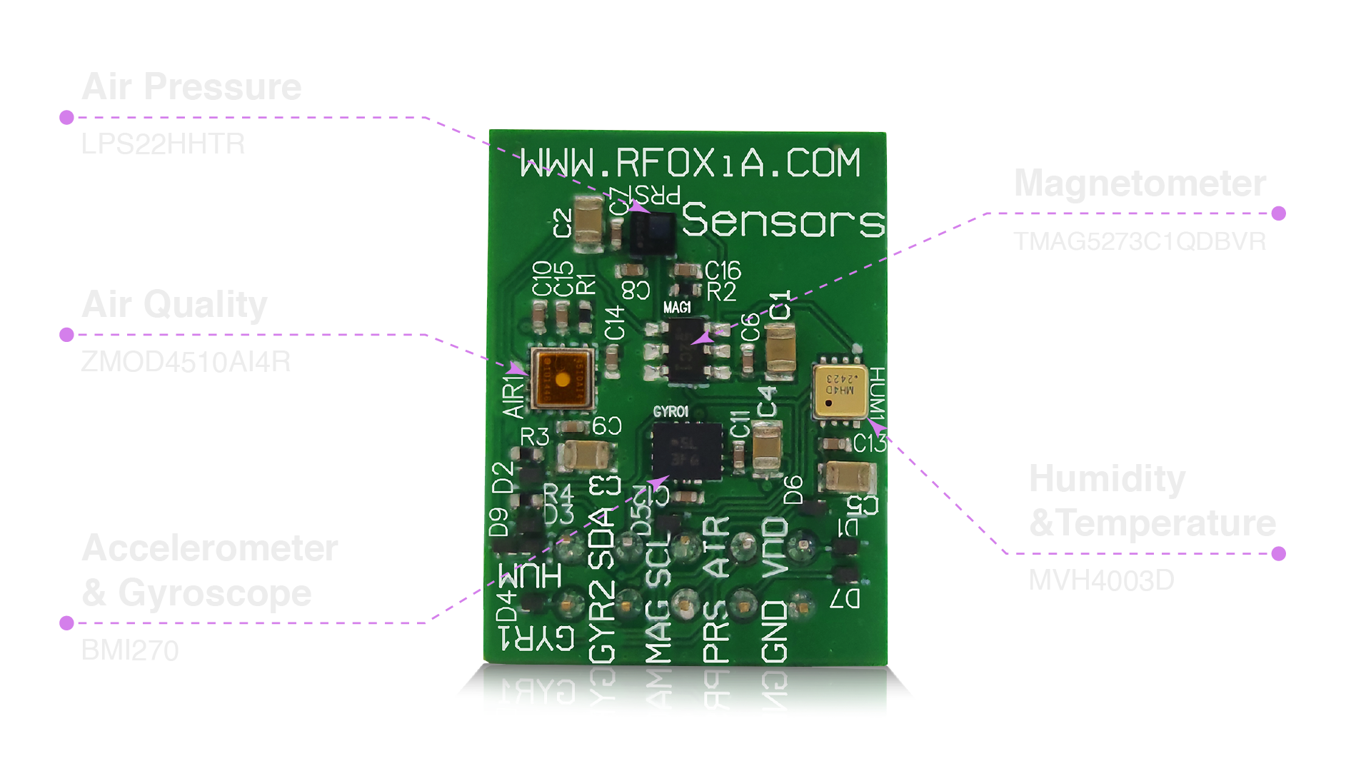
Motion Sensing: BMI270 from Bosch Sensortec
The BMI270 is Bosch Sensortec's flagship IMU (Inertial Measurement Unit), combining a six-axis accelerometer and gyroscope in a single ultra-low-power package. It is the same sensor family used in professional drone flight controllers, sports performance wearables, and industrial robotics. The BMI270 features built-in motion detection algorithms, step counting, gesture recognition, and activity classification at the hardware level — meaning your firmware does not need to do the heavy lifting for basic motion events.
For drone builders, this is flight-critical data. For robotics engineers, it is the core of your navigation loop. For data network contributors, it provides motion context that makes environmental readings more meaningful — you know whether the sensor was stationary and properly mounted when the air quality reading was captured.
Magnetometer: TMAG5273C1QDBVR from Texas Instruments
Texas Instruments' TMAG5273 is a high-accuracy three-axis linear Hall-effect sensor capable of detecting magnetic field strength across all three spatial axes. For navigation applications, this provides true north heading data independent of GPS. For industrial applications, it can detect the presence and orientation of magnetic components in machinery. Combined with the accelerometer and gyroscope data from the BMI270, the TMAG5273 completes a full nine-axis motion and orientation sensing suite.
Barometric Pressure: LPS22HHTR from STMicroelectronics
STMicroelectronics' LPS22HH is a MEMS pressure sensor with a measurement range of 260 to 1260 hPa and a noise floor of 0.75 Pa RMS. In practical terms, this level of precision allows altitude resolution of approximately 6 centimeters — sufficient for detailed drone altitude hold without GPS dependency. For environmental monitoring applications, the LPS22HH provides the barometric pressure data that correlates directly with weather patterns and is one of the five required data points for verified data network contribution.
Humidity and Temperature: MVH4003D from MEMSVision
MEMSVision's MVH4003D is a combined humidity and temperature sensor optimized for outdoor environmental monitoring. Unlike lower-cost alternatives, it is designed for long-term stability in field conditions — meaning readings remain accurate after months of outdoor deployment without calibration drift. For agricultural technology buyers, accurate humidity and temperature data at hyper-local resolution is the primary data type they are purchasing. A weather station 10 kilometers away cannot tell a precision agriculture system what is happening in field row 14 right now. Your deployed sensor can.
Air Quality: ZMOD4510AI4R from Renesas
The ZMOD4510 from Renesas is an outdoor air quality sensor specifically engineered to detect NO2 (nitrogen dioxide) and O3 (ozone) — the primary indicators of urban air pollution and ground-level ozone formation. This is not a generic VOC sensor repurposed for outdoor use. The ZMOD4510 was designed from the ground up for outdoor deployment, with an electrochemical measurement principle that provides reliable readings in variable temperature and humidity conditions. Air quality data at street-level resolution is increasingly valuable to smart city operators, public health researchers, and environmental agencies — none of whom can instrument every city block with dedicated monitoring stations.
Precision Motion and Environmental Sensing in One Package
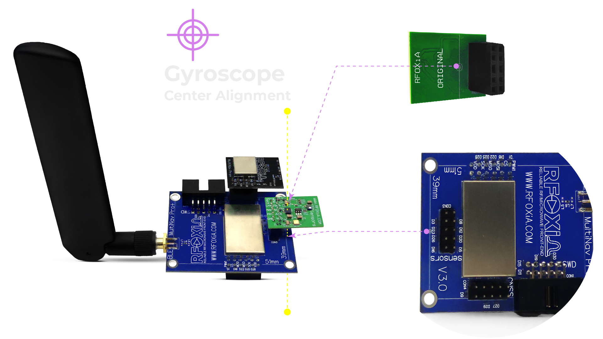
What makes the MultiNav Pro+ Sensors Module genuinely unusual is that it bridges two different sensor categories that are typically sold separately: motion sensing and environmental sensing.
Motion sensors — the accelerometer, gyroscope, and magnetometer — are the domain of flight controllers, robotics platforms, and navigation systems. They answer the question: where is the platform, how is it oriented, and how is it moving?
Environmental sensors — temperature, humidity, pressure, and air quality — are the domain of weather stations, field instruments, and industrial monitoring systems. They answer the question: what is the surrounding environment like right now?
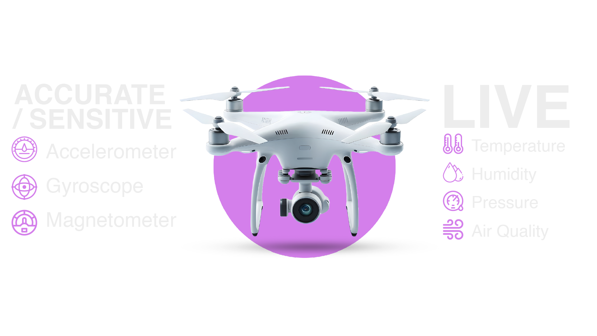
For drone operators and robotics engineers, having both on one board means a single module provides complete situational awareness: you know your platform's attitude and the environmental conditions affecting its performance simultaneously. For IoT developers building outdoor monitoring nodes, the motion data provides tamper detection and deployment validation — if your sensor moves, you know it.
For the RFOXiA data network, the combination matters for a different reason. Data verification requires that submitted readings pass anomaly detection — comparing your sensor output against regional reference sources to confirm plausibility. A sensor that also reports its own motion state and GPS location (when combined with the GNSS module) provides the context needed to validate data quality automatically.
I2C Architecture: Why a Single Communication Line Is the Right Design Choice
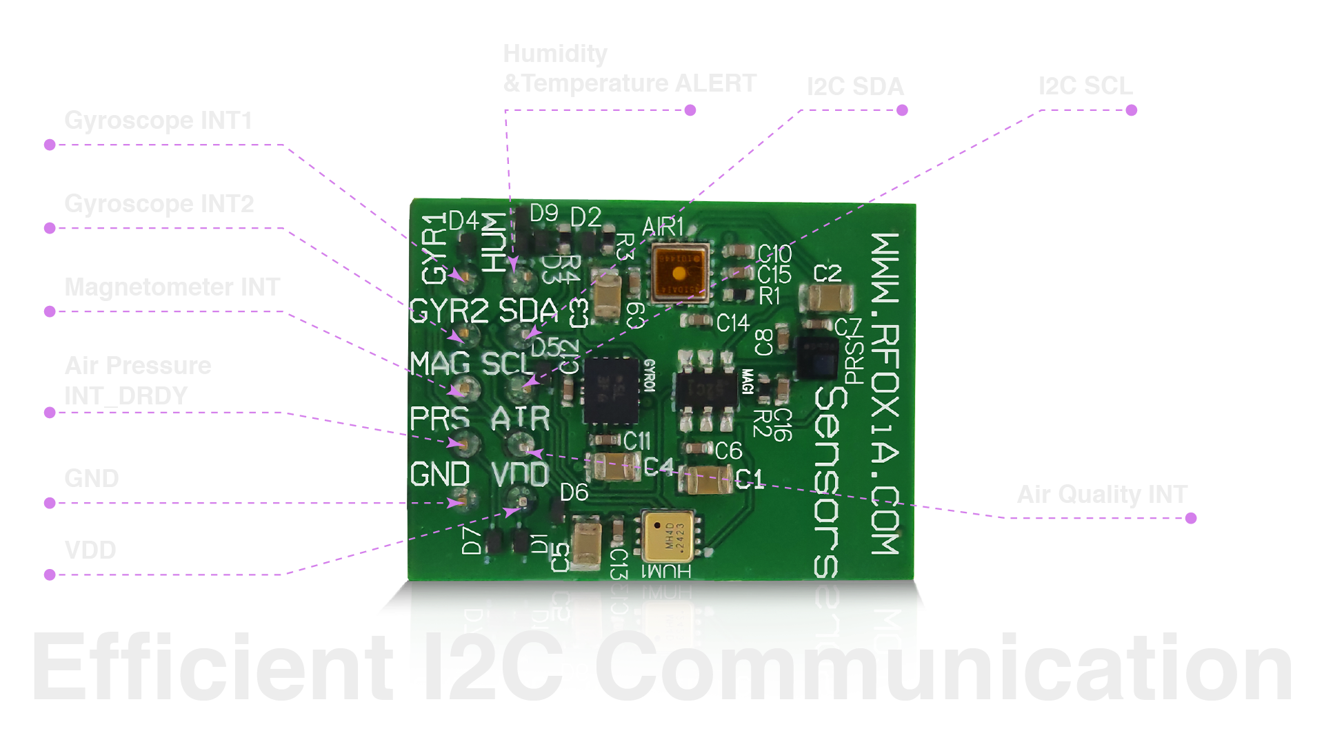
Seven sensors sounds like it should require a complex wiring harness. The MultiNav Pro+ Sensors Module solves this elegantly: all seven sensors communicate over a single I2C bus, each with a unique I2C address. Your microcontroller sees one two-wire interface (SDA + SCL) and can address each sensor independently by its address.
This design decision has practical consequences:
Minimal pin usage. I2C requires only two GPIO pins regardless of how many devices are on the bus. On a pin-constrained platform like a small drone flight controller or a wearable device, this is the difference between the module fitting your design or not.
No data collision. Because each sensor has a dedicated address, the master controller polls each device individually. There is no risk of two sensors transmitting simultaneously and corrupting the data stream.
Simple integration. Any microcontroller with I2C support can communicate with this module immediately. Arduino, STM32, ESP32, Raspberry Pi, Nordic nRF — the I2C protocol is universal. You are not learning a proprietary interface or integrating a custom driver stack from scratch.
Scalable bus. If your design needs additional I2C peripherals — an OLED display, an external EEPROM, additional sensors — they share the same two wires. The bus accommodates up to 127 devices theoretically, and in practice, dozens.
For developers integrating this module into their first project, the I2C architecture means less time fighting wiring complexity and more time on application logic. For experienced engineers, it means the module drops cleanly into existing designs without architectural changes.
Compact Form Factor: 24mm × 18mm for Space-Constrained Deployments
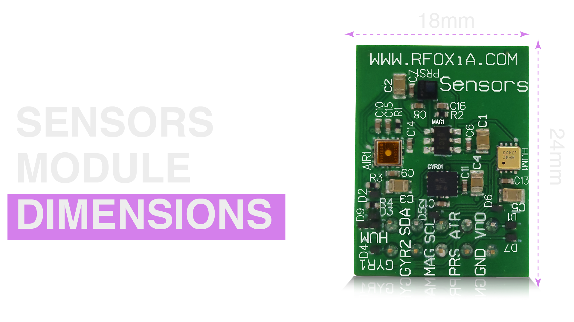
At 24mm × 18mm, the MultiNav Pro+ Sensors Module is smaller than a standard postage stamp. This is not a cosmetic specification — it is an engineering requirement for most of the applications this module targets.
Drone builders operating in weight-optimized configurations measure payload in grams. A module that delivers seven sensor functions in the footprint of a thumbnail is a meaningful engineering advantage over integrating seven discrete breakout boards with their associated cabling.
Wearable device developers face even tighter constraints. The entire board stack — sensors, microcontroller, radio, battery — must fit within a form factor a person is willing to wear. The MultiNav Pro+ Sensors Module's footprint allows it to integrate into wristband, patch, or clip-format wearables without dominating the board area.
For outdoor IoT deployments, enclosure size directly affects both unit cost and installation flexibility. A smaller module fits in a smaller enclosure, which costs less, weighs less, and can be mounted in more locations — on a fence post, under a eave, attached to a streetlight arm. Every deployment location that becomes accessible because the hardware fits is another potential data network node generating sensor data stream revenue.
Real-Time Environmental Data: What the Stream Actually Looks Like
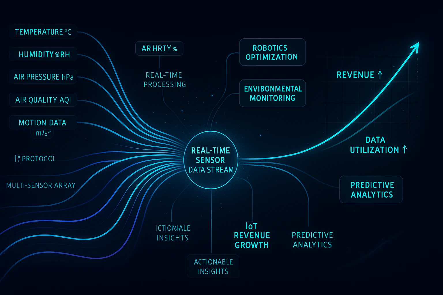
Data streaming is not a passive background process you set up and forget. It is a live feed of verified sensor readings — temperature, humidity, air pressure, air quality, and GPS location — that flows continuously from your deployed module to the RFOXiA servers, where it is processed, validated, and made available to data buyers.
From the user's perspective inside RFOXiA Club, the data appears as live visualizations on the Command Center dashboard. You can see your sensor readings update in real time, watch the verification status confirm that your session is active and earning, and monitor your daily reward accumulation.
From the data buyer's perspective, what they receive is sensor data stream revenue content — timestamped, GPS-validated environmental readings at second-level temporal resolution, from a location where they have no other instrumentation. A precision agriculture platform integrating your node's data sees microclimatic conditions at the field level updated every second. A smart city operator sees air quality at the street level without deploying and maintaining their own hardware.
The verification system ensures data quality. All five required data points (temperature, humidity, pressure, air quality, GPS) must be present and plausible. GPS confirms outdoor deployment — an indoor sensor cannot spoof an outdoor reading. Readings are cross-referenced against regional reference data to detect anomalies. Only verified sessions earn rewards.
Base reward rates run from $0.08 to $0.25 per day, with scarcity bonuses for nodes in data-sparse locations and uptime bonuses for consistent streaming — reaching up to $0.40 per day for verified complete sessions. Early network contributors lock in Pioneer rates that hold as the network grows and base rates adjust.
For a developer deploying ten nodes across a mid-sized city, that is up to $4 per day — $1,460 per year — from hardware they may have already purchased for their own projects. The sensors are already running. The data is already being generated. The RFOXiA network converts that stream into recurring income.
Applications: Where This Module Belongs
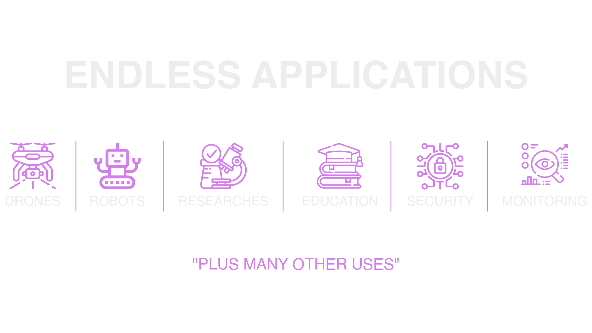
The MultiNav Pro+ Sensors Module is not positioned for a single application category. Its sensor suite covers enough ground that it fits naturally into a wide range of serious projects:
Professional Drone Operations: IMU data for flight controller integration, barometric altitude hold, GPS-independent attitude reference, and environmental condition monitoring for flight planning and safety.
Precision Agriculture: Hyper-local temperature, humidity, and air pressure monitoring at field level. When connected to the RFOXiA data network, these deployments generate sensor data stream revenue while providing operational value.
Smart City Infrastructure: Air quality monitoring at street level, feeding both local dashboards and the RFOXiA network. City operators and environmental agencies need this resolution — public weather APIs cannot provide it.
Robotics and Autonomous Vehicles: Nine-axis motion sensing (accelerometer + gyroscope + magnetometer) for navigation, attitude estimation, and odometry. Combined with the GNSS module for outdoor autonomous operation.
Environmental Research: Field-deployable sensor arrays for academic and institutional research projects requiring multi-parameter environmental monitoring at locations without fixed infrastructure.
Industrial IoT: Equipment monitoring with environmental context — temperature and humidity affect machine performance. Motion detection adds tamper alerts and operational state awareness.
Wearable Health and Performance Devices: Motion analysis, environmental exposure monitoring, and altitude tracking in a form factor compatible with wearable integration.
For developers exploring any of these applications, the RFOXiA Integrated Sensors Module at $39 represents the fastest path from concept to live sensor data — with an ecosystem already built around making that data valuable.
Sensor Data Stream Revenue: The Business Model Behind the Module
RFOXiA is not just a hardware company selling modules. It is building a distributed sensor network that generates recurring value from the data those modules produce. Understanding the business model helps you understand why the hardware is priced the way it is and what the long-term value of becoming an early network contributor actually means.
The data buyers are enterprises that need hyper-local, high-resolution environmental data that public APIs cannot provide. Agricultural technology platforms need field-level microclimatic data. Logistics companies need environmental condition monitoring at depot and route locations. Insurance and reinsurance firms model environmental risk using granular data. Smart city operators need street-level air quality that government monitoring stations cannot deliver. University research institutions need field data from locations they cannot economically instrument themselves.
The data sellers are RFOXiA network contributors — developers, researchers, and hardware enthusiasts who have already deployed sensors for their own projects and are now streaming verified data to the network in parallel.
RFOXiA aggregates the network's data, applies verification and quality control, and sells access to enterprise buyers. Contributors earn daily rewards based on their node's location, uptime, and data completeness. The network becomes more valuable as it grows — more nodes, more locations, more temporal continuity — and the data value compounds as coverage expands.
This is what sensor data stream revenue looks like in practice: a $39 module that earns up to $0.40 per day, every day it streams verified data. At that rate, a single node recoups its cost in approximately 97 days and runs in profit indefinitely after that. Deploy multiple nodes and the math scales directly.
To participate in the data network, you need the Sensors Module deployed outdoors with GPS validation (provided by the GNSS module), connected to the RFOXiA platform through your account. The Developer Bundle — combining the BLE Module, GNSS Module, Sensors Module, and Power/Program Kit — is the fastest way to stand up a complete, network-ready node.
You can get started with the hardware directly through the RFOXiA Integrated Sensors Module page, or join RFOXiA Club for free to explore the platform, earn $10 in welcome credits, and see the data network dashboard before you purchase anything.
Integration With the RFOXiA Ecosystem
The MultiNav Pro+ Sensors Module does not operate in isolation. It is one component in a vertically integrated ecosystem designed so that every piece amplifies the value of every other piece.
- BLE Module provides long-range wireless connectivity — up to 5km ground-to-ground — so your sensor node can stream data from locations without Wi-Fi or cellular coverage.
- GNSS Module provides GPS-verified location data at 18Hz update rate and 1.5m accuracy — the outdoor deployment validation the data network requires.
- Power/Program Kit provides supercapacitor-based power with a 5-minute charge and 24-hour runtime — so your node runs continuously without battery management headaches.
- RFOXiA Connect App displays live sensor data on your phone and provides the control interface for drone and robotics deployments, working completely without internet.
- RFOXiA Club is the platform where data streams are verified, rewards are tracked, firmware is generated with AI assistance, and the developer community shares projects and knowledge.
Together, these components form a system where a field-deployed sensor node can operate entirely without internet infrastructure — communicating over BLE to a local hub, verifying GPS location, streaming environmental data, and earning data network rewards — in locations where no other solution would work.
Why FCC Certification Matters for Data Network Deployments
The MultiNav Pro+ Sensors Module is FCC certified. For casual maker projects, this might seem like a bureaucratic detail. For serious deployments generating sensor data stream revenue, it matters significantly.
FCC certification means the module has been tested and verified to operate within legal emission limits in the United States. For commercial deployments — selling data from sensors deployed at commercial properties, partnering with municipalities, or integrating into enterprise IoT infrastructure — operating certified hardware is a legal and contractual requirement. A data buyer purchasing environmental monitoring from a network of uncertified sensors is buying data with regulatory exposure attached to it.
RFOXiA certifying all four modules in its product line — at the price points it sells them — is part of why the company occupies market space that competitors have not entered. Certification costs time and money. It raises the barrier to entry for anyone attempting to replicate what RFOXiA has built.
For network contributors, it means your deployment is legitimate, your data is commercially usable, and your participation in the data network is defensible in any enterprise conversation about data sourcing.
Getting Started: Your Path From Module to Revenue
The path from purchasing a MultiNav Pro+ Sensors Module to generating active sensor data stream revenue is straightforward:
- Join RFOXiA Club — free signup, $10 welcome credit, access to the full platform including the data network dashboard and AI firmware builder.
- Purchase the Sensors Module — $39, ships from current inventory of 150 units.
- Deploy outdoors — mount the sensor in a weatherproof enclosure at an outdoor location with clear sky view for GPS validation.
- Connect to the network — activate your node through RFOXiA Club and confirm your first verified data session.
- Stream and earn — once verified, your node earns daily rewards for every complete streaming session.
For the fastest path to a fully capable node, the Developer Bundle combines everything you need — BLE Module, GNSS Module, Sensors Module, and Power/Program Kit — for $199, with $50 in earned credits applicable from the funnel toward the purchase price.
Explore the full sensor module specifications, confirm availability, and begin your order at the RFOXiA Integrated Sensors Module page.
Final Thoughts
The MultiNav Pro+ Sensors Module is a $39 piece of hardware that does something no comparable product does: it provides professional-grade, multi-parameter environmental and motion sensing in a form factor small enough for drones and wearables, built from components sourced from Bosch, Texas Instruments, STMicroelectronics, MEMSVision, and Renesas, FCC certified for commercial deployment, and natively integrated into a platform that converts your sensor data stream into daily revenue.
Sensor data stream revenue is not a future concept. The data network is live. The buyers are real. The verification system is operational. The only thing missing from the equation is your node — and at $39, the barrier to entry has never been lower.
The developers and researchers who build the first thousand nodes in this network will lock in Pioneer rates and establish the density that makes the dataset valuable to enterprise buyers. The time to deploy is before the network fills in around you, not after.
Start with the module. Deploy it. Stream verified data. Watch the rewards accumulate. Then scale.
Written by: Moamen Mohamed LinkedIn