
Survey Grade GPS Module Affordable: The MultiNav Pro+ Changes Everything
Finally, a Survey Grade GPS Module Affordable Enough for Every Builder
For years, the gap between consumer-grade GPS and professional survey-grade accuracy has been enormous — not just in performance, but in price. Survey-grade GNSS receivers capable of sub-2-meter accuracy have historically cost thousands of dollars, putting them out of reach for drone builders, robotics engineers, independent researchers, and IoT developers who need precision but can't justify enterprise pricing.
The RFOXiA MultiNav Pro+™ GNSS Module breaks that barrier completely.
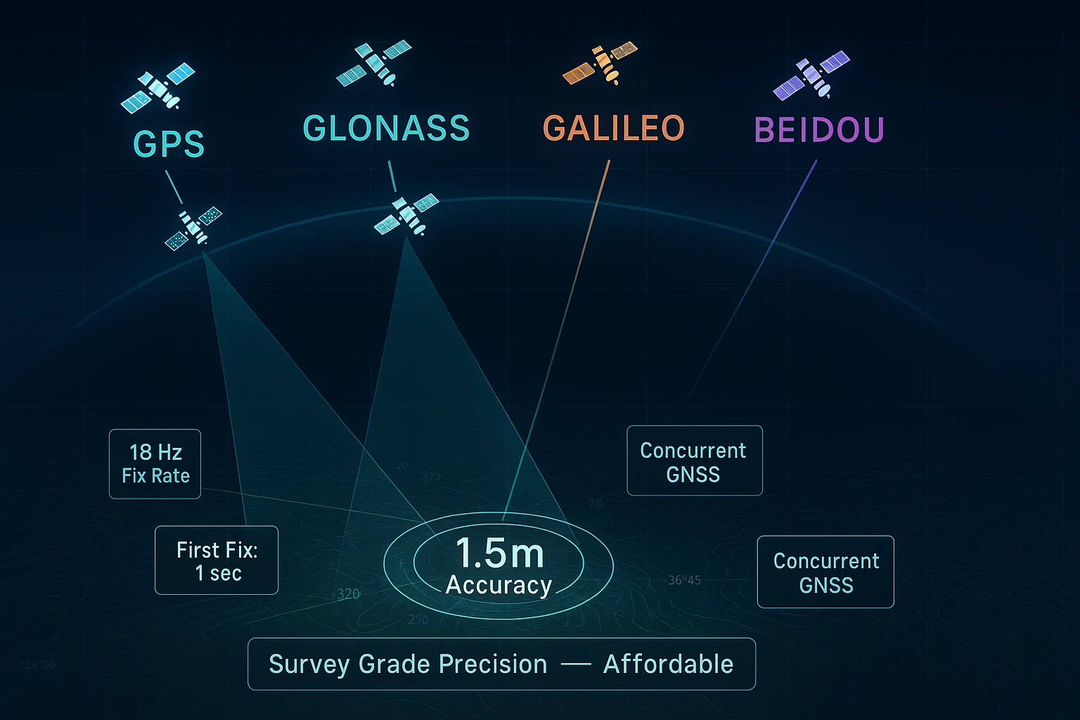
At just $49, the MultiNav Pro+ delivers 1.5-meter accuracy, an 18Hz fix rate, concurrent multi-constellation support across GPS, GLONASS, Galileo, and BeiDou, and an open-source driver library that works seamlessly with Arduino IDE and virtually any embedded toolchain. This is a survey grade GPS module affordable to every serious builder — without compromise on the specifications that actually matter.
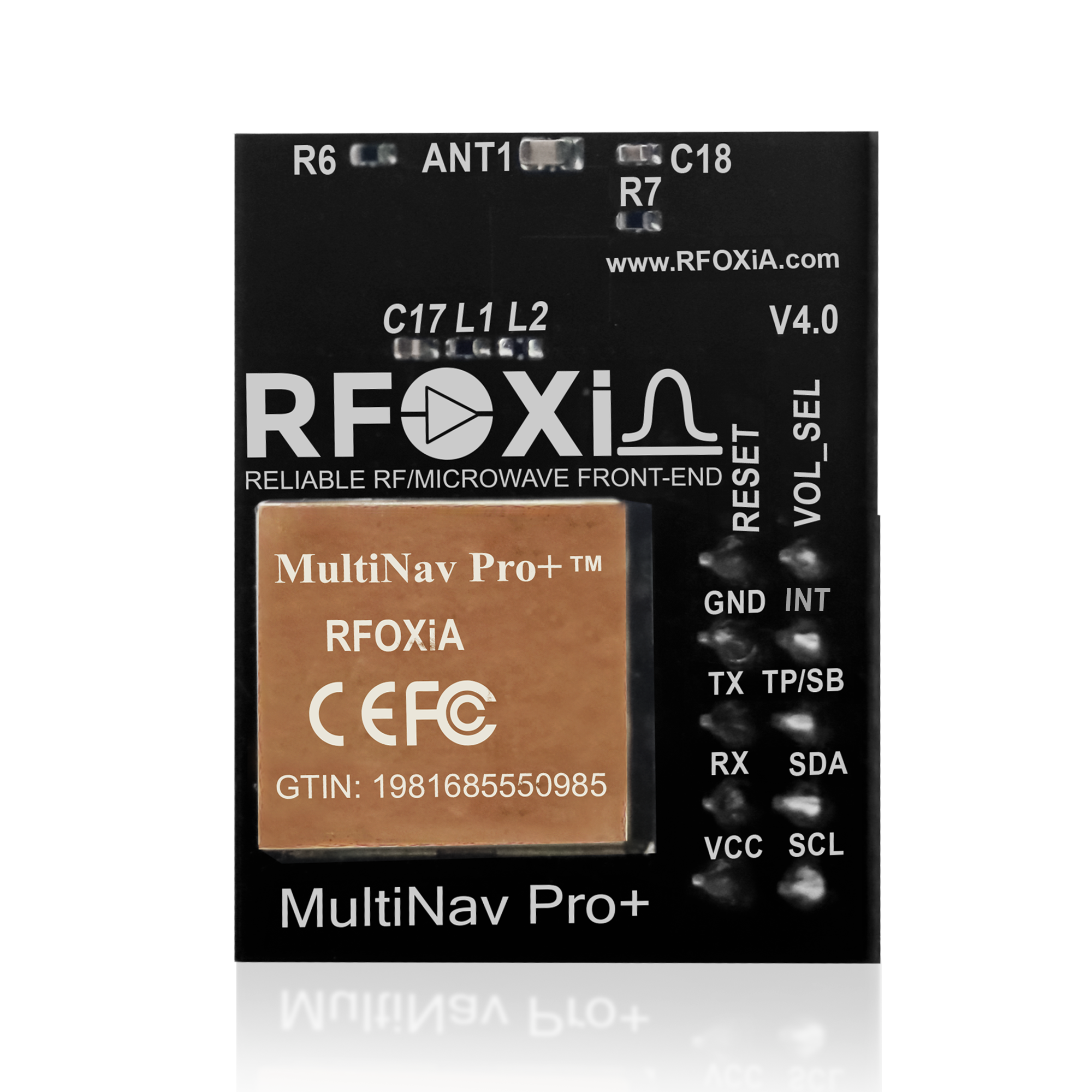
This article breaks down exactly what makes the MultiNav Pro+ a category-defining product, who it's built for, how it compares to the alternatives, and why builders worldwide are choosing it as their go-to GNSS solution.
What Does "Survey Grade" Actually Mean?
The term "survey grade" refers to GPS and GNSS systems capable of delivering positional accuracy at or below 2 meters in real-world outdoor conditions — and in professional surveying contexts, often into the centimeter range using RTK (Real-Time Kinematic) corrections.
For most applications — drone navigation, precision agriculture, autonomous robotics, asset tracking, field research, and IoT telemetry — sub-2-meter accuracy is not just sufficient, it's exactly what the application demands. The ability to know your position within 1.5 meters is the difference between a drone landing on a target versus drifting into an obstacle. It's the difference between a research data point being useful versus being noise.
Until recently, achieving that level of accuracy in a compact, embeddable module at an accessible price was simply not possible. The MultiNav Pro+ changes the calculus entirely.
MultiNav Pro+ Key Specifications at a Glance
Before diving into the deeper analysis, here are the headline specifications that define the MultiNav Pro+:
- Accuracy: Less than 1.5 meters
- Fix Rate: Up to 18Hz
- First Fix: 1 second
- Satellite Systems: GPS, GLONASS, Galileo, BeiDou (concurrent)
- GNSS Chip: u-blox MIA-M10Q (latest generation)
- Interfaces: UART (TX/RX) and I2C (SCL/SDA)
- Operating Voltage: 1.8V and 3.3V
- Power Consumption: 25–30mA
- Dimensions: 26mm x 22mm
- Antenna: Integrated high-gain chip antenna
- Software: Open-source C library + u-center GUI support
- Price: $49
- Certification: FCC certified
Every one of those numbers represents a deliberate engineering decision. Let's walk through each.
1.5-Meter Accuracy: What It Enables

The MultiNav Pro+'s sub-1.5-meter accuracy is the core specification that elevates it from a general-purpose GPS module into a tool worthy of professional applications.
For context:
- Standard smartphone GPS accuracy: 3–5 meters in ideal conditions, often worse
- Consumer-grade embedded GPS modules: 2.5–5 meters typical
- MultiNav Pro+: Under 1.5 meters, consistently
This level of accuracy opens the door to applications that simply aren't feasible with standard GPS:
Drone return-to-home and precision landing — A drone that knows its position within 1.5 meters can execute automated landing sequences with confidence. At 5-meter accuracy, landing on a pad becomes unreliable.
Precision agriculture waypoint navigation — Autonomous agricultural equipment following planned routes needs to stay within meters of its intended path. The MultiNav Pro+ delivers that.
Research-grade data collection — Environmental researchers, field scientists, and IoT data network contributors need GPS positions that are actually meaningful. A 1.5-meter position attached to a sensor reading makes that data defensible.
Asset and personnel tracking — Real-time tracking of field teams, vehicles, or equipment where location accuracy directly impacts operational decisions.
This is why the MultiNav Pro+ is the GNSS module powering the RFOXiA data network — GPS-verified outdoor deployment requires accuracy that actually validates the node's physical location.
18Hz Fix Rate: Why Speed Matters
Most embedded GPS modules update their position solution once per second — a 1Hz fix rate. Some professional modules offer 5Hz or 10Hz. The MultiNav Pro+ delivers up to 18Hz.
For static applications, fix rate doesn't matter much. But for any application involving movement — drones, vehicles, robots, wearables, handheld tracking devices — fix rate is directly linked to tracking quality.
At 1Hz, a drone flying at 30mph moves approximately 13 meters between GPS updates. At 18Hz, that gap shrinks to less than 1 meter. The difference in tracking fidelity is dramatic, and it has direct implications for flight controller performance, autopilot accuracy, and telemetry data quality.
The 18Hz fix rate combined with 1.5-meter positional accuracy makes the MultiNav Pro+ one of the highest-performance embedded GNSS solutions available at any price point in the maker and developer market.
u-blox MIA-M10Q: The Engine Behind the Performance
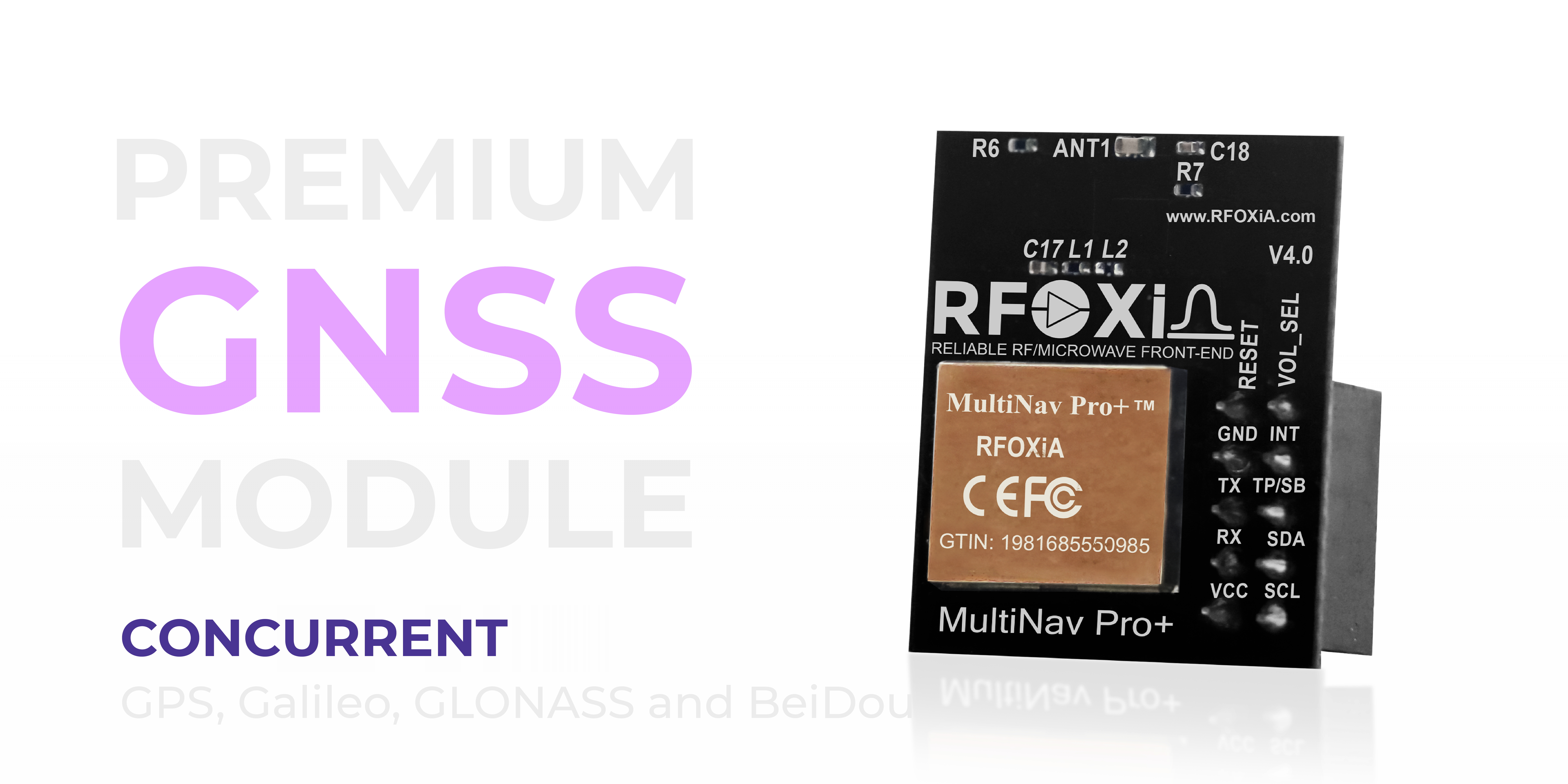
The MultiNav Pro+ is built around the u-blox MIA-M10Q — the latest generation GNSS chip from the most trusted name in professional navigation silicon.
u-blox modules are used in automotive navigation systems, aviation avionics, maritime equipment, and professional survey instruments worldwide. The MIA-M10Q brings that pedigree to a chip designed for embedded applications, offering:
- Concurrent reception of all four major satellite constellations
- Industry-leading sensitivity for acquisition and tracking
- Advanced signal processing to minimize multipath interference
- Ultra-low power architecture suitable for battery-powered designs
- Sub-second first fix times in hot-start conditions
RFOXiA's implementation adds a proprietary RF/microwave microstrip filter that further reduces interference and maximizes signal clarity. This is not a reference design clone — it's an engineered RF solution built by a team with deep expertise in RF hardware design.
The result is a module that consistently outperforms its specifications in real-world conditions, including urban canyons, partially obstructed skies, and electromagnetically noisy environments.
Concurrent Multi-Constellation: GPS + GLONASS + Galileo + BeiDou Simultaneously
Many lower-cost GPS modules receive only GPS satellites. Some dual-constellation modules add GLONASS. The MultiNav Pro+ receives all four major constellations simultaneously — GPS, GLONASS, Galileo, and BeiDou.
Why does this matter?
At any given moment, the number of satellites visible from a ground location is the primary determinant of positioning accuracy and fix reliability. GPS alone provides approximately 12–15 satellites in view. Adding all four constellations can double or triple the visible satellite count, delivering:
- Faster initial fix acquisition (more signals to lock onto)
- Better accuracy through geometric diversity (satellites distributed more evenly across the sky)
- Greater reliability in challenging environments (trees, buildings, terrain obstruction)
- Maintained fix in conditions where single-constellation modules would lose lock
For drone operations in complex environments, for field research in dense vegetation, for tracking devices in urban environments — multi-constellation support is not a luxury feature. It's a fundamental requirement for reliable operation.
Compact and Power-Efficient by Design
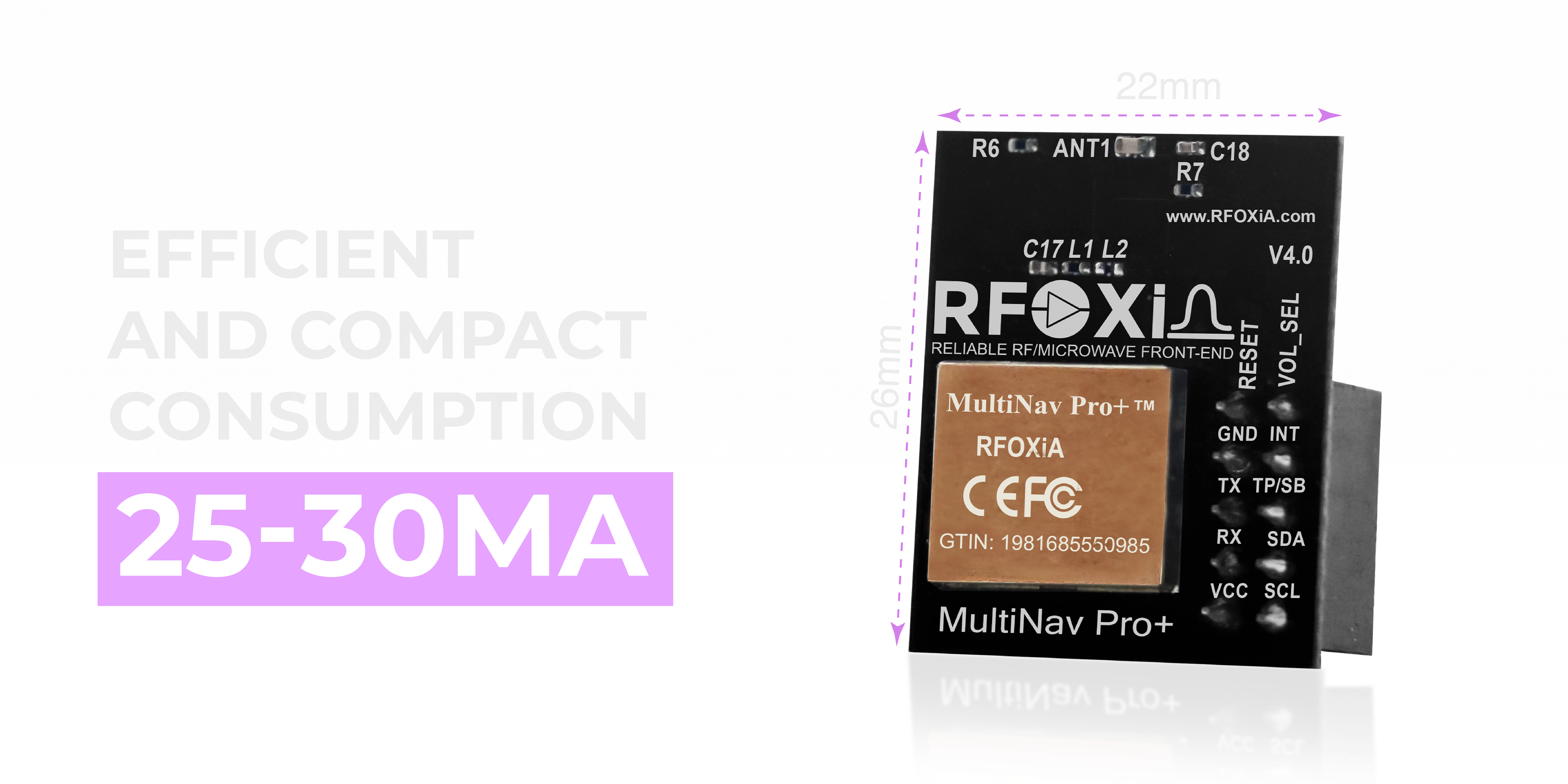
At 26mm x 22mm, the MultiNav Pro+ is engineered for integration. This is a module designed to fit inside products, not to sit on a bench as a development curiosity.
The 25–30mA power draw in active tracking mode is remarkably efficient for a multi-constellation receiver operating at 18Hz. This enables:
- Direct integration into battery-powered devices without thermal or power budget concerns
- Extended runtime when paired with the RFOXiA Power/Program Kit
- Deployment in compact enclosures where heat management would otherwise be an issue
The integrated high-gain chip antenna eliminates the need for an external antenna in most deployment scenarios, further simplifying integration and reducing the total component count and board area required.
For wearable applications, compact drone builds, embedded tracking devices, and miniaturized IoT nodes, the MultiNav Pro+'s combination of small footprint and low power consumption is a critical design advantage.
Flexible Connectivity: UART and I2C
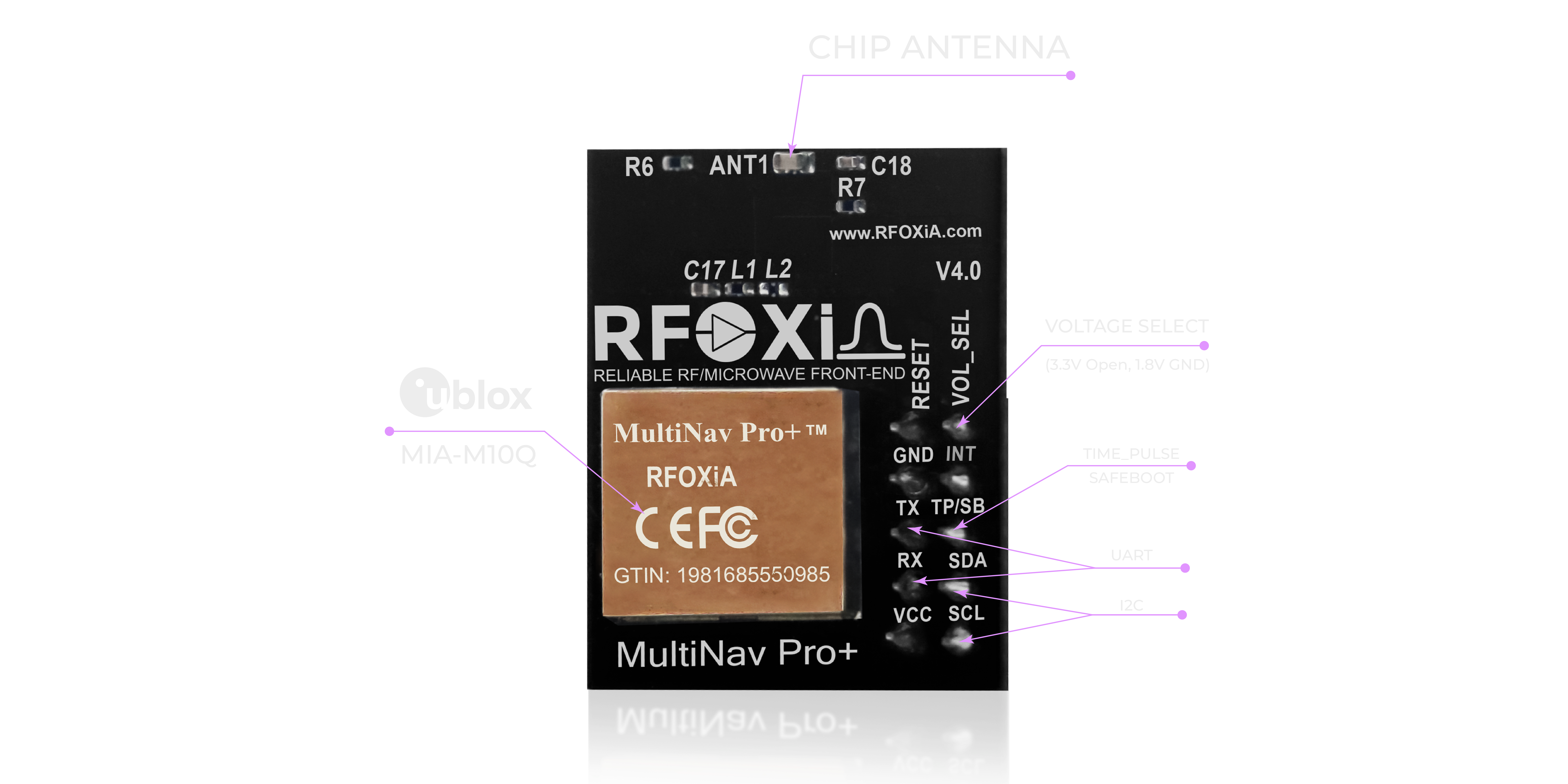
The MultiNav Pro+ supports both UART and I2C interfaces, with voltage compatibility at both 1.8V and 3.3V logic levels.
This dual-interface approach means the module connects directly to:
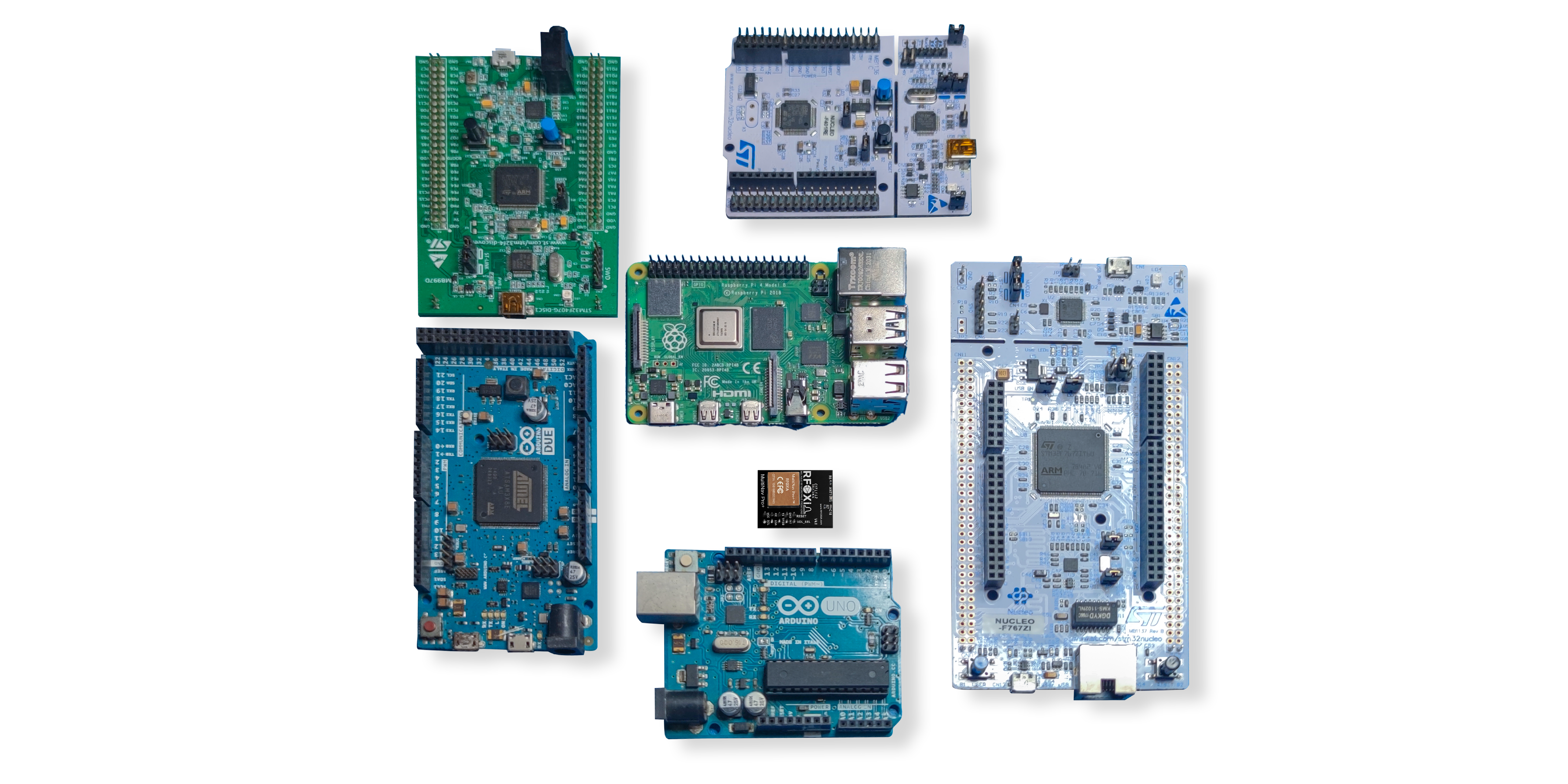
- Arduino and Arduino-compatible boards
- STM32 microcontrollers
- ESP32 and ESP8266
- Raspberry Pi and single-board computers
- Custom embedded designs at 1.8V or 3.3V logic
- Flight controllers with available serial ports
- Any microcontroller with a UART or I2C peripheral
The 1.8V support is particularly significant for integration with modern low-power microcontrollers and application processors that operate at sub-3.3V logic levels — eliminating the need for level shifting hardware in many designs.
When used within the RFOXiA ecosystem, the GNSS module integrates directly with the BLE Module for long-range position telemetry transmission, and with the Sensors Module for complete environmental monitoring and location-tagged data collection.
Open Source Driver and Development Tools
Hardware is only as useful as the software ecosystem around it. The MultiNav Pro+ ships with a fully open-source C language library that implements the NMEA standard protocol, making it compatible with virtually every development environment and toolchain.
For Arduino developers: Import the library directly into Arduino IDE. Parse NMEA sentences, extract latitude, longitude, altitude, speed, and course data, and configure the module's operating parameters — all through clean, documented API calls.
For embedded C developers: The raw NMEA protocol implementation provides direct access to all module capabilities without abstraction layer overhead. Integrate directly into FreeRTOS projects, STM32CubeIDE workflows, or any bare-metal embedded application.
For Python developers on single-board computers: Standard pyserial or smbus libraries handle UART and I2C communication respectively, with the NMEA library handling sentence parsing.
Open-source means no licensing fees, no restrictive agreements, and full community extensibility. The driver is on GitHub, forkable, modifiable, and contributable.
u-center Software Integration
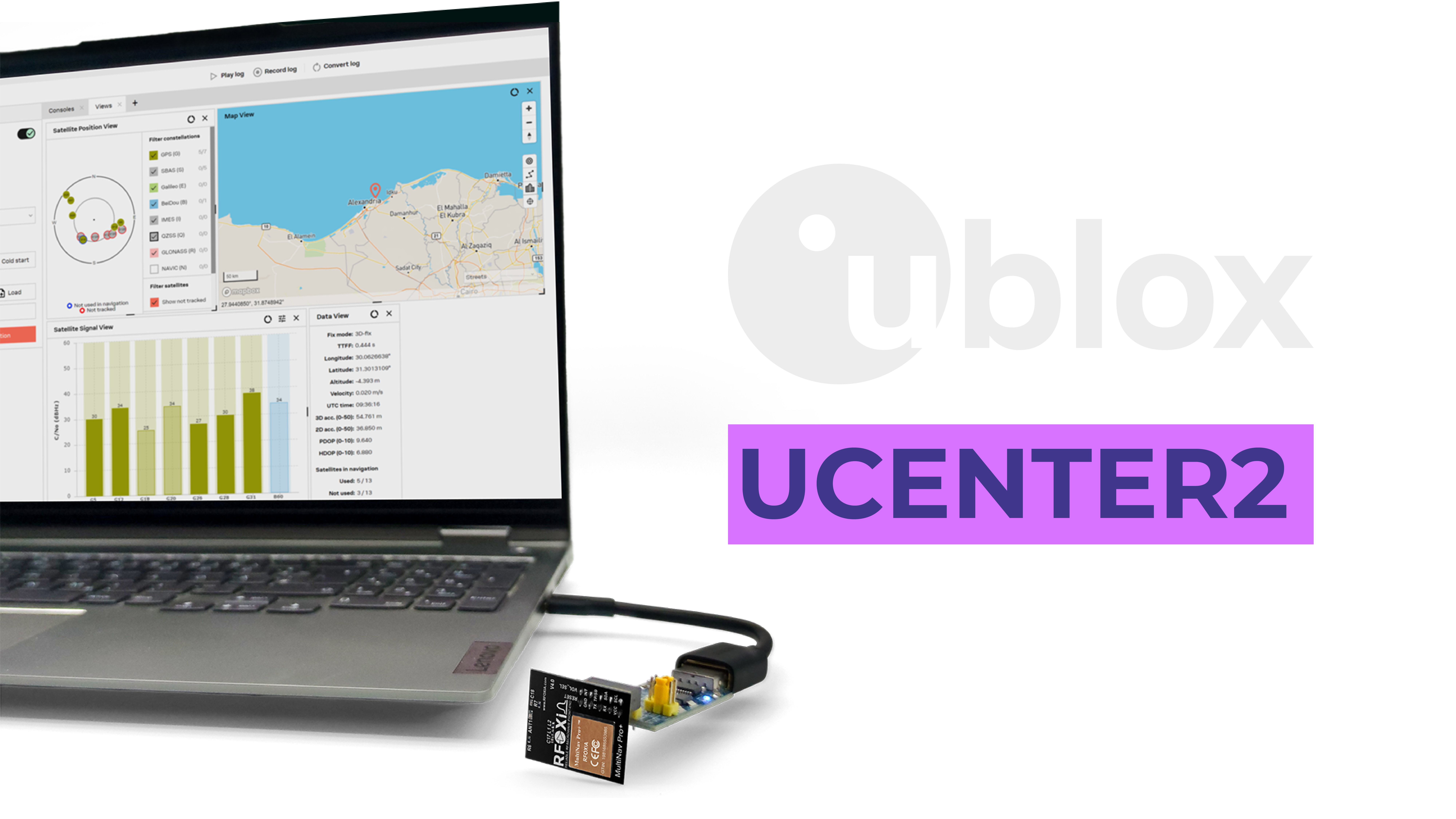
Beyond the embedded driver library, the MultiNav Pro+ is fully compatible with u-blox's u-center software — a professional GNSS evaluation and configuration tool used by engineers at major electronics companies worldwide.
u-center provides:
- Satellite visualization — Real-time sky plot showing position and signal strength of every visible satellite across all four constellations
- Position tracking — Map-based live tracking of module position
- Signal analysis — Detailed carrier-to-noise ratio graphs for signal quality assessment
- Configuration interface — Full access to module configuration registers for advanced customization
- Data logging — Record position, velocity, and satellite data for post-mission analysis
- Message configuration — Enable, disable, and configure which NMEA sentences the module outputs
For developers who need to characterize module performance, validate installation quality, or configure advanced operating modes, u-center provides a professional-grade interface that typically comes only with significantly more expensive receivers.
The fact that a $49 module is fully compatible with enterprise-level evaluation software is a direct reflection of the quality of the u-blox silicon at its core.
Use Cases: Where the MultiNav Pro+ Excels

The MultiNav Pro+ is intentionally designed as a universal precision GNSS solution. Its combination of accuracy, update rate, interface flexibility, and compact form factor makes it appropriate across an extraordinarily wide range of applications:
Drone and UAV Applications
Autopilot position hold, return-to-home, waypoint navigation, precision landing, geo-fencing, and telemetry. The 18Hz update rate is specifically valuable here — flight controllers need position updates faster than 1Hz for stable autonomous flight.
IoT Environmental Data Networks
When deployed with the RFOXiA Sensors Module, the GNSS module provides GPS-verified location data that validates outdoor sensor placement for the RFOXiA data network reward program. Every environmental data point becomes location-tagged, verified, and monetizable.
Wearables and Personal Tracking
The 26mm x 22mm footprint and 25–30mA power draw enable integration into compact wearable devices — GPS watches, personal emergency beacons, animal tracking collars, sports performance monitors.
Precision Agriculture
Autonomous and semi-autonomous agricultural equipment following planned routes. Field mapping and survey data collection. Crop monitoring device positioning.
Research and Scientific Instrumentation
GPS-tagged environmental readings, atmospheric sampling, wildlife tracking, geological survey support, oceanographic buoy positioning.
Robotics
Outdoor robot navigation, GPS-guided path following, geofenced operation, position-aware sensor fusion.
Asset and Fleet Tracking
Vehicle tracking, equipment monitoring, container and cargo location, personnel tracking in field operations.
Learning and Development
The open-source driver and Arduino compatibility make the MultiNav Pro+ an ideal learning platform for embedded systems students, hobbyists, and developers new to GNSS integration.
The RFOXiA Ecosystem Advantage
The MultiNav Pro+ is a powerful standalone module. But its full potential is realized as part of the complete RFOXiA hardware ecosystem.
When combined with the RFOXiA BLE Module (5km ground-to-ground, 15–20km man-to-drone range), GPS position data can be transmitted wirelessly over extraordinary distances — without internet connectivity, without cellular infrastructure, without subscription fees.
A drone carrying both modules can stream its real-time GPS position to a ground operator at ranges that dwarf anything achievable with commodity Bluetooth. The RFOXiA Connect app displays live GPS position on a map, paired with live sensor data from the Sensors Module, all controlled through a PS5-style interface — completely offline.
This is the vision: not just a survey grade GPS module affordable to every builder, but a complete wireless ecosystem that turns precision location data into real-world capability and, through the data network, into revenue.
If you're building something that needs to know exactly where it is and communicate that position over long distances without infrastructure, the RFOXiA Accurate GNSS Module is the foundation you need.
Competitive Context: What Else Is Available?
The market for embedded GNSS modules occupies two distinct zones:
Budget consumer modules ($5–$20): Modules like the NEO-6M and similar u-blox legacy parts offer basic GPS functionality at low cost. Typical accuracy is 2.5–5 meters, fix rates are usually 5–10Hz maximum, and multi-constellation support is limited or absent. These modules are adequate for applications where rough location is sufficient.
Professional GNSS receivers ($200–$5,000+): Survey-grade receivers with RTK correction capability, ruggedized enclosures, and enterprise support contracts. These are the tools of professional surveyors and large-scale commercial operations. Accurate, powerful — and completely inaccessible to the developer market.
The MultiNav Pro+ occupies the space between these extremes with a combination of specifications that genuinely belongs in the professional tier, delivered at a price point that belongs in the accessible tier.
At $49, with sub-1.5-meter accuracy and 18Hz updates on the latest u-blox silicon, the MultiNav Pro+ makes the case that a survey grade GPS module affordable to every builder is no longer a future possibility — it's a product you can order today.
Technical Integration Guide: Getting Started
Integration begins with selecting your interface. For most microcontroller projects, UART is the simplest path:
- Connect VCC to 3.3V (or 1.8V for low-voltage systems)
- Connect GND to system ground
- Connect TX to microcontroller RX pin
- Connect RX to microcontroller TX pin
- Install the open-source library via Arduino Library Manager or clone from GitHub
- Initialize the serial port at the appropriate baud rate (default 9600 baud)
- Parse NMEA sentences using the provided library functions
For I2C integration:
- Connect VCC and GND as above
- Connect SCL and SDA to the microcontroller I2C bus with appropriate pull-up resistors
- Use the I2C address as documented in the library
- Request NMEA data through the I2C read interface
First fix typically occurs within 1 second in hot-start conditions (previously acquired almanac and ephemeris data cached). Cold-start times depend on satellite visibility and atmospheric conditions but are consistently fast due to the multi-constellation signal diversity.
For advanced configuration — adjusting update rate, enabling/disabling specific constellations, configuring NMEA output messages — connect to a PC via USB-UART adapter and use u-center for a visual configuration workflow.
FCC Certification: Why It Matters for Your Project
FCC certification is not a checkbox. It is a legal requirement for any electronic device that intentionally or unintentionally radiates RF energy and is sold, distributed, or used in the United States.
When you build a product around an FCC-certified module like the MultiNav Pro+, you inherit that certification's coverage for the RF subsystem. This dramatically simplifies the certification path for your end product — you don't need to certify the GNSS receiver independently, only your complete system's additional RF sources.
For commercial product developers, this is a significant cost and timeline reduction. For individual builders, it means the module is legally compliant for use in the US without restriction.
All RFOXiA modules carry FCC certification. This is one of the key reasons the modules are accepted by professional distributors and appropriate for commercial product integration.
Pricing, Availability, and What's Included
The MultiNav Pro+ is priced at $49 and is in stock and ready to ship.
Each package includes:
- MultiNav Pro+™ GNSS Module
- Quick Start Guide
The open-source driver library is available immediately upon purchase and is freely accessible on GitHub for pre-purchase evaluation.
For developers building complete wireless systems, the MultiNav Pro+ is available as part of the Developer Bundle at $199 — combining the BLE Module, GNSS Module, Sensors Module, and Power/Program Kit into a single integrated ecosystem package.
New members joining RFOXiA Club receive a $10 welcome credit applicable toward any hardware purchase, including the MultiNav Pro+.
If you're ready to add professional-grade precision positioning to your next project, the RFOXiA Accurate GNSS Module is waiting.
Conclusion: The Survey Grade GPS Module Affordable Benchmark Has Changed
The MultiNav Pro+ GNSS Module redefines what developers, researchers, drone builders, and IoT engineers should expect from an affordable positioning solution.
1.5-meter accuracy. 18Hz updates. Concurrent GPS, GLONASS, Galileo, and BeiDou. The latest u-blox silicon. Open-source firmware. FCC certified. $49.
This is what a survey grade GPS module affordable enough for every serious builder looks like. This is precision navigation without the enterprise price tag. This is RFOXiA delivering on its core promise: democratizing technology that was previously reserved for those with unlimited budgets.
Whether you're building a long-range autonomous drone, contributing to the RFOXiA data network, developing a precision agriculture solution, or simply building something extraordinary — the MultiNav Pro+ gives you the positioning foundation to do it right.
Ready to build with precision? Order the RFOXiA Accurate GNSS Module today and experience the difference that real accuracy makes.
Join RFOXiA Club — it's free, and your $10 welcome credit is waiting.
Written by: Moamen Mohamed LinkedIn