
UAV GNSS Positioning Module: The Complete Guide to Precision Navigation with MultiNav Pro+
Why Your UAV GNSS Positioning Module Defines the Success of Every Mission
Every drone flight lives or dies by one variable: location accuracy. Whether you are mapping agricultural fields, tracking fast-moving assets, coordinating search and rescue operations, or pushing the boundaries of autonomous flight, your UAV GNSS positioning module is the single piece of hardware that determines whether your data is trustworthy or your aircraft lands where you intended.
Most developers accept mediocre location performance because they assume professional-grade GNSS is expensive, bulky, or difficult to integrate. The MultiNav Pro+ from RFOXiA was built to destroy that assumption entirely.
This guide covers everything you need to know about selecting, understanding, and integrating a high-performance UAV GNSS positioning module — and why the MultiNav Pro+ stands alone in its class for drone builders, IoT engineers, embedded developers, and researchers who demand precision without compromise.
What Makes a GNSS Module "Professional Grade" for UAV Applications?
Before examining the MultiNav Pro+ in detail, it is worth understanding what separates a professional UAV GNSS positioning module from the commodity GPS breakout boards that flood the maker market.
Fix Rate: The Speed of Truth
Most low-cost GPS modules offer 1Hz to 5Hz update rates. That means your position refreshes once every second, or five times per second at best. On a drone traveling at 60 km/h, a 1Hz update rate means your position data is already 16 meters stale by the time the next update arrives. For agricultural mapping, autonomous waypoint navigation, or precision landing, that latency is unacceptable.
A professional-grade UAV GNSS positioning module operates at 10Hz or higher. The MultiNav Pro+ delivers an 18Hz fix rate — meaning position updates 18 times per second — making it one of the fastest consumer-accessible GNSS modules available for embedded integration.
Accuracy: What "1.5 Meters" Actually Means
CEP (Circular Error Probable) at 50% describes where half of all position fixes land within a given radius. Consumer GPS often advertises "3-5 meter accuracy" under ideal conditions, which in practice degrades to 8-15 meters in real-world environments with multipath interference, atmospheric effects, and satellite geometry variation.
The MultiNav Pro+ achieves less than 1.5-meter accuracy under standard open-sky conditions. For a drone application, this means your mapped coordinates, waypoints, and return-to-home positions reflect reality — not a statistical average that could place your aircraft on the wrong side of a building.
Multi-Constellation Support: Never Losing the Sky
Single-constellation GPS receivers depend entirely on the US GPS satellite network — 31 satellites, not all visible from any given location. When GPS geometry is poor, accuracy degrades. When urban canyons block satellites, coverage disappears.
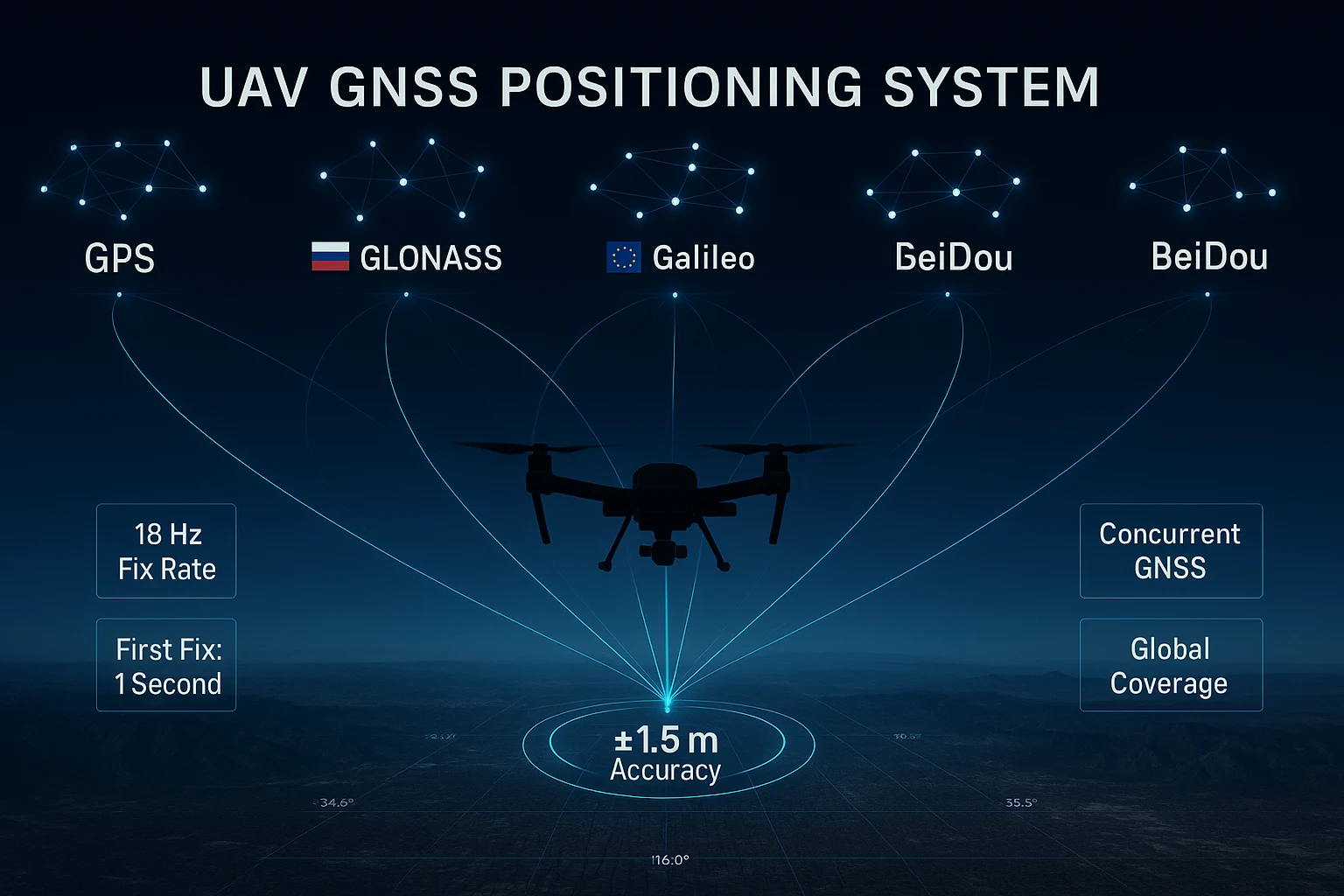
A professional UAV GNSS positioning module connects to multiple satellite constellations simultaneously. The MultiNav Pro+ supports concurrent GPS, Galileo, GLONASS, and BeiDou — giving it access to over 100 satellites across four independent global networks simultaneously. The result is dramatically better geometry, faster first fixes, and resilience in challenging environments where single-constellation receivers fail entirely.
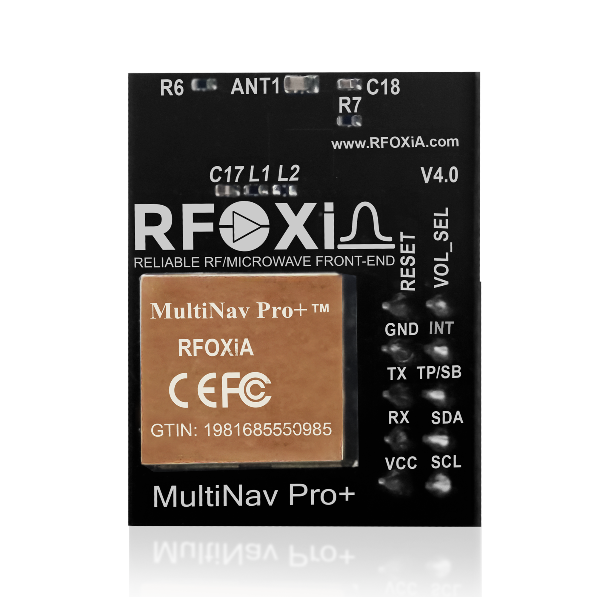
Introducing the MultiNav Pro+: RFOXiA's Precision UAV GNSS Positioning Module
The MultiNav Pro+ is RFOXiA's professional-grade GNSS module, engineered from the ground up for demanding UAV, robotics, IoT, and research applications. It combines the latest silicon from u-blox with proprietary RF filtering, an integrated high-gain chip antenna, and a software library designed to eliminate integration friction for embedded developers.
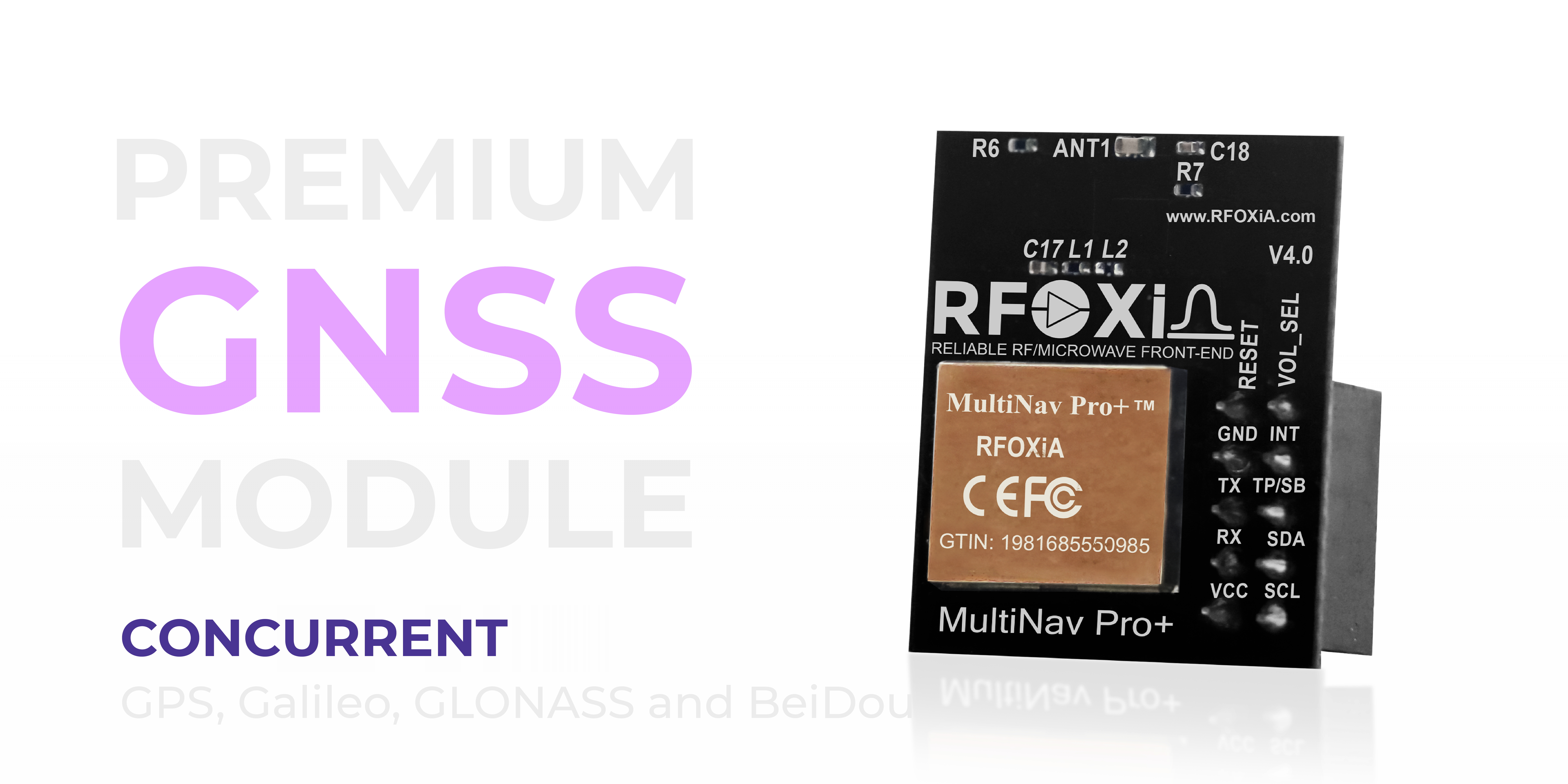
At the core of the MultiNav Pro+ is the u-blox MIA-M10Q — one of the most advanced GNSS receiver chips available for compact embedded integration. u-blox is the industry's benchmark for precision navigation silicon, trusted by automotive manufacturers, aviation system integrators, and professional survey equipment builders worldwide. The MIA-M10Q brings that industrial pedigree into a module designed for maker-accessible pricing without sacrificing performance.
Core Specifications: Numbers That Matter for Drone Builders
Accuracy and Fix Performance
The specification that drone builders, survey operators, and autonomous vehicle engineers care about most is the combination of accuracy and update rate. The MultiNav Pro+ delivers on both dimensions simultaneously — something that most modules in this price range fail to achieve.
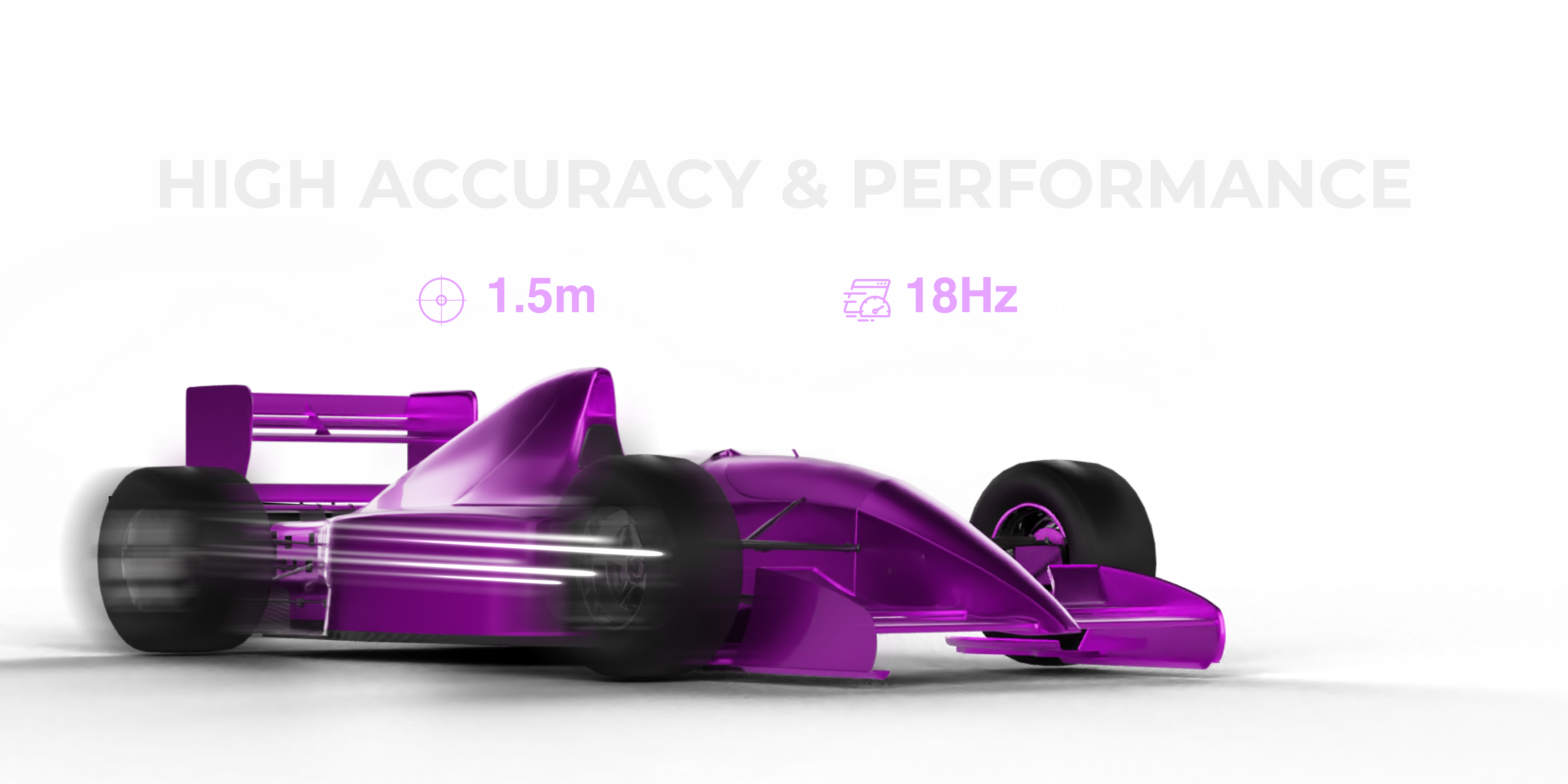
- Position accuracy: Less than 1.5 meters CEP
- Fix rate: Up to 18Hz — eighteen position updates per second
- Time to first fix (TTFF): As fast as 1 second with valid almanac data
- Concurrent constellation support: GPS, Galileo, GLONASS, BeiDou simultaneously
The 1-second first fix capability is particularly significant for UAV applications. Drone missions often require rapid deployment — waiting 30-60 seconds for a GPS fix in the field is operationally costly. The MultiNav Pro+ acquires its initial lock in approximately 1 second when almanac data is warm, enabling launch readiness in seconds rather than minutes.
Power Efficiency: Critical for Battery-Powered UAV Platforms
Every milliamp drawn from a drone's power system directly impacts flight time. A GNSS module that demands 100-150mA creates meaningful power budget pressure on small UAV platforms.
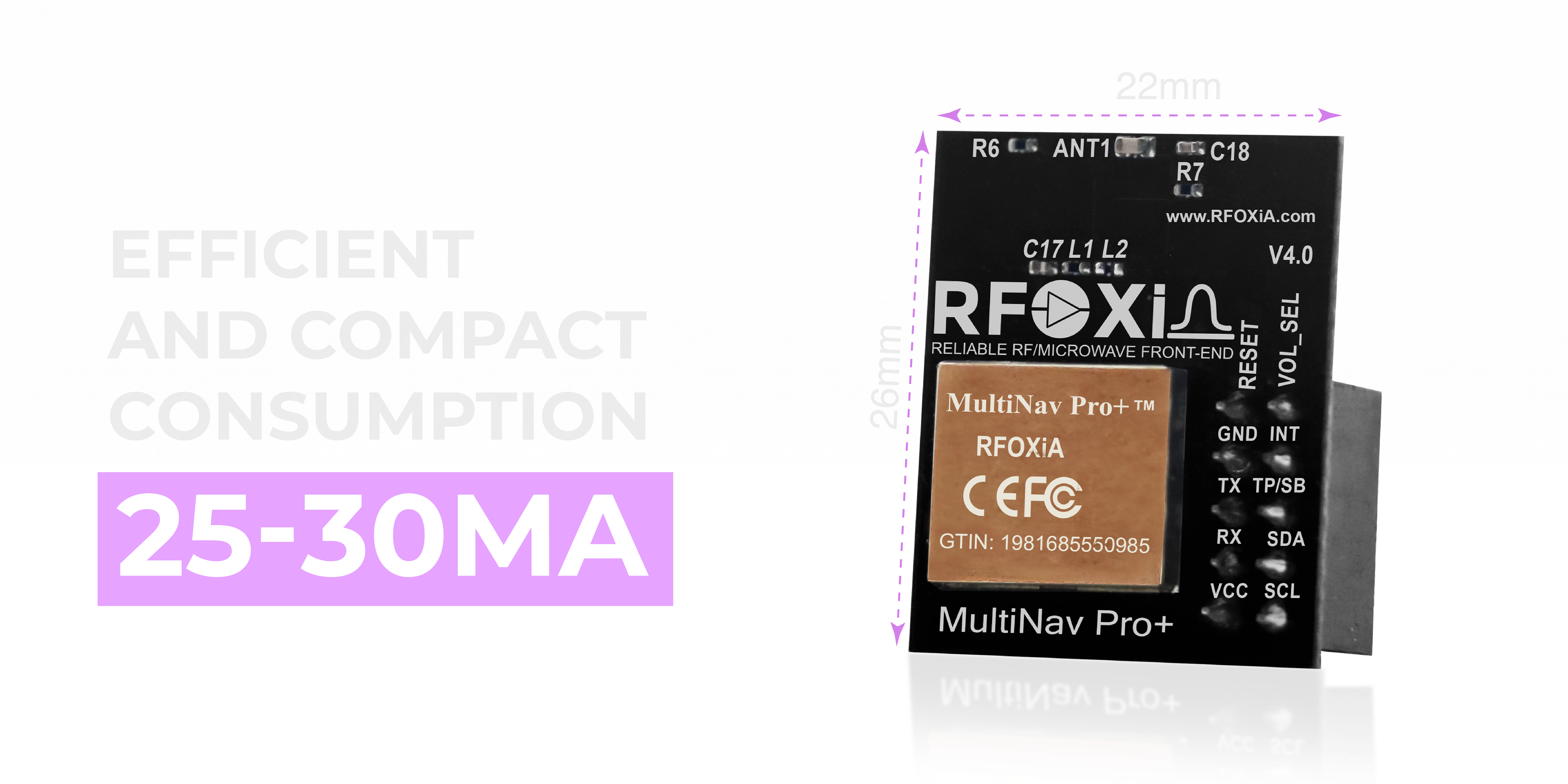
The MultiNav Pro+ operates at 25-30mA in full multi-constellation tracking mode — remarkably efficient for a module simultaneously processing signals from four satellite networks at 18Hz. The physical footprint is equally impressive: 26mm x 22mm, making it suitable for integration into miniaturized UAV frames, nano drones, wearable tracking devices, and space-constrained IoT enclosures.
This combination of low power draw and compact form factor makes the MultiNav Pro+ one of the few professional-grade UAV GNSS positioning modules that works equally well in a 5-inch FPV quad, a mapping fixed-wing, or a palm-sized autonomous rover.
Interface Flexibility: Works with Your Existing Stack
Developer time is expensive. A GNSS module that requires custom interface work, exotic voltage levels, or proprietary protocols adds weeks to any project timeline. The MultiNav Pro+ was designed for maximum compatibility with existing hardware and software ecosystems.
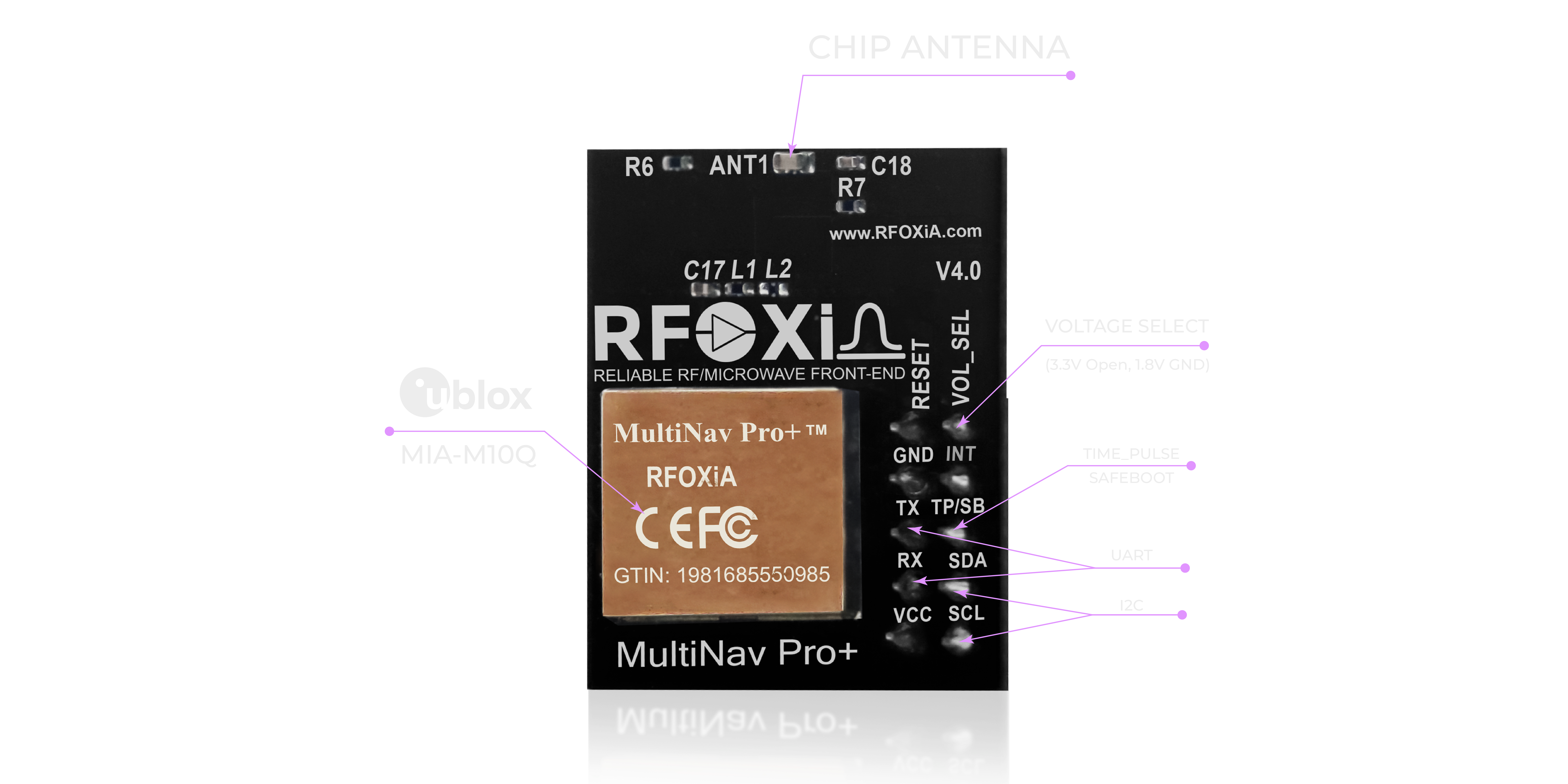
Interface options:
- UART: TX/RX — compatible with virtually every microcontroller, flight controller, and single-board computer
- I2C: SCL/SDA — enables bus sharing with other sensors on shared wiring
Voltage compatibility:
- 1.8V — for low-power MCUs and modern ARM processors
- 3.3V — standard for Arduino, ESP32, STM32, Raspberry Pi, and most development platforms
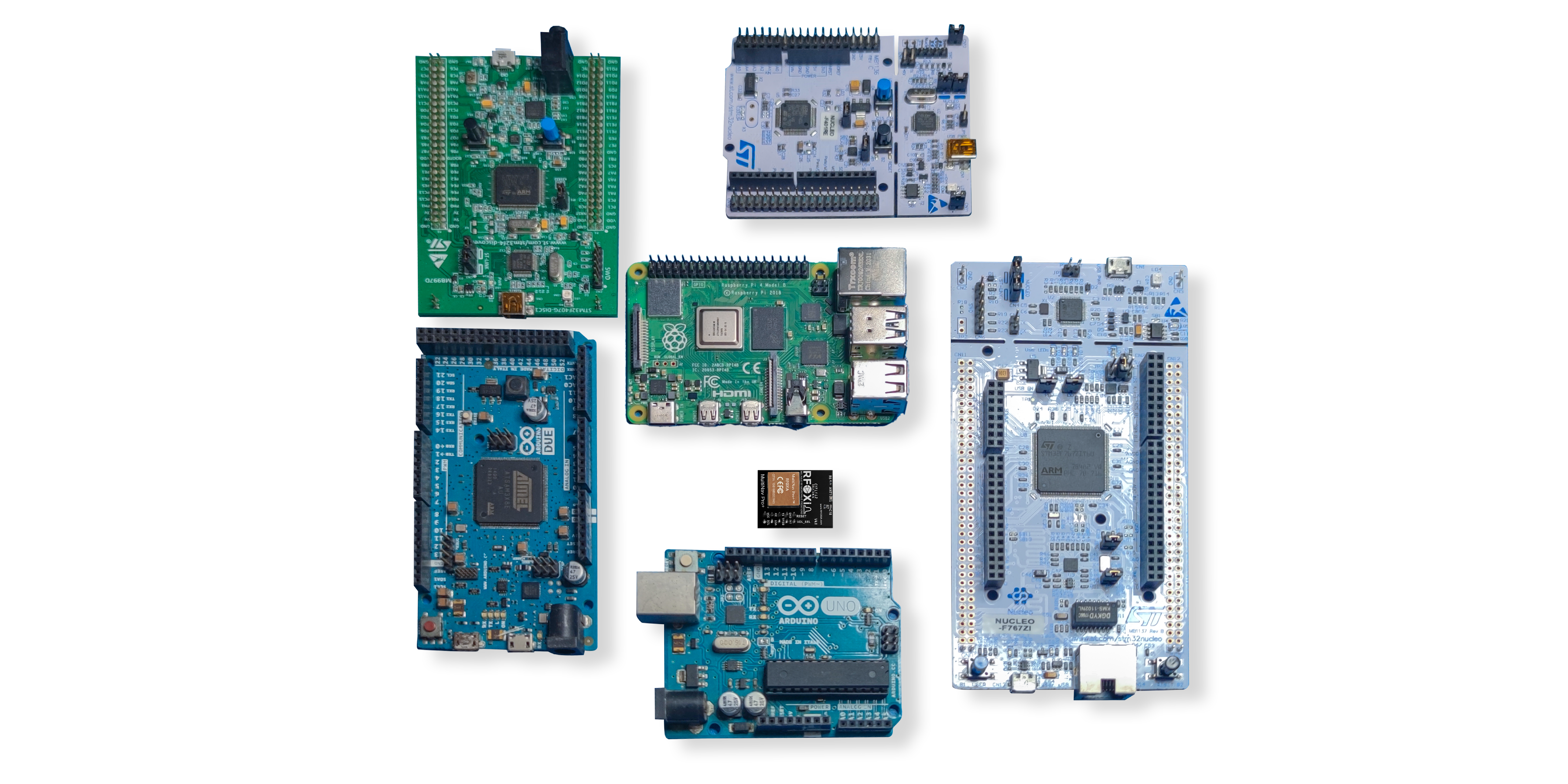
This dual-interface, dual-voltage design means the MultiNav Pro+ integrates directly with Arduino, ESP32, STM32, Teensy, Raspberry Pi, NVIDIA Jetson, and virtually any other development platform without level shifting or additional hardware.
Open Source Driver: From Unboxing to Data in Minutes
Hardware that ships without quality software support forces developers to spend hours — sometimes days — writing driver code before a single GNSS fix can be read. RFOXiA solves this completely.
The MultiNav Pro+ ships with a fully open-source C language driver library implementing the complete NMEA standard protocol command set. The library is structured for direct import into Arduino IDE — meaning a developer with no prior GNSS experience can have live position data streaming to their serial monitor within minutes of unboxing.
The same library works with any C-compatible toolchain: PlatformIO, STM32CubeIDE, ESP-IDF, Zephyr RTOS, and custom embedded build systems. The NMEA standard compliance ensures compatibility with any software that reads standard GNSS data formats — flight controllers, mapping software, telemetry systems, and custom data loggers.
Open source means full visibility into the implementation — no black-box driver behavior, no hidden licensing fees, no dependency on a vendor SDK that disappears when a company pivots. The complete source is yours to inspect, modify, and redistribute.
For developers integrating the MultiNav Pro+ into a product that will go into production, this matters: you own the entire software stack from the physical antenna to your application layer.
U-Center Software: Professional Evaluation and Configuration
Beyond the embedded driver library, the MultiNav Pro+ is fully compatible with u-blox's U-Center software — the industry-standard GUI tool for GNSS module evaluation, configuration, and diagnostics.

U-Center provides:
- Satellite sky plot visualization — see which satellites are visible, their signal strength, and elevation angles in real time
- Position tracking map — watch your module's reported position update live as you move
- Signal quality analysis — identify interference sources, multipath conditions, and antenna placement issues
- Module configuration — set update rates, constellation selection, power modes, and output formats
- Data logging — record GNSS sessions for post-processing and analysis
- Firmware update — keep the u-blox MIA-M10Q running the latest navigation firmware
For drone builders, U-Center is invaluable for antenna placement optimization before committing to a final hardware design. For researchers, it provides the signal-level detail necessary to characterize GNSS performance in challenging environments. For developers, it accelerates integration validation dramatically.
Real-World Applications: Where the MultiNav Pro+ Excels
The MultiNav Pro+ was designed for the full spectrum of professional wireless and autonomous applications — not just one narrow use case.

UAV and Drone Applications
This is the MultiNav Pro+'s primary design target. The 18Hz fix rate feeds flight controllers with position data at a rate that matches modern control loop frequencies. The 1.5-meter accuracy provides reliable geo-referencing for photogrammetry missions. The 25-30mA power draw adds negligible load to the aircraft's power budget. The compact 26x22mm footprint fits on standard GNSS mounting masts without modification.
For FPV and racing applications, the fast fix and multi-constellation support means reliable GPS rescue and return-to-home functionality even in environments where single-constellation GPS struggles.
IoT and Environmental Monitoring
Deployed as part of a fixed IoT installation — combined with RFOXiA's Sensors Module — the MultiNav Pro+ provides GPS-verified location stamps that authenticate data provenance. For RFOXiA's data monetization network, GNSS validation is a core requirement: outdoor deployment is verified by satellite fix, ensuring that environmental data sold to enterprise buyers comes from verified outdoor locations rather than spoofed indoor sensors.
Wearable and Personal Tracking
The 1.8V operating voltage and 25-30mA consumption make the MultiNav Pro+ suitable for battery-powered wearable devices where power budget is the primary engineering constraint. The compact form factor enables integration into devices smaller than most off-the-shelf GNSS breakout boards.
Automotive and Fleet Tracking
The multi-constellation design provides the satellite geometry depth needed for reliable urban canyon performance — one of the most challenging environments for automotive GNSS. The 18Hz update rate enables smooth velocity estimation and dead-reckoning sensor fusion in high-speed applications.
Academic Research
Researchers studying RF propagation, atmospheric effects on GNSS signals, or developing novel positioning algorithms benefit from the full U-Center integration, open-source driver transparency, and the u-blox MIA-M10Q's extensive configuration flexibility. The module's professional specifications provide a reliable reference platform for comparative studies.
The RFOXiA Ecosystem Advantage
The MultiNav Pro+ is exceptional as a standalone UAV GNSS positioning module — but it was designed to be part of something larger.
RFOXiA builds vertically integrated wireless development ecosystems. The MultiNav Pro+ pairs natively with:
- MultiNav Pro+ BLE Module — 5km ground-to-ground, 15-20km man-to-drone long-range Bluetooth link that streams live GPS data from your aircraft to your phone without internet infrastructure
- Sensors Module — seven environmental sensors (temperature, humidity, air pressure, air quality, accelerometer, gyroscope, magnetometer) that pair with GNSS for geo-stamped environmental logging
- Power/Program Kit — supercapacitor-based power system with 5-minute charge and 24-hour runtime for field deployment without battery concerns
- RFOXiA Connect App — iOS and Android application that displays live GPS tracking on an integrated map, paired with PS5-style drone/robot control interface
- RFOXiA Club — developer platform with AI firmware builder, community, data network, and resource library
For developers who want the complete picture — hardware that controls, senses, locates, and communicates — the RFOXiA Accurate GNSS Module is the location foundation of a system where every component was built to work together.
RFOXiA Club members also gain access to the AI Firmware Builder, which generates production-ready firmware for custom GNSS integrations from plain-language descriptions — dramatically compressing the time from idea to working prototype.
Technical Specifications Summary
| Parameter | Value |
|---|---|
| GNSS Chip | u-blox MIA-M10Q |
| Position Accuracy | < 1.5 meters CEP |
| Fix Rate | Up to 18Hz |
| Time to First Fix | ~1 second (warm start) |
| Constellation Support | GPS, Galileo, GLONASS, BeiDou (concurrent) |
| Interface | UART (TX/RX), I2C (SCL/SDA) |
| Supply Voltage | 1.8V / 3.3V |
| Current Consumption | 25-30mA (tracking) |
| Dimensions | 26mm x 22mm |
| Antenna | Integrated high-gain chip antenna |
| RF Filtering | Proprietary RF/microwave microstrip filter |
| Driver | Open-source C library, NMEA standard |
| IDE Compatibility | Arduino IDE, PlatformIO, STM32CubeIDE, and all C toolchains |
| Certification | FCC certified |
| Price | $49 |
Why FCC Certification Matters for Your Project
Many GNSS modules on the market — particularly lower-cost alternatives from unverified sources — operate without FCC certification. This matters for several reasons beyond legal compliance.
FCC certification requires that a module meets specific emissions standards and does not interfere with other radio systems. For a drone operator whose aircraft also carries radio control receivers, FPV video transmitters, and long-range telemetry links, an uncertified GNSS module introduces real risk of cross-interference that degrades the performance of every other wireless system on the aircraft.
The MultiNav Pro+ carries full FCC certification — providing confidence that its emissions profile is characterized, documented, and compliant. For developers building products intended for commercial sale, this certification is also a requirement for distribution through major channels including DigiKey, Mouser, and other professional distributors.
Getting Started with the MultiNav Pro+
Integration is designed to require minimal time investment:
- Connect — UART or I2C to your microcontroller or flight controller
- Power — 3.3V from your development board's regulated output
- Import — the open-source C library into Arduino IDE or your preferred toolchain
- Initialize — call the library init function to configure the MIA-M10Q
- Read — position, velocity, fix quality, and satellite count are immediately available as structured data
The included Quick Start Guide walks through each step with wiring diagrams and example code. The U-Center software provides real-time visual confirmation that the module is acquiring satellites correctly before you commit to embedded integration.
For developers building within the RFOXiA ecosystem, the AI Firmware Builder in RFOXiA Club can generate custom integration code for GNSS combined with sensor logging, BLE telemetry transmission, or data network streaming — all from a plain-language description of your application.
Conclusion: The Standard for Professional UAV GNSS Positioning
A capable UAV GNSS positioning module is not a component you want to compromise on. It is the foundation of every location-dependent decision your aircraft or system makes. Inaccurate position data does not just produce bad maps — it produces bad landings, failed missions, and lost hardware.
The MultiNav Pro+ was built for developers who understand this. It delivers professional-grade specifications — 1.5-meter accuracy, 18Hz fix rate, concurrent four-constellation support, 1-second first fix — in a compact, power-efficient, FCC-certified module at a price that belongs in every serious developer's toolkit.
Paired with RFOXiA's complete wireless ecosystem and backed by an open-source software library, U-Center compatibility, and the full support of the RFOXiA Club developer community, it is the only GNSS module you will need for professional UAV, IoT, research, and tracking applications.
Explore the full specifications and order the RFOXiA Accurate GNSS Module today — and experience what precision navigation actually feels like when the hardware was designed to perform rather than merely function.
Written by: Moamen Mohamed LinkedIn