
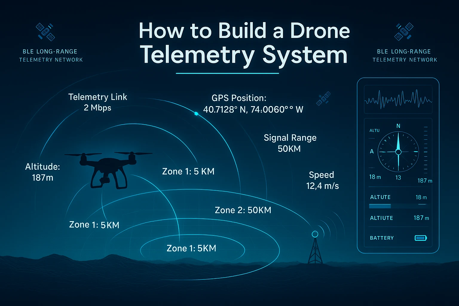
How to Build a Drone Telemetry System That Actually Works at Range
RFOXiA Long Range Bluetooth Module
How to Build a Drone Telemetry System: The Complete Guide for Serious Builders
If you've ever tried to build a reliable drone telemetry system, you know the frustration. Standard Bluetooth modules drop out at 80 meters. Wi-Fi-based solutions require infrastructure. Dedicated RC telemetry links are expensive, proprietary, and locked down. And the moment your drone climbs above the treeline or drifts beyond line of sight, your data link disappears.
This guide is for builders who are done settling. We're going to walk through exactly how to build a drone telemetry system — one that delivers real-time sensor data, GPS position, and two-way communication at distances that commodity hardware simply cannot match. We'll cover the architecture, the hardware choices, the integration steps, and the software stack that ties it all together.
By the end, you'll understand not just how to wire modules together, but why each design decision matters — and how the right hardware platform transforms a hobby project into a professional-grade system.
Why Most Drone Telemetry Systems Fail at Range
Before diving into how to build a drone telemetry system, it's worth understanding the root cause of failure in most existing setups.
The Commodity BLE Problem
Most developers reach for off-the-shelf BLE modules because they're cheap, widely available, and easy to integrate. Nordic nRF52 modules, Silicon Labs BGM series, and various Chinese SoC boards flood the market at $5–15 per unit. They work fine on the bench. They work fine in your living room.
Then you take your drone outside.
The moment you introduce ground reflections, multipath interference, and the actual physics of RF propagation at altitude, commodity BLE performance collapses. These modules are designed and optimized for proximity applications — smartwatches, earbuds, asset trackers in warehouses. Their receiver sensitivity, output power, and antenna design reflect that use case.
For drone telemetry, you need something fundamentally different.
The RF Physics You Need to Understand
Range in wireless systems is governed by the Friis transmission equation. At its core, range is determined by:
- Transmit power (EIRP) — how much power leaves the antenna
- Receiver sensitivity — how weak a signal the receiver can still decode
- Antenna gain — how effectively the antenna focuses energy in the desired direction
- Path loss — how much energy the signal loses traveling through space
Commodity BLE modules are engineered to stay within regulatory limits while minimizing cost. They hit the minimum acceptable receiver sensitivity, use internal chip antennas optimized for size not gain, and offer no RF front-end amplification.
A properly engineered long-range BLE module addresses every one of these variables with purpose-built RF design. And that changes everything.
The Hardware Foundation: What You Actually Need
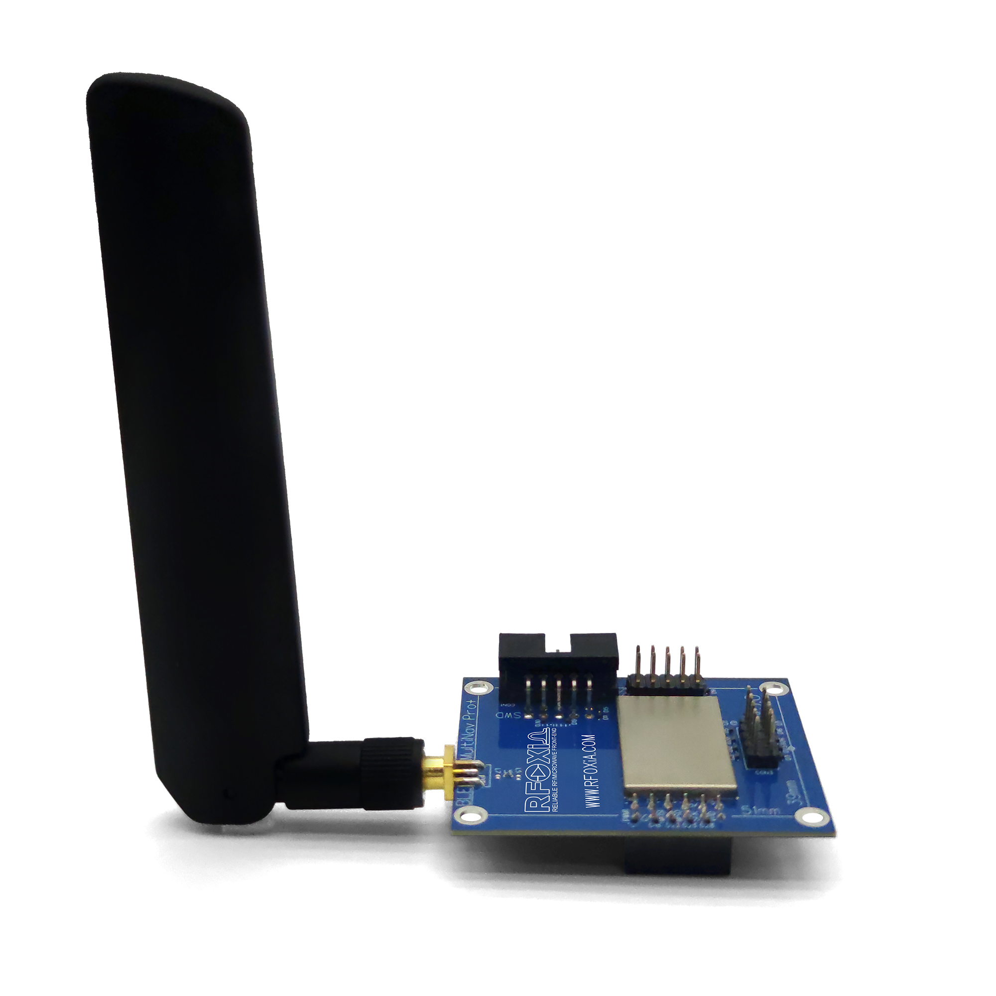
To build a drone telemetry system that performs at real-world distances, your hardware stack needs to include:
- A long-range wireless communication module — the link between drone and ground station
- A GNSS module — for precise position tracking at high update rates
- A sensors module — for environmental and flight data
- A power management system — for reliable, uninterrupted field deployment
- A software interface — for real-time visualization and control
Each of these components needs to be designed to work together. Mismatched interfaces, incompatible voltage levels, and asynchronous data protocols are the silent killers of amateur telemetry builds.
Step 1: Choose Your Wireless Link
This is the most critical decision in the entire build. Everything downstream depends on it.
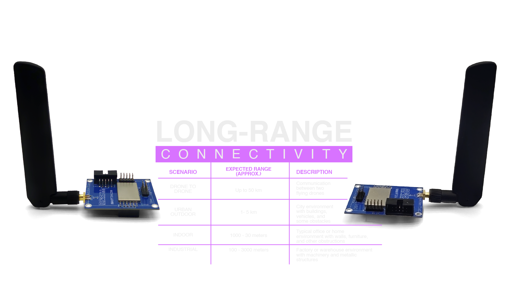
The RFOXiA MultiNav Pro+ Long Range Bluetooth Module is purpose-built for exactly this application. It achieves what no commodity module can:
- 5KM range when paired with a smartphone on the ground
- 15–20KM range in man-to-drone configuration
- 50KM range in drone-to-drone or elevated-to-elevated configurations
- 2Mbps data rate — sufficient for real-time sensor streaming, GPS telemetry, and control commands simultaneously
These specs aren't marketing claims. They're the result of a purpose-designed RF front-end with external amplifiers, optimized PCB layout, and an advanced high-gain chip antenna — all packaged in a 57mm × 47mm form factor that fits on virtually any drone frame.
The module is powered by the STM32WB07CCV6 — a dual-core processor that handles the BLE stack on one core and your application firmware on the other. This architecture eliminates the timing conflicts that plague single-core BLE implementations and ensures the radio stack never blocks your application logic.
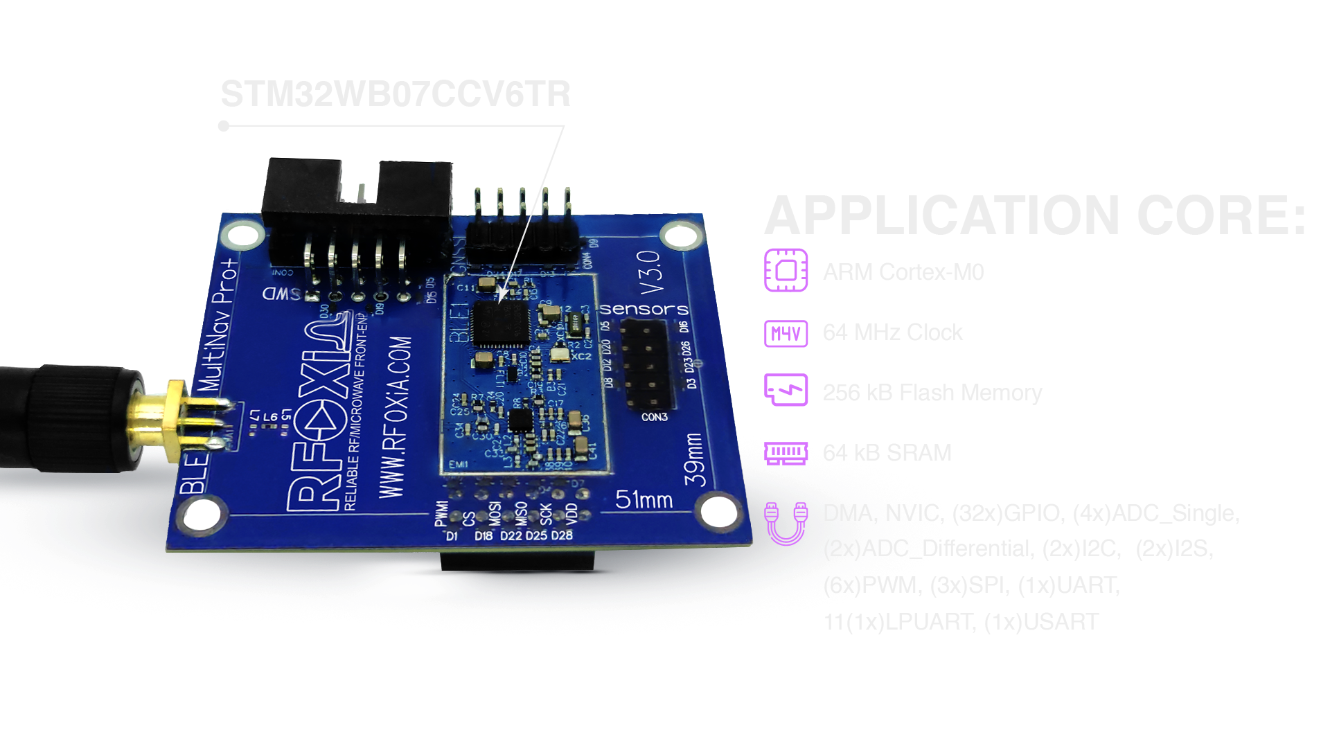
For those building systems that need to learn how to build a drone telemetry system from the ground up, the STM32WB07's SWD programming interface means you have full access to flash your own firmware, modify the BLE stack parameters, and optimize for your specific data patterns.
Why not ExpressLRS or traditional RC telemetry?
ExpressLRS is a capable open-source RC link optimized for low-latency control. It's excellent at what it does. But it doesn't carry environmental sensor data, doesn't integrate with mobile app ecosystems, doesn't support mesh networking, and offers no data monetization pathway. It's a control link, not a telemetry ecosystem.
The MultiNav Pro+ is both — a control link and a full telemetry backbone.
Step 2: Add Precision GNSS
Drone telemetry without position data is just noise. Your system needs to know exactly where the drone is — not approximately, not with 3-second lag, but in real time with enough accuracy to matter.
The RFOXiA GNSS Module delivers:
- 1.5-meter accuracy — sufficient for precision navigation and geofencing
- 18Hz fix rate — critical for tracking fast-moving platforms where 1Hz GPS creates dangerous position uncertainty
- FCC certified — ready for legitimate deployment
At 18Hz, the module outputs 18 position updates per second. A drone traveling at 15 meters per second (54km/h) moves only 0.83 meters between updates. That's the resolution you need for meaningful real-time tracking.
The GNSS module connects directly to the GNSS interface on the MultiNav Pro+ BLE module, eliminating external wiring complexity and ensuring synchronized data timestamps.
Step 3: Integrate Environmental Sensors
A complete drone telemetry system doesn't just track position — it monitors the environment the drone is operating in.
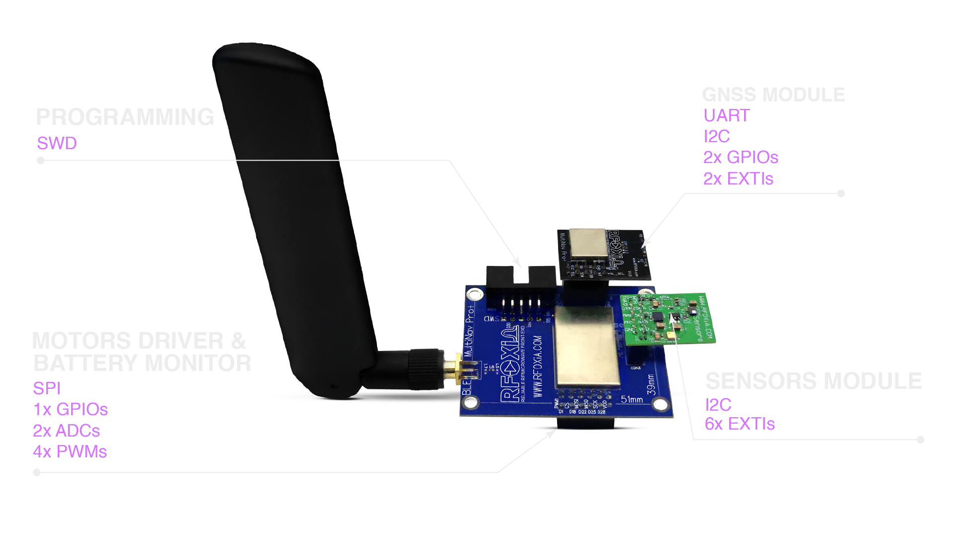
The RFOXiA Sensors Module packs seven sensors onto a single board:
- Temperature
- Humidity
- Air pressure (barometric altitude)
- Air quality (AQI)
- Accelerometer (3-axis)
- Gyroscope (3-axis)
- Magnetometer (compass heading)
For drone telemetry, the barometric pressure sensor provides a secondary altitude reference independent of GPS, the accelerometer and gyroscope augment IMU data, and the magnetometer provides compass heading for orientation tracking.
For research and environmental monitoring applications, the temperature, humidity, and air quality sensors turn your drone into a flying sensing platform — collecting hyperlocal atmospheric data that ground stations and satellite imagery cannot replicate.
Step 4: Solve the Power Problem
Field deployment breaks most telemetry systems not because of the electronics — but because of power. Batteries die. Battery swaps interrupt sessions. In cold weather, LiPo capacity drops 20–30%. In remote locations, there's no USB port to recharge.
The RFOXiA Power/Program Kit addresses all of this with supercapacitor-based power management:
- 5-minute charge to full capacity
- 24-hour runtime powering the complete module stack
- Integrated STLink programmer for firmware updates in the field
Supercapacitors don't degrade in cold temperatures the way lithium chemistry does. They handle thousands of charge cycles without capacity loss. And 5-minute recharge means a brief rest stop is enough to restore full operational capacity.
Step 5: Understand the Data Link Architecture
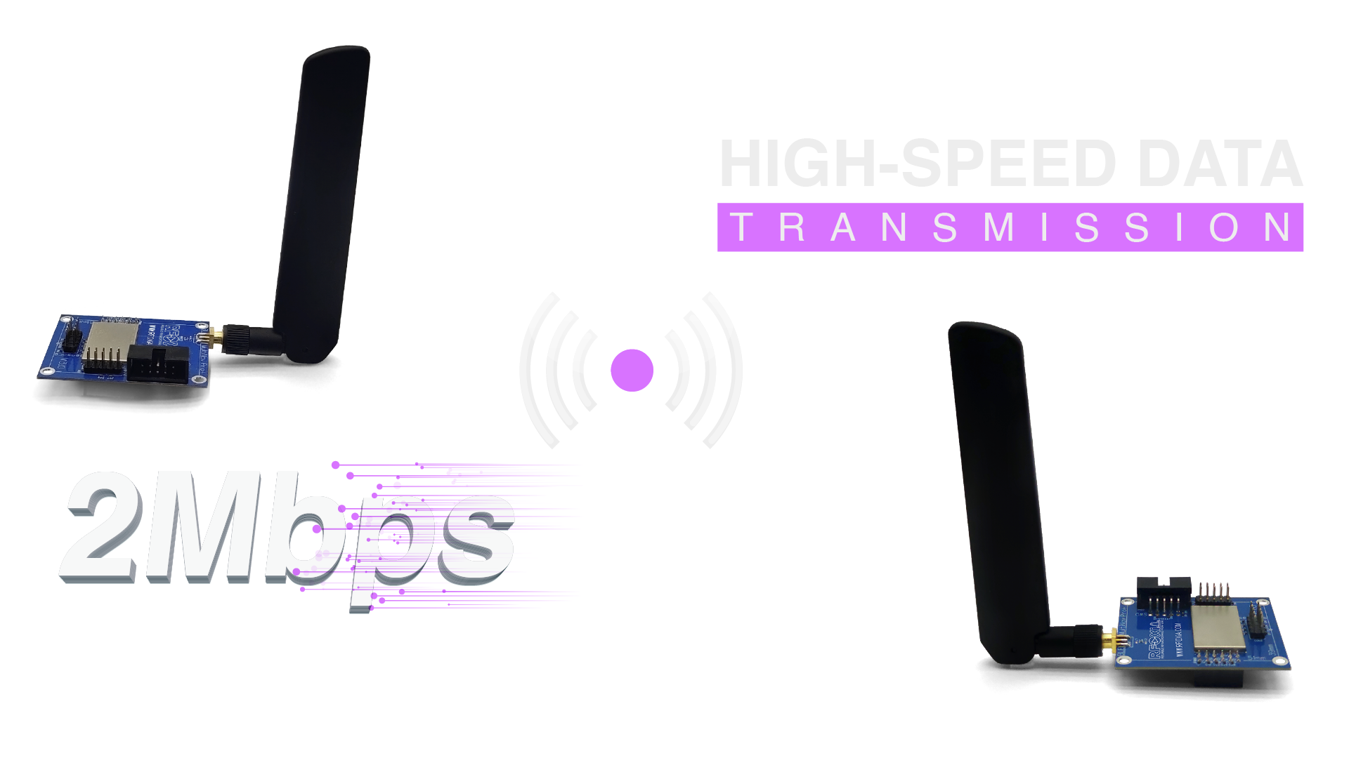
Once the hardware is assembled, you need to understand the data flow through your telemetry system.
Architecture Overview
[Drone: BLE Module + GNSS + Sensors]
          |
          | BLE Link (up to 20KM man-to-drone)
          |
[Ground: BLE Module paired to smartphone]
          |
          | Local BLE (standard proximity)
          |
[RFOXiA Connect App — Live Map + Sensor Display]
The drone-side module aggregates data from the GNSS module (position, velocity, altitude) and the Sensors module (environmental readings), packages it into BLE packets at 2Mbps, and transmits to the ground-side module.
The ground-side module receives the data and forwards it via standard short-range BLE to the connected smartphone running RFOXiA Connect.
The entire link is completely internet-independent. No cloud server. No cellular data. No infrastructure. Your drone can be 15 kilometers away in a location with zero connectivity, and your real-time telemetry still works.
Drone-to-Drone Extension
For multi-drone operations or relay configurations, two airborne modules can communicate at up to 50KM. This enables:
- Lead drone relaying telemetry from follower drones
- Autonomous swarm coordination without ground station bandwidth
- Extended range operations using airborne relay nodes
Step 6: Configure the Control Interface
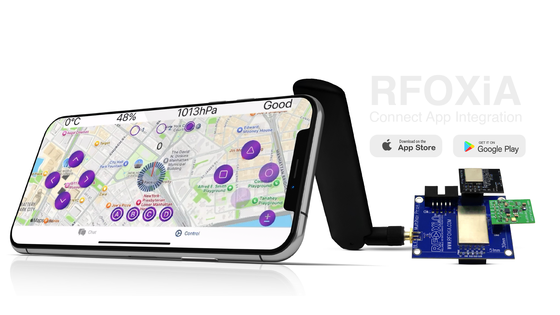
The RFOXiA Connect App (iOS and Android) is your ground station interface. It provides:
- Live map view with real-time GPS position overlay
- Sensor data dashboard displaying all telemetry streams
- PS5-style controller interface for direct drone/robot control
- Automation center for programmable control sequences
Setup is straightforward. Open the app, connect to your ground-side BLE module, and your drone's telemetry streams immediately into the interface. Position updates appear on the map at the GNSS module's 18Hz rate. Sensor values refresh in real time.
The controller interface sends commands back through the same BLE link — so you're not just receiving telemetry, you're closing the control loop through the same channel.
Step 7: Write or Generate Your Firmware
This is where most builders hit a wall. Custom telemetry firmware means understanding BLE GATT services, characteristic notifications, data serialization, and interrupt-driven sensor reads. Done from scratch, this is weeks of work.
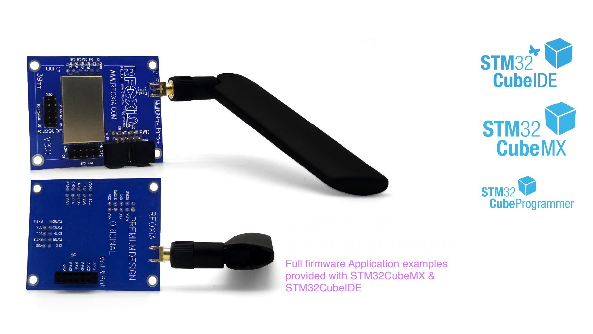
RFOXiA solves this two ways:
Option 1: Use the open-source firmware baseline
The MultiNav Pro+ firmware is fully open source on GitHub. The repository includes complete examples for BLE data streaming, GNSS data parsing, sensor integration, and power management. Fork it, modify it, flash it via SWD through the integrated programmer on the Power Kit.
This is the path for developers who want full control at the firmware level.
Option 2: Use the AI Firmware Builder
RFOXiA Club includes an integrated AI firmware development tool. Describe your application in plain language — "Stream GPS position and barometric altitude at 10Hz, and send motor control commands received via BLE to four PWM outputs" — and the AI generates complete, production-ready STM32 firmware with full source code.
For teams that need to learn how to build a drone telemetry system without a six-month embedded development detour, this capability changes the economics of the entire project.
Step 8: Enable Mesh Communication
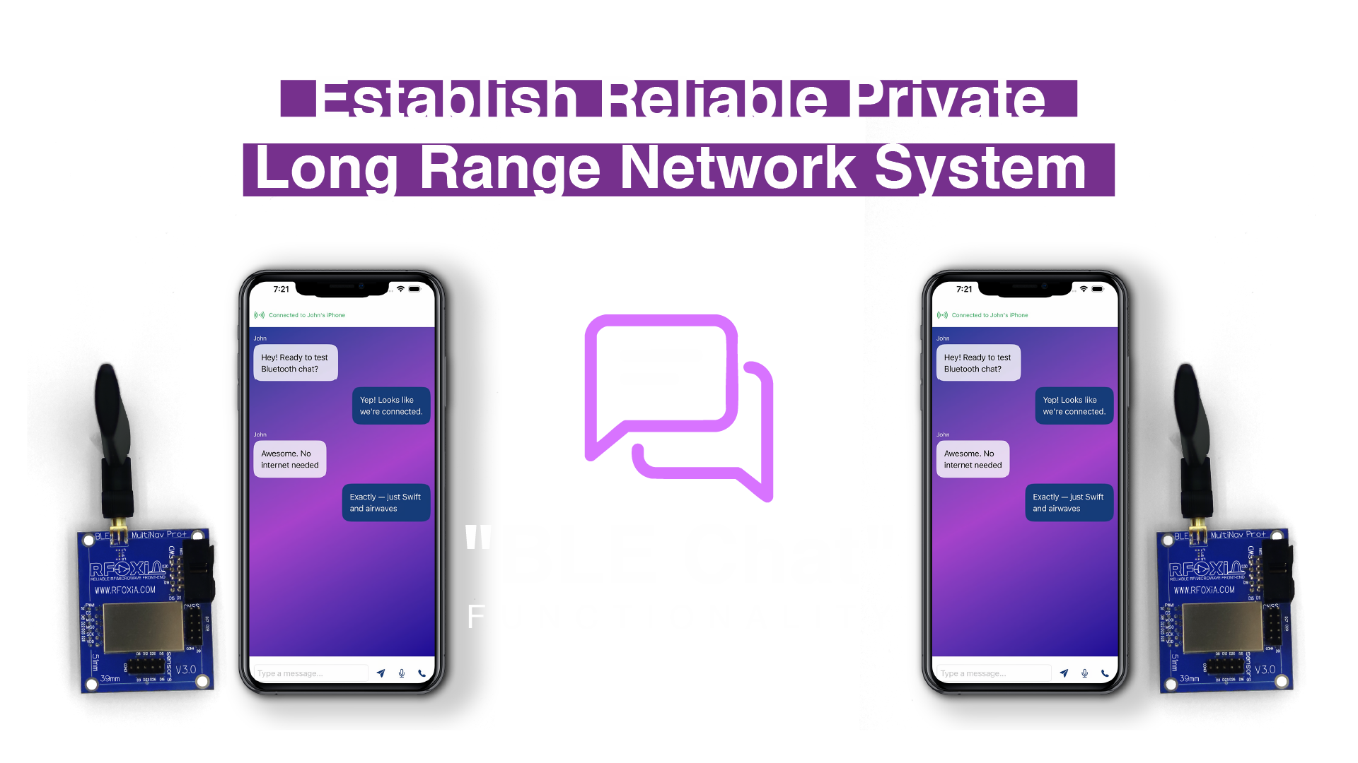
The MultiNav Pro+ includes BLE Chat — a mesh communication layer that enables direct, internet-independent messaging between any two users running the RFOXiA Connect app.
For drone operations, this means your ground team members can communicate with each other using the same hardware that's running your telemetry link. No separate radios. No walkie-talkies. No cellular dependency.
For search and rescue, disaster response, or remote expedition operations, BLE Chat turns a network of MultiNav Pro+ modules into a communication grid that operates entirely off-infrastructure.
Physical Integration: Form Factor and Mounting
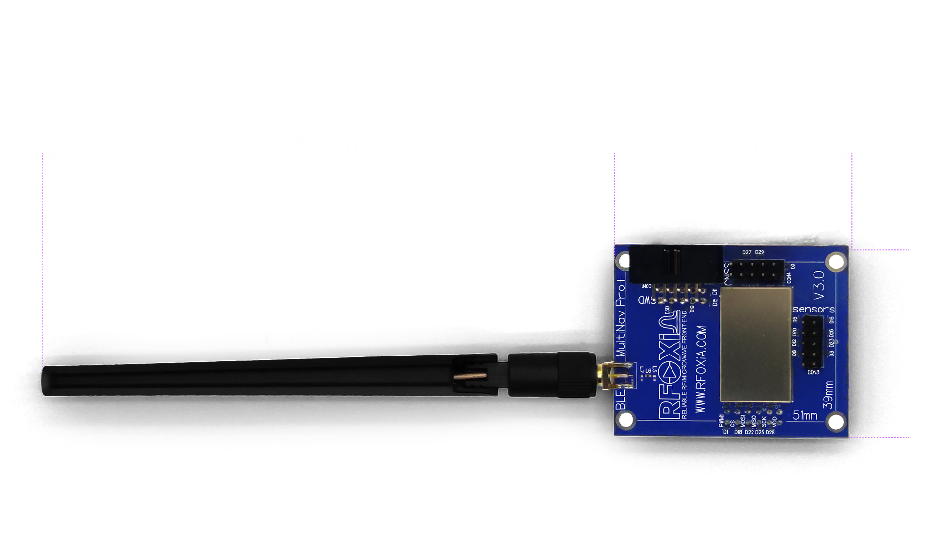
The MultiNav Pro+ measures 57mm × 47mm with a fixing frame of 54mm × 34mm and corner mounting holes. The 140mm antenna extends from the board — plan your airframe integration to keep the antenna as vertical as possible for omnidirectional coverage.
For standard 5-inch FPV freestyle frames, the module mounts cleanly to the top plate using the corner standoffs. For larger platforms — 7-inch, 10-inch, fixed-wing, or custom airframes — the compact footprint means it fits virtually anywhere.
Keep the following in mind during physical integration:
- Antenna clearance: The 140mm antenna should have at least 20mm clearance from carbon fiber or metal structures to avoid detuning
- Vibration isolation: Use foam standoffs between the module and frame to prevent vibration-induced micro-fractures on solder joints
- Heat management: The STM32WB07 generates modest heat under continuous BLE transmission — ensure some airflow over the board
Timing and Synchronization
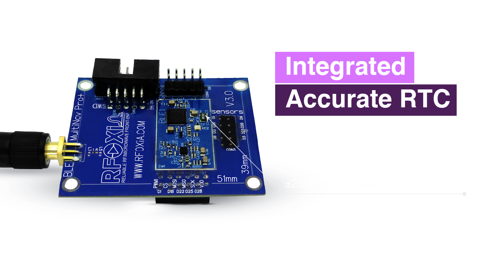
One often-overlooked element in drone telemetry systems is timing. When you're correlating position data with sensor readings, or synchronizing data streams from multiple drones, timestamp accuracy matters enormously.
The MultiNav Pro+ includes an integrated RTC crystal that provides accurate real-time clock capability. This means every sensor reading and every GPS fix can be tagged with a precise timestamp — enabling accurate post-flight data analysis, multi-drone data correlation, and synchronized logging.
For research applications where temporal accuracy is critical — atmospheric profiling, environmental sensing transects, precision agriculture passes — the integrated RTC eliminates the timestamp drift that plagues systems relying on software timers.
The Complete Stack: Developer Bundle
For builders who want everything working from day one, the RFOXiA Developer Bundle packages the complete ecosystem:
- MultiNav Pro+ BLE Module (2× for ground and drone)
- GNSS Module
- Sensors Module
- Power/Program Kit
- RFOXiA Club access with AI Firmware Builder
- RFOXiA Connect App license
Every component is FCC certified. Every component is designed to work together. The interfaces are compatible by design, not by accident.
For serious drone builders who need to learn how to build a drone telemetry system that performs at professional range without a $5,000 military-grade hardware budget, this is the stack.
You can explore the RFOXiA Long Range Bluetooth Module and the full Developer Bundle on the RFOXiA store.
Beyond Telemetry: The Data Network Opportunity
Once your system is deployed and operational, there's an additional opportunity that most builders haven't considered.
The RFOXiA data network pays node operators for verified environmental sensor data. If your Sensors Module is streaming outdoor environmental readings with GPS validation, you can enroll in the reward program and earn daily credits redeemable toward additional hardware.
For research operations already deploying sensors outdoors, this turns operational hardware into a passive data asset — your equipment earns while it works.
Summary: How to Build a Drone Telemetry System That Performs
Building a drone telemetry system that works at real-world distances requires purpose-built hardware. Commodity BLE modules are not the answer. Proprietary RC systems are not the answer. The answer is a vertically integrated platform designed from the ground up for this exact application.
| Requirement | RFOXiA Solution |
|---|---|
| Long-range link | MultiNav Pro+ BLE — 20KM man-to-drone |
| Precision position | GNSS Module — 18Hz, 1.5m accuracy |
| Environmental sensing | Sensors Module — 7 sensors |
| Reliable field power | Power Kit — 5-min charge, 24hr runtime |
| Control interface | RFOXiA Connect App — iOS + Android |
| Firmware development | AI Firmware Builder + open source repo |
| FCC compliance | All modules certified |
The RFOXiA MultiNav Pro+ BLE Module is the only product on the market that delivers 50KM Bluetooth range, 2Mbps data rate, and a complete integrated ecosystem at $59 for two units.
If you're ready to build a telemetry system that doesn't quit at the edge of your field, the hardware is in stock and ships today.
RFOXiA — Democratizing Connectivity and Computing Power.
Written by: Moamen Mohamed LinkedIn